Pages

Friday, March 27, 2015

Elkhorn

No Coffee down there, T minus 1600 feet.

All photos: Emile Elliot   

Elkhorn is too woody upstream of Big Twelve Creek to be worth running in my opinion.  From there down a few large rapids with wood still need to be negotiated before reaching the final canyon which has some nice boating and is described on Oregonkayaking.  Crunch N' Munch requires some creative portaging when flows are up, Razorback is just downstream and should be run center/right, erring to the right.  Getting to the creek is the largest obstacle to overcome.  We have it on the list this summer to try and figure out access via Big Twelve Creek, it looked to have some clean drops on it.  When we ran Elkhorn, we put in near the end of the road on the north side of the drainage (NF-201) and ran out of light shortly after exiting the final canyon section.


The access road is at about 4,000 feet and often snowed in, the following pictures are from tripcheck and these locations can be used to assess whether the road to Elkhorn will be drive-able.  We had no issues with snow on the road when we did the run.

Day after we ran Elkhorn, similar to the day of.


 The snow conditions where we put on Jan 19, 2015 around 3800 feet, near the end of NF-201 at the junction with a spur road.   44.8153, -122.2886

                                 
The hike in was steep and brushy, but doable.  Dropping 1200 vertical feet, there was only need for a rope at one cliff band.  Lucas part way down the hill.

There were a couple of stand out rapids above Big Twelve Creek, but too much portaging to see a return trip from anyone in our group.  It's unfortunate the wood is there because the creek bed is high quality.

 Ben, motivated as always picked off one of the rapids the rest of us chose to walk.

Eventually we passed by Big Twelve Creek and the stream got a little larger, if we return it will be via this creek.  At some point below this confluence we came to a rapid we had been on the lookout for, since we had heard Willy Dinsdale's story of having one of his top 3 worst swims in this rapid.  We dubbed this rapid "Wet Willy", in light of that sans boat trip Willy took through this rapid when running the stream at higher flows with his brother Ben.  Helmet Cam footage of that event can be seen at the end of the following video.


At the lower flows we had, the rapid was more manageable.  Though most of the group still portaged. 

The top ledge of Wet Willy.


Only Ben ran the sieve drop at the end of Wet Willy (11:20 in the video).

 Below here be ready to get a little creative until you are below the "Potato Rapid".  There are a few good rapids in this section, also many difficult rapids with large boulders and wood hazards.  In this section Ben caught the scariest eddy I have seen caught in person, mere feet above where his channel went underground.  

It wasn't all a wood fest, there were clean sections of Elkhorn below Wet Willy.  


One of our favorites was a unique triple drop called Blind Luck. signaling the start of the Oregonkayaking section.  Its hard to see around the corner after the first two drops, but it was clean when we were there.  Scouting from the left is harder, but would offer a view of the third tier.

Emile enters Blind Luck


 All of the portages on the run were low difficulty aside from Crunch N' Munch, though they add up after awhile.  Below the Potato Rapid (read Oregonkayaking report) its read and run to the take out with a couple of wood hazards.  As I mentioned earlier we ran out of light just below Potato Rock and ran a half mile of class IV in the dark before stashing the boats and walking to the road.  Ben finished the run in the dark and the recovery team who came in the next weekend to retrieve the rest of the boats (Joe Kemper, Anna Herring, and Emile Elliot) was surprised he hadn't gotten stuck in one of the two log hazards below where the rest of us walked off.

The boats were patiently waiting right were we left them when the recovery team went in the next weekend to retrieve them.  We have learned that when hiking out, it's best to ditch the boats near the creek.  In the past we have tried to hike them out, only to ditch them in the dark part way through the hike and struggle to locate where we left them.  It's much easier to find them if you leave them near the creek where landmarks are easier to come by.


We had 2,000 cfs which we felt was the minimal flow to be considered "in", though it has been run as low as 1,100 cfs.  The Dinsdales had 4-5000 cfs and called that medium high.  Does this mean 3000-4000 in the LNF@Mehama is medium?  Maybe.  If I go back I would shoot for 3000.

The section I would consider returning to.

  If you enjoy this type of trip, try to figure out access via Big Twelve Creek.  If you do not enjoy adventure, you will not enjoy this creek.


If you do the run, be ready for the unexpected, Elkhorn is full of surprises both good and bad

 We even saw a unicorn!

At the end of the day Elkhorn is a tough day of boating, and a magical place.

Now most of the pictures were of the good stuff, so before deciding an Elkhorn trip is for you take a look at the following video Anna created highlighting the tedious portions of the trip.
     

       -jacob

Thursday, March 19, 2015

North Umpqua: Narrows

Deadline Falls at ~ 3,000 cfs
Photo: Aaron Lieberman


BETA


***This description is a guide for summertime flows.  If the stream is swelled from rain things will be different.***


Stream: Most people will give Deadline Falls a look on the drive up from an obvious roadside pull out.  Here you can see the whole drop and scout the right side in detail.  

From there head up to Baker Wayside and walk a short trail down to the river.  I recommend starting from the top of the park at highway level to avoid an attainment, then a ferry.  

There is a class III right next to the wayside, then Baker Falls is not far downstream.  At higher levels, you'll want to scope it out from the Wayside first if not familiar, there is a pocket hole that while easy to clear on the right side of the channel at summer flows, would suck to end up in if you didn't know where to go beforehand.  We scouted from the right bank easily at 800 cfs.


There is some easy cruising through Baker Alley below here, and a nice lunch spot on river-left.

Keep an eye out for ways to increase the fun factor on the small rapids in this section.

At the end of a long flat stretch in upper Cable, with a saucy surf wave for the bold.

A turbulent eddyline next to the Cable access spur is next and offers squirt and roll practice.

Next is Upper Cable which is class III and pretty open in terms of lines. 

 Eddy out below on the left to scout Deadline in detail.  There are a number of lines, but the one we took was off a ramping boof on the center left.  And while the hole can be a bit intimidating, the move was straight forward.


                                                                         Photo: Kody Dewbre


There is a short and easy rapid below and then the river eases up for awhile as you pass Rock Creek.  There is some more easy floating below Rock Creek before the Narrows.  Eddy out either side at low flows or right at high flows to scout.   The river pinches down to the left here and travels through a chaotic chute.  Aside from powerful hydraulics there are no obvious hazards on this one.


                                                                                Photo: Kody Dewbre


Around the corner is one last ramp that can be scouted easily on the left.  The river pools up at this point and but 50 yards downstream is the trail leading up to the parking area.  


Downstream of this point is flatwater and class II down to Glide.

All the drops are easily lappable at medium to low flows.  With an easy shuttle, reliable summer flows, and being only 30 minutes off I-5, this run is a solid resource.
  
Flows:  This description is for flows you would find in the summer. North Umpqua @ Copeland Creek.  Pictures from the following trip report are at 1,300 cfs.  The photos above were taken at 870 cfs.

Access:  Take Highway 138 out of Roseburg, just after passing through Glide you will cross the North Umpqua ending up on river right.  3.4 miles past this bridge will be a small turn out on the right.  If you just want to run the whitewater use this as a take out, a trail leads back up from the river.  If you want to keep floating you can, there are other take out options roadside (still steep) or at the bridge you crossed near Glide.

To get to the put in continue upstream along Hwy 138 crossing over Rock Creek, continue another 1/4 mile to a pull out from which you can get a look at Deadline Falls.  Continue upstream from Deadline to any pull out you see fit to use as a put in.


----------------------------------------------------------------------------------------------------------------------------------------------
Original Write-up
----------------------------------------------------------------------------------------------------------------------------------------------


This is a nice section of the North Umpqua that reminded us of the Niagara section of the North Santiam closer to our home in the Willamette Valley. 

Our day started at Toketee Hot Springs.  After a night of camping we went for one more soak before packing up and heading to Whitehorse Falls on the Clearwater River.

Ben didn't want to get his dry gear wet, so ran it without any.

Jesse saw the snow in the parking area and decided gear was worth the hassle.

 Priscilla from the side

 After a couple laps on this falls, the crew headed downstream to check out Little Steamboat Falls which was too low for our taste.  We refueled with ice cream and gatorade at the local store before heading down to check out Deadline Falls.


A quick scout revealed a technical boof line on the right and a deep water line on the left.  The main concern being a large hole in the center. We were undecided about doing the run so drove down to check out the narrows to see if that one called to us.  It looked like a fun, straightforward move so we drove back up to a pullout 1/2 mile above the Rock Creek bridge and geared up.  There was a pool to warm up in, then a straight forward class III with some fun waves before we pulled over on the left to re-scout Deadline.  Jesse and Priscilla took the chute on the far right, while Ben and I decided the main line down the left looked good.

Priscilla approaches the lip of the right side chute.


Jesse gets lift off on his way through the chute


The left line was a little intimidating, but not too difficult.

Ben shoots through


Everyone hit their lines as planned and we continued downstream through a few class II-III rapids before we eddied out left to check out the Narrows again.  Ben got thrown around a bit in his playboat, but the rest of us were able to stay upright in our creek boats.


This rapid reminded me of an easier and shorter version of the rapid with the same name on the North Santiam.


 We turned the corner to see another horizon and scouted this from the left.  It was a fun ramp into a hole.  Ben went for the meat down the middle, the rest of us went left.  We saw some locals below here that allowed us to hike up to the road through the property they were renting, most people walk up a short trail to a wayside immediately downstream of the ramp rapid.

We had 1300 cfs in the North Umpqua@ Copeland Creek.  I imagine this section is nearly always runnable.  When flows get spicy, there is a sneak channel to the left of Deadline that may be worth looking into.


If you felt like the run was too short and want to do another run of similar difficulty (but drastically different character), run the last mile of Rock Creek if flows are adequate starting at Anabel rd.  This creek flows into the North Umpqua below Deadline Falls and flows can be assessed from the bridge during the Deadline shuttle.  We got down Rock Creek with the North Umpqua@ Copeland Creek reading 1300 cfs.

Thursday, March 12, 2015

Andrew Enlists


Into the Outside's favorite waterfall runner has joined the military.  Andrew left town early this week, but before leaving put together this Edit of his last trip down the Little White as a civilian.  We wish him the best, that the rewards outweigh the sacrifices.

Andrew way, way down below.

Hold tight.


It's hard not to love the guy.

Peony Falls

Andrew has represented the community through his work at local kayak shops and at times on the TV.


Andrew doing the masochists at into the outside proud.  

Andrew, thank you and good luck.


Thursday, March 5, 2015

Pistol River


Beta
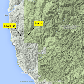
4.6 miles


We ran the Pistol River early in our South Coast tour to start the new year.  We had scouted out a couple rivers the day before and were ready to get in our boats.  We ran into some access issues when trying to reach an upper put in, but found convenient access to this middle section.  After a short walk on an old road, we arrived at a beautiful pool complete with bear tracks.


Access Issues.


Wildlife


Put In


We floated a couple easy miles, this part was mostly pool and riffle with a couple intermediate rapids.  One of the rapids had massive boulders, but an easy line to the left. 

 On the paddle in.


 About the time we started wondering if I had interpreted the maps incorrectly during earlier research, a horizon line between large boulders presented itself.  We scouted from the left, finding shore routes through large boulders.  There was a clear line, but it was a little intimidating.  Priscilla and Anna chose to walk this rapid on the left, while I had success paddling the rapid.

Barrett and Aaron scouting the first large rapid in the Pistol.


 The whitewater portion of this section is shaped like a pistol.  


Running the first significant rapid on the Pistol, entering The Grip at low water.


This was the beginning of an interesting section of river.  It was obvious this stream experiences massive amounts of water as house size boulders were strewn about all over the place. 


 This type of river does not usually channelize well, but that was not the case this time.  We found clean lines through a couple of rapids before reaching our next scout.

This rapid kicks off The Barrel, it is a straight forward lead in 
to a ledge hole.  All three of us ran this one successfully. 


Downstream the Pistol pinched down and dropped over a ledge.  This ledge had a tricky entrance into a significant hydraulic.

None of us were feeling this one and we all portaged, left was a better route.  It was run on a subsequent trip.

Downstream is a pool at the end of The Barrel.  Below here is one more rapid that was tricky at our flow before the whitewater tapers out and returns to riffles.

We found a rope swing that was put to good use.

Just below here was our take out on the right.  Downstream are more rapids, and subsequent trips have run them.

Aaron Koontz lower down.


This was an enjoyable section of water that could be run at a variety of flows.  The river could handle huge amounts of water and still be runnable, but it would be very class V.  It can also be run pretty low, we were near the bottom of flows on Jan 2, 2015 with 1800 cfs on the Chetco gauge and 225 cfs on the Floras Cr Nr Langlois gauge with flows dropping very slowly all week.

The photos by Yann were taken May 16, 2020.  On that trip the Chetco gauge was at 4500 cfs, the Winchuck went from 800 to 600 and back up to 800.  The Floras Cr Nr Langlois gauge dropped from 400 to 300 cfs.  They called that a great flow.


  -jacob