The hike also has the highest concentration of ticks I have ever seen. The last time I hiked the trail I wore long pants tucked into my socks and we checked frequently for the bugs. Eventually we were able to spot them on the grasses lining the trail and avoided any latching on. There is also poison oak, and usually some small trees down across the trail. The trail winds up many tributaries, so progress feels slow, and while there are a few short uphill climbs, the gradient isn't significant after the first mile. Having said all that, it is totally worth the trail obstacles to paddle this phenomenal run.
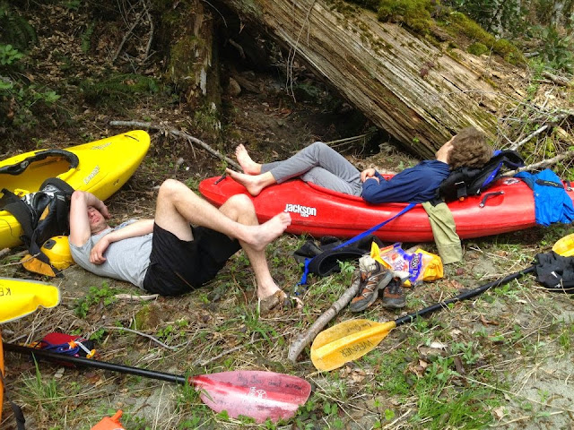
Resting at the put in.
The run is characterized by short steep rapids in a pool drop setting (at least at lower levels). The majority of the rapids can be boat scouted effectively, and a quick bank scout at moments to check for wood, which is infrequent. The lines are straightforward enough that rarely will it be necessary for a group bank scout.
After the hike in, there is a short warm up before getting to the rapids. They start nice and gradual, and before you know it you are in a wonderful rhythm of class IV-IV+ read and run bouldery rapids at low/medium flows.
Or as I have heard, a more intimidating onslaught of large holes at juicier flows.
Part of the beauty of this run is that aside from its aesthetic beauty, the whitewater is all manageable and can be sorted out without prior knowledge if you match the water level to your skill-set, and willing to deal with obstacles as they arise.
At the flows I was there, eddies were abundant, and most everything was read-and-run, but keep an eye out for wood which is sometimes in play. One noteworthy rapid occurs at 8:15 in the video below. There is an innocuous lead in to a flat-top shelf rock dividing the flow. At low levels the apparent center line leads to a manky drop with several small sieves to avoid. The left line, while blind, is much cleaner. Thankfully, sieves are few on the run.
When you see the walls rising dramatically, you will be approaching the final gorge section, which contains the largest of the rapids. In 2022, there was a river wide log jam immediately below one of the first rapids in the final gorge, but with easy portage options. The gorge contains the only longer rapids on the run and serves up some excellent boofs. At moderate flows plentiful eddies exist still for scouting. If you made it this far without difficulties there shouldn’t be anything to worry about, but egress from within the gorge would be difficult at best.
I do recall scouting the final rapid, "Fat Lady", and as a result that was one of the few rapids we got a picture of.
Below Fat Lady, things ease off. You can either cruse to the confluence with the Salmon, or if you want one last bit of excitement, you can walk your boat up to paddle Steinecker Falls, which enters visibly on the left in the runout.
Here is a video from a group at about 1400 cfs.
April 17, 2022
The Cal-Salmon River (that Wooley flows into) is about 45 miles south of Happy Camp on highway 96 (which follows the Klamath River).
----------------------------------------------------------------------------------------------------------------------------------------------


No comments:
Post a Comment