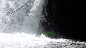
Stream: The run starts off with a nice 10'er at the put in. From this point until Cookie Monster there is loads of quality class III-IV whitewater in a small and intimate streambed. Hugh Creek adds some water when it enters from the right and the creek seems to get even better for awhile.
About 2 miles downstream of Hugh Creek is Cookie Monster, just after a gradual 180 degree turn in the river to the right. The horizon line is obvious, and while there is a good eddy on the left, it can be partially blocked by wood so stay frosty. Cookie Monster is easier at low water, at high water a large hole forms.
Cookie Monster.
In the next mile below Cookie Monster are a couple ledges that are taller than what has been typical for the creek. The first is easiest far right. The second should be scouted from the bridge on the drive up to locate the best landing zone, center-ish. Downstream it's boogie to the Hot Springs Fork of the Collowash confluence, and then in a 1/4 mile of easy floating you will be able to see the horizon line for the finale at Pegleg Falls. Pegleg is an off-vertical 15' drop into a forgiving pool with many line choices, a good way to finish a good run.

This is a high mountain Oregon stream, so keep an eye out for wood. There are usually some portages, and some wood dodging, but historically the wood has not kept the run from being worth doing.
Since you are so close, instead of gearing down, consider driving downstream less than 1/4 mile to the bridge over Blister Creek. There is a beautiful 30' park and huck visible just upstream of the bridge.
Flows: Clackamas at Three Lynx at 5,000 cfs is considered medium. 3,000 is a low, but still worth doing flow. I haven't heard of anyone taking a trip up there and having too much water yet.
Access: Take out at Pegleg Falls (44.9572, -122.1619), or continue through the Hot Springs Fork of the Collowash as far as you have time for.
From Estacada, take Hwy 224 SE up the Clackamas River for 29 miles (passing the Ripplebrook Ranger Station at 24.5 miles). At the 29 mile mark turn right onto NF-63 where you will quickly cross the Clackamas and less than a mile later the Collowash. Following the Collowash upstream for 3.5 miles past the turn off Hwy 224, and turn right onto NF-70/Bagby Rd. In 5.5 miles is Pegleg Falls, which is no longer operational. However, you can still park at the gate and walk down into what used to be the campground to confirm you are at the right spot by looking upstream (you will see Pegleg).
To get to the put in, continue upstream on the same road 3.9 miles (stay right at 1.8 and 3.5 mi). Looking down into the creek you should be able to see a log jam, put in below it, which is just above the first ten foot drop (44.9352, -122.2117).
Notes: You can read about pioneering this creek over at Oregonkayaking.net.
----------------------------------------------------------------------------------------------------------------------------------------------
Trip Report
----------------------------------------------------------------------------------------------------------------------------------------------
----------------------------------------------------------------------------------------------------------------------------------------------
We headed up to Nohorn creek yesterday (May 8, 2011). It was low but still a good time at 3,000 cfs on the Clackamas @ Three Lynx gauge.
We used the upper put in that Pete Giordano found last year. The snow situation meant the last mile of the road was not drivable, but also that we could drag our boats. This upper put in added a small slide and a nice ten foot boof. Followed by a short log jam portage and some other splashy rapids. I would choose this upper put in for any trip to Nohorn.
The rest of the run is well documented over at Oregonkayaking.net.
Once Hugh creek come in on the right the creek enters a fun mini gorge section with good quality III-IV rapids. There are some in-between sections that were a bit dull at this level, but at normal levels these would move right along and the classic Oregon scenery helps pass the time as usual.
We kept thinking every horizon was Cookie Monster. But it was pretty obvious when we got there. We snuck into an eddy at the lip on the left. Though catching an eddy higher up might be a good idea if there is more water in the stream.
Nate and Luke point out the issues with the rapid.
The low water meant the big hole that usually dominates the left side of Cookie Monster wasn't in play. A couple of us ran it, but it had enough going on that most took the portage route on the left.
The six foot ledge has a log in it now. Luke went for the rail slide which was pretty sweet, with more water I would suggest running middle or right.
Luke, round 2.
Luke picks out another route.
Our trip in fast forward.
To get to the upper put in. Go towards these coordinate points (can copy paste these into google maps). 44.931235489969055,-122.2170639038086
If you are looking at the creek (should be the first good view you get since crossing Hugh Creek) and see a short bedrock slide with a tree spanning the creek right over the slide.
Put in there, just above the slide to save yourself some mank upstream.
-Jacob


yes, that looks like low water.
ReplyDelete