BETA
Stream: Stream information
Flows: Flow information
Access: Access information
----------------------------------------------------------------------------------------------------------------------------------------------
Story/Notes
----------------------------------------------------------------------------------------------------------------------------------------------
----------------------------------------------------------------------------------------------------------------------------------------------
I first visited Priest Lake in high school (northern Idaho panhandle) and had taken the trip up to the natural waterslide on Kent Creek. I had a blast and was irrevocably captivated by the large granite slides visible on Lion Creek during the hike up.
Last year my friend Alex, who lives near that area in Coeur D'Alene, heard about something called the Pack River. He told us about it and we were excited to visit him and check it out. Our main interest was the Pack, but we also put Lion Creek on the list. That trip didn't work out last year due to dismal snowpack, but this year we gave it a go the weekend before Memorial Day.
Lion Creek starts at 3:16
Video by Nick Hymel
Video by Nick Hymel
Northern Exposure: Idaho Road Trip 2016 to the Pack River and Lions Creek from IKNick on Vimeo.
Friday we did the Pack, then Saturday we headed for Priest Lake and Lion Creek. We drove to the end of the road up Lion Creek and walked down to the creek to mark our take out. We had scouted from a couple places on the drive up and decided to save the section below the parking area for another day.
We got some good beta from local boaters Chris Calentano and Kurt Dobbins who were up there to check out Lion Creek, Chris photographing with his girlfriend Heidi and Kurt boating.
The 1.5 mile hike was about as easy as they come along an old road grade.
As challenging as the hike got.
Before long the old road crossed Lion Creek, at which point we walked upstream on river right a short ways to get a bonus slide.
We pulled over when we returned to the road crossing not far below the bonus slide and hiked up Kent Creek to do the waterslide. There was a trash bag with a pillow some locals had left that we used as padding for the slide. I wouldn't want to do this much more water as the trick is to stop in a pothole halfway down the slide, and if you miss the pothole the slide continues another 100 feet into a nasty undercut. Super fun at this flow, but caution is required and lower flows are advisable.
The next bedrock feature below the confluence with Kent Creek wraps around a couple of corners, starting easy but quickly building into the only rapid we portaged on this trip (it has been run). It is easiest to get out on the left before the first of the small slides to scout the whole series.
More interesting drops continue below, scout thoroughly and watch for wood which wasn't an issue on our trip but reportedly has been in the past.
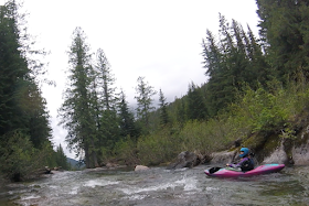
Eventually we reached a short meadow with nice views and a welcome break from the action.
At the end of this meadow is a short class III boulder garden and then a large horizon line.
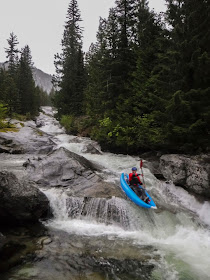
The first drop is better scouted on the left, and portaged on the right. The most obvious line is down the left, though there were other options that had potential.
We were sure to set up a person with a throw rope at the base of this drop as it leads directly into another large slide with high mangle potential in the event of a missed line. Fortunately this second drop has a clear line on the far right and the two drops together make for an exciting rapid.
Alex at the bottom of the two part sequence.
There is a small pool here and then another tall granite cascade with a number of fun moves in the right channel, and some decapitation potential in the left. This one can be easily scouted and portaged on the right. Because it was so convenient to move around on the bank so we were able to set up our ideal safety conditions including a valet to help direct boats over a shallow bit mid-rapid.
Kurt takes off.
Photo: Priscilla Macy
It looks like hitting the wall is inevitable, but we all we able to avoid contact.
Photo: Priscilla Macy
The two channels came together and dropped into a significant hole. With all the speed generated from the slide all of us who ran it slid over easily.
Photo: Priscilla Macy
Downstream was a final challenging rapid before things eased to class III-IV down to the take out.
Be sure to mark your take out before putting on! Just downstream the creek enters a rapid with a nasty overhang at head level, then drops 200 feet in the next quarter mile.
Be sure to mark your take out before putting on! Just downstream the creek enters a rapid with a nasty overhang at head level, then drops 200 feet in the next quarter mile.
We were very happy with this run and I certainly hope to return. We had 450 cfs on the Boundary Creek gauge and 600 cfs on the Pack River gauge.
The part we ran
Notes:
For curiosities sake I hiked upstream from where we put on and saw some pretty marginal whitewater.

-jacob


No comments:
Post a Comment