

BETA
4 miles (another 5.5 on mainstem Rough and Ready)
It's hard to give it a class rating, but I feel comfortable saying that to enjoy the run, a class V skill set (and judgement) along with the ability to react to the unexpected would be a good per-requisite.
It's hard to give it a class rating, but I feel comfortable saying that to enjoy the run, a class V skill set (and judgement) along with the ability to react to the unexpected would be a good per-requisite.
Stream: Emile Elliott grew up near Grants Pass, and whenever we talked about the area he always mentioned the whispers he had heard of a run in the area the Knapp brothers had considered their favorite run. He knew was it was near Cave Junction, ran dry in the summer, and you hiked a long way (possibly 6 miles up from the bottom). He was pretty sure it was one of the tributaries to Rough and Ready Creek, which meets those parameters.

At first glance I thought the run looked kind of lame. Where you drive over it, it's spread out and gravelly. The satellite imagery didn't get me fired up either. Yann Crist-Evans began talking about it more often this year, so I looked at it again. Making a mental stew from photos and reports Zach Collier has from trips into the drainage, the whispers of a great run from Emile, and Yann's enthusiasm, I got the motivation I needed to put in the logistical efforts to get a group in there. An opportunity arose on a weekend we were headed down to visit Priscilla's parents in Grants Pass.
I was lobbying for an overnighter in the NF Smith or Chetco drainages since the conditions were uniquely shaping up for something like that, but only half the the group was up for it. The other half were more interested in the Rough and Ready headwaters, which seemed like an odd choice to me given the forecast, but once Joseph dropped out (he was part of the contingent interested in the overnight option), the momentum swung heavily towards Rough and Ready. Iv'e never been against low water if it's a run Iv'e never done before so long as the stream is floatable, and it's a place I want to see, thus I was quickly converted to the Rough and Ready idea.
Rough and Ready take out, the highway 199 bridge between Cave Junction and O'Brien.

Most of the information I could muster up from the internet was from the North Fork of Rough and Ready Creek, but the mapwork I was doing made the South Fork look like the run I would have put money on the Knapps liking so much.

Access to this area is tricky, which is why it is still the special place Zach Collier (who has boated more in the drainage than most) describes whenever he writes about the area. While the option to hike up the south fork from the bottom existed, I was in for a penny, in for a pound so wanted to go in from the top and see the whole stream. This would increase the logistical difficulty, but in the end would mean less hiking and more boating. The major obstacles going in from the top would be the uncertain snow situation, and a gate on the shuttle road protecting the drainage from Port Orford Root-Rot. This gate is typically shut during the time of year the creek has enough water to float, increasing the length of the hike, and I didn't actually know where on the road it was.
Regardless of the extra challenges of accessing the creek from the top, the team was up for the challenge.

Joseph Hatcher drove up the shuttle road after work a couple days before our trip, sending us coordinates for where exactly the gate was, and giving us a better sense of the length of the hike and snow situation. I try not to let the challenge of carrying a kayak keep me from boating rivers I'd like to check out, and neither do the people who were planning to be on this trip, so the trigger was pulled.
Going to places where others are not can be part of the appeal of kayaking.

Photo: Priscilla Macy
We hit snow on the road at about 4,000', the hiking on the road from there was easy. Once we hit the cross country potion of the hike the going slowed. Things started out brushy, opened up for awhile, then started descending steeply amungst boulders.

It was actually a nice, warm day for January, in the 60's. We ate a snack once we reached river-level and gazed downstream at the first couple logs we were going to need to negotiate. We were putting in as high as seemed floatable in the drainage, and based on imagery recon were expecting 5-10 log portages in the first mile, which dropped 400 feet.
After taking our time gearing up, we started our descent on what had correctly been anticipated as minimal flows.
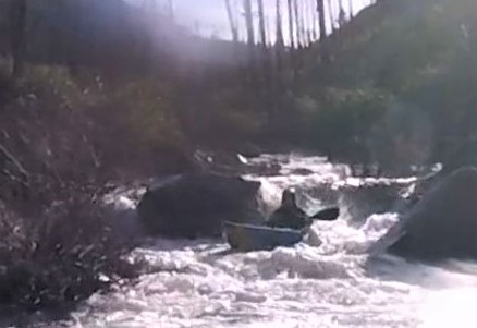
We were happy to be able to dodge the first couple logs as we started getting into a rythym on what was quickly becoming a cool trip. The run was uniform, similar to many of the creeks in the area.
We were finding the creek to be mostly read and run, continuous boulder cascades with plenty of boofs.

There were a few nice ledges in that first mile that Priscilla (who was in an IK) hopped out to check before giving us the verbal.

One of them ended up having a log that we were able to railside, Ben spiced up the move with a hula-paddle around the neck/camera mug.

We were pleased to be finding that all the trees we had seen on satellite imagery were actually suspended 5-10 feet above the creek and non-factors for paddlers. This has happened nearly every time I have done an obscure run in the Siskiyous, Ben calls these faux portages "shadow trees" and we were paddling under all of them.

In fact, in almost 10 miles of paddling we had only 1 wood portage, and even that would have probably been runnable with more water. After the first steep mile, Ben noticed his boat was taking on a lot of water, we pulled over to drain and saw that his duct-tape patch had been scraped off enough to be letting water in. We ate another snack while Ben spent some time adhering more duct tape on with a lighter.
We were thankful it was a nice day or the patching would have likely been futile.

After half hour or so we were ready to get back to it. While the gradient had eased, that was relative, this next mile dropped about 250' (about what you have through Gettin' Busy on the Little White Salmon).
Despite the steep gradient, the river was manageable, and still nearly all read and run.

It was remarkable how wherever the water was going, there was a way through. It was an intuitive creek to read and run, though in a few places we did venture away from the main channel.

Photo: Priscilla Macy
After another half mile to a mile, Ben's new patch had been scraped off by the constant boulder contact due to the low water level. We now had just an hour and a half of daylight, and 2 miles before we reached the confluence with the NF of Rough and Ready, then another few miles on the mainstem. Daylight concerns were beginning to enter the conversation.
We ate another snack and pondered the forest of Port Orford Cedar while Ben worked on getting his boat patched up.

Photo: Priscilla Macy
The whitewater continued

Ben's patch failed again awhile later, and while he thought about hiking out, decided instead to make a mad dash for the take out. The nature of the creek was conducive to this, as at the flow we had if you just aimed for the deepest channel, that was typically the line so scouting hadn't been something we had needed to do since those ledges from the first mile. After helping Priscilla unpin her IK, Ben took off on his own while I helped Priscilla re-attach a thigh strap that had come off in the pin.
An IK has it's advantages on low water creeks, but something about the character of the run was making this a common occurrence.

The gradient had now eased off to the magic 200 fpm threshold and our downstream progress increased as we caught fewer eddies. Bedrock rapids appeared every now and then, creating fun chutes and ledges.

Barrett, Priscilla and I did end up portaging one boulder pile that we later found out Ben had bombed through successfully. Otherwise, it was more of the same, fun read and run, imagining how fantastic the run would be with more water.

Near the end of the run the creek started going around islands and was less awesome, but still had it's moments.

Finally we reached the confluence with the North Fork, with 45 minutes or so of daylight left. After a quick surf we headed downstream, at more of a relaxed pace. The assessment of the water level relative to the river bed had been promoted from "floatable" on the south fork to "low" after the confluence, we relaxed a bit knowing we would be making better time from here out.
Eventually we caught up to Ben, who was on shore draining his boat. He had gotten a new crack that was about a foot long and would take more time to fix than we had left of daylight. He would just paddle as far as he could as his boat took on water, then drain. We were checking the watch and he was making it about 10 minutes between drains, his boat was filling up fast enough that it was bulging his spray skirt up.
"What a beautiful, floating boat Barrett has. Maybe he'd trade if I asked nice?"
- Possibly what Ben was thinking

Fortunately the mainstem of Rough and Ready was III-III+ at this flow so he was able to make his way through. Without the ability to boof he was having to channel his squirt boating skills.
I initially wondered if he might enjoy the challenge, but his expressions indicated otherwise.

As the light was fading we reached the low-head dam, indicating we were most of the way through the main stem. One last boat drain here before boofing the left side of the dam (deemed reasonable due to the low flow) before making the final push for the take out.

With more water, this hydraulic has proven fatal. Use good judgement here, it's an easy portage.

Photo: Priscilla Macy
The creek was interesting in this lower section, in that it was on a wide flood plain and went between islands, the downstream view looked "off". I don't really know how to explain it, but it was neat and if you paddle the stream I'm sure you'll understand.

It did get dark about 10 minutes before the take out, but the paddling was easy enough and without clouds there was enough ambient light to get where we needed to go.
All but done, as the lights from vehicles crossing the take out bridge became visible.

We took out feeling like we had a nice adventure, and I saw why the Knapps would like it so much. The South Fork is 3-4 miles of non-stop whitewater, everything goes where you think it would, and it's mostly read and run. I don't think there is another creek I have done of that nature and quality.
On my list of creeks to return to, this one sits at the top (with the correct flows next time of course).

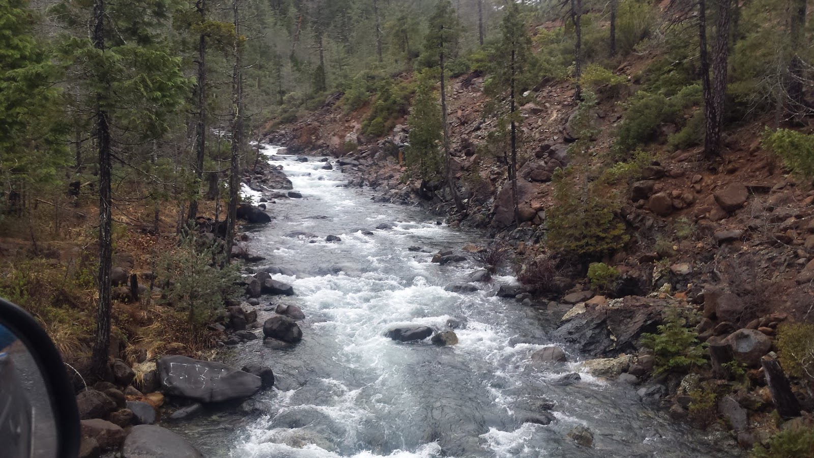
Flows: Too low, I believe Jan 27 or 29th would have been good flows for SF Rough and Ready. We had just under the "1" mark on the bridge.

Take out bridge on the morning of our trip.

Driving over Whiskey Creek during the shuttle, flows were similar in this creek to SF Rough and Ready.
Access: Know the snow situation before you head to the Rough and Ready headwaters, unless you are hiking all the way up from the bottom, you will be driving to 3,000'-4,000'.
The take out is where highway 199 crosses Rough and Ready Creek 5 miles south of Cave Junction (42.092838, -123.683421). This is also where the painted gage is.
To get to the put in, head further south on 199 to O'Brien and turn right onto Lone Mountain Rd. If you are not looking at a map, stay on that road for 13 1/2 miles until you hit a gate. If you are looking at a map, this road changes names and is called 5505/Lone Mountain/4402/Wimer, then at the very end just before the gate stay right on the better road onto 112.
Beyond the gate (42.013778, -123.836150), you will spend some time hiking on a road, then descend to the creek cross-country. You'll want to make your own plan for how to do that. Here is the route we took.
Click on the map to increase resolution.


