I had my usual difficulties getting people to come on this exploratory trip, luckily Stephen Cameron caught a whim and joined.
This stream is part of two forks that join the headwaters of the NF Siletz. When I came to school 3 years ago this was the first stream that caught my attention because of an obvious waterfall on the topo maps. After learning the nature of access in the coast range I new this one would be a challenging stream to check out.
Last weekend, I passed on a trip to California and instead scouted out the headwaters of the NF Siletz. I knew Boulder creek was up here and I wanted to check that out, plus I wanted to check out the access situation on Warnicke, while at the same time getting a look at the Valley of the Giants fork of the NF Siletz and take a hike through some of the few true old growth stands remaining in Oregon's coast range.
My scouting trip was a larger success than I had expected. Gates were open, roads went farther than I expected, it looked like this stream could be done without excess effort. Another thing I noticed was the geology was promising. Trip reports of the NF Siletz left me with the impression it would not be worth the effort, but the guidebook run actually looked good too.
The highlights of this trip were hiking through the Valley of the Giants, which is where I saw Warnicke for the first time, as well as some very large trees. Second was discovering the road up Warnicke had an open gate. I started driving up this road and made it about a mile in the course of half an hour. There were a ton of limbs and rocks to move off the sloppy road and my Civic has little clearance. I eventually turned back, satisfied that the road went far enough to make a trip worthwhile.
Levels lined up perfectly the next weekend, so after Stephen arrived in Monmouth, we made the long drive into the coast range. We decided to only bring one car and jog shuttle, which turned out to be the right call. We made it two miles before the road bermed out, leaving us with a 2 mile hike to the put in.
The hike was pretty tame. We hiked along an old, slightly grown over logging road with a couple easy-to-nagotiate washouts. Dragging was possible, though we stuck to our backpacks. Eventually we decided to just shwack down to the creek instead of going all the way to the bridge which turned out to be an interesting call. We ended up putting in just below a large class five rapid and upstream? Slides as far as the eye could see. Since neither of us were very interested in the drop it was a mixed blessing putting in where we did. We missed out on what looked to be fun slides between us and the bridge, but we didn't have to portage this drop.
*to those that like this sort of drop, it is completely runnable, no wood or sieves and not too scary, just very class V. Had our favorite probe unit not just moved to Eastern Oregon I'm sure it would have been run. It can be scouted from the right very easily, but hardly at all from the left where we were.
Andrew Bradley and I returned and ran this drop in 2012. Its totally good to go and fun.
In 2012 the CCC went in and got a few more descents of the Golden Goose. Unfortunately one of these resulted in a dislocated shoulder.
Lucas Glick with a good line.
Nick Chambers photo
Stephen and I liked what we were seeing geology and water level wise as we floated into the class III stuff below Golden Goose.
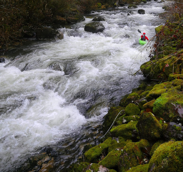
Just around the next corner started a mile of quality boating. Class IV boulder gardens with hardly any wood and really fun. Steep and continuous. There were lots of 3-4 foot boofs and fun moves. Every horizon we were waiting for another waterfall, but one never did materialize. We probably only scouted twice in this section as Stephen brought his slalom skill set to the run and made it so we hardly had to get out at all. If Stephen had not been on the trip, I would likely have been scouting more.
After the end of this mile was a log portage. The next mile was III-IV with another log portage, and the last mile was III+ with another portage. All portages were easy. Stephen did have one interesting portage by seal launching five feet off a log midstream that went well.
Stephen did almost have to drop into a rapid blind when he ran out of eddies, but was able to catch some slack water along the left wall and saw that the drop went, it turned out not be a big issue, but was exciting for a moment. This is the drop he runs the bottom part of in the video (He eddied out part way down to let me get a shot as I had already jumped out of my boat when I saw things weren't going to plan).
Speaking of video, this was the only shot I got because we were cruising pretty quickly down the run.
The creek was fun all the way to the confluence with Valley of the Giants fork. The final drop was an island and as Stephen said about his run "I just ran an unrunnable drop, got stopped by that hole, then ducked a log". If someone else does this, don't worry, its not as bad as it sounds ;)
From here we had a mile and a half of high quality class III down to the confluence with Boulder Creek, where we took out. We then "jogged the shuttle", and headed home happy about our accomplishments.
--------------------------------------------
NOTES
-Stephen mentioned how un-epic this trip was. If there was vehicle access to the top, there would be no reason not to run this thing often when the chance arose.
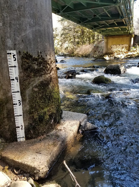
-I know there are not a lot of paddlers out there who like this type of run, but there are some, and if you want to see a new run that is pretty fun without much work involved, check this run out when the Siletz gauge is over 4,000 cfs.
-This area is the rainiest place in the lower 48 that has a gauge (google Laurel Mtn.). I have been tricked by nice weather in the Willamette Valley more than once and dressed accordingly only to show up to rain in this area of the coast range only 30 miles to the west.
-You also drive through Valsetz if coming from Portland, which was once the rainiest city in the lower 48. (it is no longer a town)
-Jacob


