Showing posts with label water. Show all posts

Thursday, March 5, 2020

South Fork Rough and Ready Creek


BETA
4 miles (another 5.5 on mainstem Rough and Ready)
It's hard to give it a class rating, but I feel comfortable saying that to enjoy the run, a class V skill set (and judgement) along with the ability to react to the unexpected would be a good per-requisite.


Stream:  Emile Elliott grew up near Grants Pass, and whenever we talked about the area he always mentioned the whispers he had heard of a run in the area the Knapp brothers had considered their favorite run.   He knew was it was near Cave Junction, ran dry in the summer, and you hiked a long way (possibly 6 miles up from the bottom).  He was pretty sure it was one of the tributaries to Rough and Ready Creek, which meets those parameters.


At first glance I thought the run looked kind of lame.  Where you drive over it, it's spread out and gravelly.  The satellite imagery didn't get me fired up either.  Yann Crist-Evans began talking about it more often this year, so I looked at it again.  Making a mental stew from photos and reports Zach Collier has from trips into the drainage, the whispers of a great run from Emile, and Yann's enthusiasm, I got the motivation I needed to put in the logistical efforts to get a group in there.  An opportunity arose on a weekend we were headed down to visit Priscilla's parents in Grants Pass.

I was lobbying for an overnighter in the NF Smith or Chetco drainages since the conditions were uniquely shaping up for something like that, but only half the the group was up for it.  The other half were more interested in the Rough and Ready headwaters, which seemed like an odd choice to me given the forecast, but once Joseph dropped out (he was part of the contingent interested in the overnight option), the momentum swung heavily towards Rough and Ready.  Iv'e never been against low water if it's a run Iv'e never done before so long as the stream is floatable, and it's a place I want to see, thus I was quickly converted to the Rough and Ready idea.

 
Rough and Ready take out, the highway 199 bridge between Cave Junction and O'Brien.


Most of the information I could muster up from the internet was from the North Fork of Rough and Ready Creek, but the mapwork I was doing made the South Fork look like the run I would have put money on the Knapps liking so much.  


Access to this area is tricky, which is why it is still the special place Zach Collier (who has boated more in the drainage than most) describes whenever he writes about the areaWhile the option to hike up the south fork from the bottom existed, I was in for a penny, in for a pound so wanted to go in from the top and see the whole stream.  This would increase the logistical difficulty, but in the end would mean less hiking and more boating.  The major obstacles going in from the top would be the uncertain snow situation, and a gate on the shuttle road protecting the drainage from Port Orford Root-Rot.  This gate is typically shut during the time of year the creek has enough water to float, increasing the length of the hike, and I didn't actually know where on the road it was.

Regardless of the extra challenges of accessing the creek from the top, the team was up for the challenge. 


Joseph Hatcher drove up the shuttle road after work a couple days before our trip, sending us coordinates for where exactly the gate was, and giving us a better sense of the length of the hike and snow situation.  I try not to let the challenge of carrying a kayak keep me from boating rivers I'd like to check out, and neither do the people who were planning to be on this trip, so the trigger was pulled.


 Going to places where others are not can be part of the appeal of kayaking. 


We hit snow on the road at about 4,000', the hiking on the road from there was easy.  Once we hit the cross country potion of the hike the going slowed.  Things started out brushy, opened up for awhile, then started descending steeply amungst boulders.    


It was actually a nice, warm day for January, in the 60's.  We ate a snack once we reached river-level and gazed downstream at the first couple logs we were going to need to negotiate.  We were putting in as high as seemed floatable in the drainage, and based on imagery recon were expecting 5-10 log portages in the first mile, which dropped 400 feet.  


After taking our time gearing up, we started our descent on what had correctly been anticipated as minimal flows.
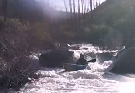


We were happy to be able to dodge the first couple logs as we started getting into a rythym on what was quickly becoming a cool trip.  The run was uniform, similar to many of the creeks in the area. 


We were finding the creek to be mostly read and run, continuous boulder cascades with plenty of boofs.


There were a few nice ledges in that first mile that Priscilla (who was in an IK) hopped out to check before giving us the verbal.


One of them ended up having a log that we were able to railside, Ben spiced up the move with a hula-paddle around the neck/camera mug.


We were pleased to be finding that all the trees we had seen on satellite imagery were actually suspended 5-10 feet above the creek and non-factors for paddlers.  This has happened nearly every time I have done an obscure run in the Siskiyous, Ben calls these faux portages "shadow trees" and we were paddling under all of them.


In fact, in almost 10 miles of paddling we had only 1 wood portage, and even that would have probably been runnable with more water.  After the first steep mile, Ben noticed his boat was taking on a lot of water, we pulled over to drain and saw that his duct-tape patch had been scraped off enough to be letting water in.  We ate another snack while Ben spent some time adhering more duct tape on with a lighter.  


We were thankful it was a nice day or the patching would have likely been futile.


After half hour or so we were ready to get back to it.   While the gradient had eased, that was relative, this next mile dropped about 250' (about what you have through Gettin' Busy on the Little White Salmon).  


Despite the steep gradient, the river was manageable, and still nearly all read and run.


 It was remarkable how wherever the water was going, there was a way through.  It was an intuitive creek to read and run, though in a few places we did venture away from the main channel.


After another half mile to a mile, Ben's new patch had been scraped off by the constant boulder contact due to the low water level.  We now had just an hour and a half of daylight, and 2 miles before we reached the confluence with the NF of Rough and Ready, then another few miles on the mainstem.   Daylight concerns were beginning to enter the conversation.

 We ate another snack and pondered the forest of Port Orford Cedar while Ben worked on getting his boat patched up.


The whitewater continued


Ben's patch failed again awhile later, and while he thought about hiking out, decided instead to make a mad dash for the take out.  The nature of the creek was conducive to this, as at the flow we had if you just aimed for the deepest channel, that was typically the line so scouting hadn't been something we had needed to do since those ledges from the first mile.  After helping Priscilla unpin her IK, Ben took off on his own while I helped Priscilla re-attach a thigh strap that had come off in the pin.  


An IK has it's advantages on low water creeks, but something about the character of the run was making this a common occurrence.


The gradient had now eased off to the magic 200 fpm threshold and our downstream progress increased as we caught fewer eddies.  Bedrock rapids appeared every now and then, creating fun chutes and ledges.


Barrett, Priscilla and I did end up portaging one boulder pile that we later found out Ben had bombed through successfully.  Otherwise, it was more of the same, fun read and run, imagining how fantastic the run would be with more water.


Near the end of the run the creek started going around islands and was less awesome, but still had it's moments.


Finally we reached the confluence with the North Fork, with 45 minutes or so of daylight left.  After a quick surf we headed downstream, at more of a relaxed pace.  The assessment of the water level relative to the river bed had been promoted from "floatable" on the south fork to "low" after the confluence, we relaxed a bit knowing we would be making better time from here out.


Eventually we caught up to Ben, who was on shore draining his boat.  He had gotten a new crack that was about a foot long and would take more time to fix than we had left of daylight.  He would just paddle as far as he could as his boat took on water, then drain.  We were checking the watch and he was making it about 10 minutes between drains, his boat was filling up fast enough that it was bulging his spray skirt up.  

"What a beautiful, floating boat Barrett has.  Maybe he'd trade if I asked nice?" 
                                                      - Possibly what Ben was thinking


Fortunately the mainstem of Rough and Ready was III-III+ at this flow so he was able to make his way through.  Without the ability to boof he was having to channel his squirt boating skills.


 I initially wondered if he might enjoy the challenge, but his expressions indicated otherwise.


As the light was fading we reached the low-head dam, indicating we were most of the way through the main stem.  One last boat drain here before boofing the left side of the dam (deemed reasonable due to the low flow) before making the final push for the take out.

With more water, this hydraulic has proven fatal.  Use good judgement here, it's an easy portage.

 The creek was interesting in this lower section, in that it was on a wide flood plain and went between islands, the downstream view looked "off".  I don't really know how to explain it, but it was neat and if you paddle the stream I'm sure you'll understand.


It did get dark about 10 minutes before the take out, but the paddling was easy enough and without clouds there was enough ambient light to get where we needed to go. 

All but done, as the lights from vehicles crossing the take out bridge became visible.


We took out feeling like we had a nice adventure, and I saw why the Knapps would like it so much.  The South Fork is 3-4 miles of non-stop whitewater, everything goes where you think it would, and it's mostly read and run.  I don't think there is another creek I have done of that nature and quality. 

 On my list of creeks to return to, this one sits at the top (with the correct flows next time of course).


Flows:  Too low, I believe Jan 27 or 29th would have been good flows for SF Rough and Ready.  We had just under the "1" mark on the bridge.


Take out bridge on the morning of our trip.

Driving over Whiskey Creek during the shuttle, flows were similar in this creek to SF Rough and Ready.
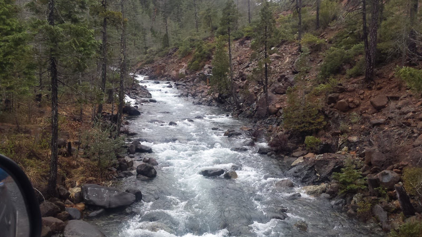


Access:  Know the snow situation before you head to the Rough and Ready headwaters, unless you are hiking all the way up from the bottom, you will be driving to 3,000'-4,000'.


The take out is where highway 199 crosses Rough and Ready Creek 5 miles south of Cave Junction (42.092838, -123.683421).  This is also where the painted gage is.

To get to the put in, head further south on 199 to O'Brien and turn right onto Lone Mountain Rd.  If you are not looking at a map, stay on that road for 13 1/2 miles until you hit a gate.  If you are looking at a map, this road changes names and is called 5505/Lone Mountain/4402/Wimer, then at the very end just before the gate stay right on the better road onto 112.

Beyond the gate (42.013778, -123.836150), you will spend some time hiking on a road, then descend to the creek cross-country.  You'll want to make your own plan for how to do that.  Here is the route we took.


Click on the map to increase resolution.


Tuesday, January 21, 2020

Big Bend Creek


  Photo: Priscilla Macy


BETA


Stream: Ben had found this creek some how or another a few years ago while driving around, then saw it had this mention in the back of Soggy Sneakers.  We had made a couple goes at it over the next couple years, but whether it was snow or logs across the road we had not made it to the put in.  


We were finally able to get on the creek near the end of 2019, and found the Soggy Sneaker description to be perfectly adequate. 

  Photo: Priscilla Macy


It had been a dismal Falls as far as water levels go, so we went for it even knowing it would be very low.  The one class V rapid (or it would be with decent flow) was steep and bouldery, lasting a couple hundred yards.  Each segment of the rapid could be broken down into individual drops at the flow we had.  Most segments we ran, a couple we portaged.
  Photo: Priscilla Macy


Below the confluence with Bulldog Creek, the creek matured a bit and the rapids were a little more quality.  Most of the run was bouldery read and run, with the occasional tease of bedrock. 
  Photo: Priscilla Macy


We had a handful of quick portages, all at water level.  In fact everything could be handled at river level.  

In this instance, I was able to hold up a log while the other two went under.


That's about all you need to know if you want to check out the creek, you might consider paddling down Steamboat Creek a ways to add some more rapids and floating if you head that way. 
 Photo: Priscilla Macy


Flows:  Iv'e had two visuals on Big Bend Creek.  The first time the Steamboat Creek gauge was at 3500 cfs, this looked like a medium flow.  We were not able to do the run due to logs blocking the road that day.  When we actually ran the creek on Dec 14, 2019 flows dropped below 1,000 cfs on the Steamboat gauge.  These flows equated to scouting the creek with our kayaks, we were able to paddle the whole way, but it was too low for interesting hydraulics to form.


Access:  Take Highway 138 East from Roseburg, in a little under 40 miles turn left onto Steamboat Creek road.  Follow Steamboat Creek road 11 miles until it crossed over Big Bend Creek.  You can take out here, or at the next bridge downstream on Steamboat Creek, which is what we did.

 After crossing Big Bend take the first immediate right turn, in 2.7 miles is a very old road dropping off to the right that could easily be missed.  We drove half a mile down this road, cutting logs as we went.  Eventually we decided it was faster and easier just to drag our kayaks down the hill.  It only took 5-10 minutes to get close enough to the creek to schwack down into it.  


Wednesday, January 8, 2020

Steelhead


Ran this while in the area doing other things.  We put in on the south fork 100 yards above the confluence with main stem.  We had fun but I wouldn't do it again.  Ben Mckenzie named the rapid halfway down "The Rapid" as it was the only one. It fed under the left wall, but was only a class IV move.  Under a handful of log portages.  Boaters were Ben Mckenzie, Kory Kellum, Andrew Bradley and myself.  Do not recall water levels but Steamboat was medium low and this creek was low, low.  


-------------------------------------------------------------------------------------------------------------------
Story
-------------------------------------------------------------------------------------------------------------------
I had injured myself earlier in the day when, while descending down into Toketee Falls, a large rock had been dislodged from above and landed hard on my shoulder.  Anna Herring hiked my boat back out and the group decided to paddle Steamboat Creek instead.  I still wasn't feeling like I could take strong strokes, so was going to just run everyone's shuttle.  At the put in was this dinky little creek with a small ledge.  I figured it was so low I could just rudder down the creek, and still get on the water so told the group I was going to do that while they paddled Steamboat.  For some reason Andrew wanted to join, then Ben and Kory.  Despite my assurances it would not be a creek with any redeemable qualities we went in with a group of 4 while the rest started down Steamboat Creek.

We laughed and giggled our way down this silly creek, pushing ourselves under logs and running exactly one defined rapid.  We got to the take out and even though there was only 15 minutes left of daylight, a rest of the guys decided to add on the 5 mile section of Steamboat creek too.  I jumped out and drove the car that had been left at the confluence down to the take out, while the other three paddled into the growing darkness.

After collecting the people who had begun their day on Steamboat hours ago, we headed back upstream to find the guys who I was pretty sure were hiking out about now.  Ben had bailed about 2 minutes into the trip so we found him near the put in, about 20 minutes later we found Kory and Andrew slogging up a sloppy hillside with big grins on their faces.

You really can't overestimate what boating with people who you can have fun with in any situation brings to the table.  The next day we ran the Gorge Electric for the first time, and the weekend was chalked up as a big success as far as a fun time goes.

Still Creek

This creek is a tributary to the Zigzag River (my favorite river growing up). They converge in view of HWY 26 on Mt Hood.  My dad and I ran a short stretch down to the confluence at one point. I recall it being class III and enjoyable.  There is an upper section that is steep with wood, but appears runnable.  That upper section might be an interesting roadside adventure for the right type of boater.  The Sandy gauge is probably useful, but I never took note of the correlation.  Zigzag runs often from rain on snow and snowmelt, Still Creek needs more rain.


Friday, December 13, 2019

North Fork Fall Creek (Eugene)


BETA
1.3 miles (we did 3 miles) 


Stream: A tiny, woody stream near Eugene.  From a bridge about 3.5 miles upstream of the Fall Creek confluence, to about 1.5 miles above Fall Creek, the North Fork is a mess of downed trees.  There were a few bedrock slides to pick off and some boulder smashing but mostly just carrying boats down the middle of the creek over, around, under, and through logs.  It took Ben and I 4 hours to go the 2 miles.

About 1.5 miles above the Falls Creek confluence the North Fork of Falls Creek picks up a bit of volume from a tributary and there are a handful of wood portages from there down.  There are also a couple runnable ten foot waterfalls and some other class III and IV bedrock rapids.   

Once on Fall Creek it's 1.5 miles of fast moving class I-II down to the take out bridge.  If the reservoir is low, there are a couple bonus class III's. 

  
Flows:  Ben and I were there January 22, 2019.  This was an ideal flow for rock boats. The last 1.5 miles could have handled more water, but the upper reaches would have been sketchy.  Below are a couple gauges in the area.


We had 5.5'-6' on the Fall Creek above North Fork gauge


Access:  

Our Put in:   43.9883, -122.5971

Better put in:  43.9864, -122.6262

Take out:  43.9727, -122.6607


Thursday, December 5, 2019

Gladiator Creek: Upper


Gladiator Creek: Upper
3 miles (+3 miles on Middle, and another 4 on the lower section)
300-400 fpm.


The uppermost section of this creek was the last to be run.  We had done the lower and middle a couple times, but the logistics of doing the upper had only resulted in a single failed attempt and a couple aborted trips.  Because of the length, I thought it might need to be done over the course of two days on the first go.  Having water levels and weather that produce two boatable days in acceptable weather conditions in this drainage are not easy to come by, especially when it has to be on a weekend.  It's especially tough because you need a group willing to commit to an early start, but you don't ever know if there will be the right amount of water until you wake up in the morning.  Then factor in the 2700' elevation of the road to drive to the trailhead and the window gets very short, often only the first storm or two of the season even give the semblence of a chance to attempt this upper run in most years.  The ingredients finally came together in October of 2019 when I got on the run with Joseph Hatcher, Ben Mckenzie, and Adam Edwards.  Priscilla was giving a talk in Eugene that night on women in the outdoors, but was willing to drive our shuttle.  Something that is appreciated and helps a lot on kayaking trips, especially so on a run like this that has many other logistical hurdles. 


On our way to a moon prance, beneath the cover of October skies.


The hike in for this Upper run is different than the Middle or Lower, it's about a 45 minute drive for the shuttle, then 4-5 miles of mostly downhill hiking on gravel roads (the roads are gated so no driving, but walk-in access is allowed).


When there is enough water for this section of the creek to run, the weather that brought it isn't usually inviting.


There are two bridges near the put in.  If you put in at the one that is further upstream, the hike is shorter, but you will have to paddle through a swamp/forest.  We just hiked the extra half mile to the second one and were glad we did.

Walking a perfectly good road to a creek, sigh.  Really though it's appreciated they even let us walk in. 


The first few minutes are pretty flat with some trees to dodge, the river then turns left and the first horizon-line becomes visible, created by Romulus and Remus.  These are back to back slides ending in a pool with an eddy on the left between the two.  We scouted Romulus on the right, and Remus on the left.  Both were clean and while we scouted Romulus for awhile, I sent everyone down Remus on verbal beta.


Weeeeee!


Downstream are a couple of small ledges, in 2019 there was a large and recent clear-cut on river right beginning shortly below the put in and ending a couple hundred yards downstream of Remus that had leaked a bunch of logs into the creek.  We were able to snake around most of these, but did have to sneak a ledge below Remus and portage a small jam just downstream.   Below this portage the creek cleaned up.


A few of the logs from the clear-cut are visible in the background of this photo.


Below the quick wood portage we floated through about 1/4 mile of class II with a couple small rapids before a gradual right turn obscured a big horizon downstream (if you are paddling along the left bank you will see the horizon sooner).  If you plan on paddling this section of creek, make note of this part.  Just above the horizon is a small, but good eddy on the left, hidden from view from above by the 2' ledge seen in the photo below.  It is best to catch this eddy one at a time.   We were taking the proper precautions, going slow and not over-committing.  Because of this we had no trouble catching the eddy and getting out above this drop despite the 100 yards of busy water above it.  If I had not known the drop was coming from a summer-time scout, it might have been a scramble to get to shore above it.


Looking upstream from the eddy that needs to be caught above the horizon.


Nobody ran this large 4 tiered drop on our trip, though Adam and Ben were considering it seriously.  If it wasn't our first time down the creek, I imagine one or both of them would have gone for it.  The final drop has a pool that is deep enough to land in, but I would not trust the depth to a plug.  I'll leave the naming to whoever runs it first.

The first two drops, of four.  Taken from shore next to the must catch eddy.


We found the portage Priscilla had sorted out last summer on the left intuitive, but brushy.  It involved a short traverse starting 20' above the creek, then descending back through a gully to creek level just below the waterfall in the photo above, and just above where the left wall turned to bare rock.  We used ropes for the last little bit of the descent back to the creek. 


Below here was another cruisy section of easy floating with the occasional small ledge.  But don't let your guard down, the biggest whitewater on this creek and one of the largest sets in the Pacific Northwest are 1/2 mile downstream.

Enjoying the calm between the storms.

Yet more class III floating ends abruptly in the Triumfallades, a set of falls and cascades leading right through and into the Pomerium, a walled in section of the creek that would require some honey badgering to descend through.  We got out on the right where the decommissioned and overgrown Castrum Road reaches the creek.  We were only just able to make out this important road marking the place to scout the Triumfallades, which comes just after a class II rapid with a wall on the right.  Tread carefully here as the Triumfallades are not something you would want to stumble into blind. 


 The photo below is taken from a last chance eddy above the Triumfallades on the right adjacent to Castrum Road (note the rock and horizon downstream).


We walked our boats up what is left of Castrum Road and dropped them at a flat spot adjacent to the rock in the photo above, where we rested for awhile.  We were protected from the rain and wind by some tall trees, with enough flat ground to lay down and cook some food.   We unloaded our boats, ate some snacks, and marveled at the large mushrooms before setting out to give the Triumfallades a look.

Big as a baby-head.


Looking up at the top half of the Triumfallades, from the Pomerium Gate.


Looking down at the Pomerium Gate in the summer.

Looking back up from inside the Pomerium.


Looking down into the Pomerium with water, there is video in the story section at the bottom of the page.


After surging into the Pomerium, one last 70' near-vertical cascade finishes off the Triumfallades.  To scout this drop when there is water in the creek would require a drone or technical ropework.  Or the full commitment route of paddling the rowdy 3rd Triumfallade into the Pomerium, then scouting the final 70' Triumfallade from the lip, fully committed for a scout that would only show you so much.  Setting safety is not realistic without a big production, and a successful descent of this drop would require channeling some Ferraro/Mcavoy magic.  None of us were even entertaining the idea of venturing into the Pomerium.  We would choose to make the longest portage of the trip when we returned tomorrow.

Big Drops make for big horizons.
The video game line I saw during a summer scout was center-left, about where the pelican box in the photo is, and hitting the left side of a large rooster just beyond the lip before catching a couple lucky bounces into the 5-10' deep pool.
 Summertime Photos from Priscilla


To portage around The Pomerium, we walked out of the trees where we had rested, crossed a washout and continued along Castrum Road.  Following it side-hill until it overlooked a gap in the bedrock down through a clear-cut gully just past and to the right of the grouping of trees in the middle of the photo.


The clear-cut had a lot of slash that made for rough going so we lowered our boats on ropes.  Looking around, we were thankful this gap in the cliffs existed.   I'm not sure how long it took to get down to creek level again, probably 30-60 minutes and with the ropes and 4 people it was not strenuous though it was important to mind your step. 

Looking down into the clear cut we descended for the portage around The Pomerium.  It would not make sense to try to get back to the creek before this point.


We returned to the creek a short ways into The Skirmishes, a long section of continuous boulder gardens.  The level had notably dropped since the previous day so we knew we would have some battling to do to get down to the Middle Bridge.  While the The Skirmishes would have been good fun at the right flow, there was a lot of rock and it was difficult to find deep bladed routes through the rapids.  There were a few wood issues, one portage and some creativity around a couple others were required.  This section was all read and run and I look forward to returning at medium flows.

Rock dodging and limb smashing through The Skirmishes.


The wood sometimes forced us into oddball channels, and despite The Skirmishes being less intimidating than the large drops on the creek, were the only rapids to produce any flips on our trip.   We were all relieved to reach the Middle bridge, knowing we were in familiar territory and were about to leave the boulders gardens behind.  I took a moment for an internal smile upon reaching the middle bridge, knowing we had just placed the last piece of the Gladiator puzzle, one I had begun a decade before.


External smiles elsewhere on the creek.
Photo: Adam Edwards


While reaching the Middle Bridge meant we had dealt with all the unknown we were going to be handling on this trip, we still needed to continue through the fun, yet not without challenge middle and lower sections (the alternate option is a 6 mile hike out).  Since Ben, Adam and I all knew the rest of the creek and had run everything below this bridge, we felt good about making efficient time and knowing where the challenges were.  That didn't mean Vesuvius Falls would let us off without some problem-solving, the water was lower than we had previously done the run and at least I knew I was planning to figure out a way not to run it.


 Ben paddling the lead in to Vesuvius, with Adam on the right in the final eddy for scouting/portaging.


 We were pretty sure with how much the level had dropped overnight, everyone was going to want to walk Vesuvius to avoid a hit, and this ended up being the case.  Since we had time on our side we elected to have Adam set up a repel around the drop down to a shallow shelf (I would not trust a repel at high flows) instead of doing a throw and go.


The rest of the day was a hoot, even though I know there is a lot of fun stuff down below Vesuvius, I always get a pleasant surprise from a rapid or two I have forgotten about since the last trip. 

Photo: Dax Kirkwood

We made good time downstream, scouting a couple times but no portages or flips.  We were having a good time sorting out what was left to be sorted on the Middle and Lower sections, doing our best to find the smoothest and most fun lines.

 Adam finds the smooth, while Joseph begins to wish he had not followed Ben and I into the jank line.

Winding down.

Once below Colosseum, the run-out can be tedious at low water like we had.  It's a price I am always willing to pay to paddle this creek, but I also enjoy looking around at all the cool structures people have built along the creek and make a game of trying to pick the channels with the least amount of wood and try to see if we can get to the bottom with at least one person not having to get out of their boat before the take out.


Trying to minimize time out of the boat with teamwork and channel-roulette.


Wrapping up a memorable trip with Ben Mckenzie, Adam Edwards, and Joseph Hatcher.


For some ramblings about why the names were given to the rapids, check out the bottom of the main Gladiator directory.


Flows:  Refer to the Gladiator gage page or main page for gauge details.  To most people I would not advocate putting in the effort for this upper section if flows were low, and would instead recommend for them to hike in from the bottom for one of the other sections, saving the upper section for prime levels. 


Our first time paddling this upper section was October 19-20, 2019
The gauge was at 3 in the morning and flows were dropping throughout the day, this first day was a good flow throughout.  You could have gone higher too.  The second day was enough to paddle on, but low.  Under 2 by the time we took out.


Here is a photo from the Upper put-in bridge the day we were there.


Access:  You will want to do your homework before attempting to paddle the upper section of this creek. and bring a good paper map, or better yet a map cached onto your phone when actually attempting the creek.

The current road situation allowed us to drive within 5 miles of the put in before reaching a gate, reaching this gate took a little under an hour in the car from the take out.  The hike was mostly flat or downhill after the initial climb up the hunting trail.  The access road gets up to 2700', so factor in the snow situation.


---------------------------------------------------------------------------------------------------------------
Memorable moments from the trip
--------------------------------------------------------------------------------------------------------


Our first successful trip down the upper section went smoothly, Joseph even wrote me afterwords joking that the trip felt "scripted", since we already knew so much about access, all the major rapids, how to get around them, etc.  I chalked the success up to so much legwork before this trip happened,  on top of years of poking around in there, Priscilla and I had taken a trip up there the Summer before so everything was fresh in my mind.


That said, there were a few memorable moments.

Right out of the gate after leaving the car, we hiked about 200' feet up a hunting trail along a ridge to save an additional mile of road hiking.  The wind was howling through there and when a gust would come up we had to stop and brace ourselves to keep from being kicked off the edge of the thin ridge-line.  There were some pretty exposed parts and I was happy to get to the top.  Upon reaching the top I found out Ben had done this short ascent with his backpack system rigged, which caused his kayak to act as a sail strapped to his back.  I was impressed he reached the top without mishap (with a little help from Joseph).


The first slide has two tiers.  The first we scouted for awhile and it took consideration and palaver to come up with a plan.   By the time we all got to the eddy at the bottom, I had already checked out the second slide to make sure it was clear of wood.  Since it was so clean I wanted to send everyone down blind.  Since you can only run something blind once, and in this age of GoPro it's even more rare to run something truly blind, an exploratory trip like this offered a unique opportunity to do so.   When I relayed to Adam I wanted to send him off without beta other than where to enter he seemed a touch skeptical, but the team was all smiles and pleased with the outcome when I joined them in the pool below a couple minutes later :)


The Pomerium is a remarkable place, Iv'e been there a couple times in the summer and standing on the Pomerium gates with water surging through below was a powerful moment for me.  If standing there had been the only rewarding moment of the trip, the effort would have been worth it to me.  Luckily it was just one of the redeemable factors of Upper Gladiator.


The Armory, the 1-2 miles of boulder gardens and wood dodging below The Pomerium, was pretty rocky on this trip as flows had dropped significantly overnight.  For the most part this read and run section went smooth, but wood forced us into weird channels at times and loads of bugger-rocks were causing strive.  There were two downstream power-flips onto rocks resulting from the edges of heavy boats flipping their captains headlong downstream onto whatever boulders were waiting there for them.  Despite these flips being mildly worrisome at the time, the events had become humorous by the time we were reflecting on them while eating dinner at the Fort Hill Diner later on that evening.


Loaded boats make for sensitive edges, we all went through a learning curve on this bouldery section.


I had always known Vesuvius would take some creativity to portage, and has been the main reason I don't run this creek all the time (my waterfall days are behind me).  We considered doing a throw and go, but I just didn't feel like doing it so took Adam up on his offer to set up a rappel.  He agreed to lower everyone down then do the only true rappel himself.  The plan was to drop into the water, blow a whistle to stop the lowering of the rope from above, then the repel-ee would do a pull up on the rope and release the carabiner attaching them to the rope.  As I dropped over the edge I looked down and the water where we would be landing was moving faster than I had hoped when we were coming up with the plan, I was concerned about releasing against the pull of the water.  I opened my mouth to object to the plan, but the rest of the team was having none of that ;)  I trust them so set my own concerns aside and focused on the task at hand.  While dangling about halfway down the cliff I saw I would be dropping into a shallow section of the pool where I would be able to stand, relieving any final reservations I had about the plan.  The rappel was the right call for this trip, but I hope to throw and go next time.


The lower section of the run starts off with Arena, it's about 15' tall so creates a horizon, but probably has the most favorable fun:hazard ratio on the whole creek.  In the past we have always hiked in from the bottom, so people can scout this drop on the way up since you can see it from the lower bridge.  Having come in from the top and having never run the creek before, Joseph had not seen this drop so we were able to treat him to a blind run of my favorite rapid on the creek.


The end of the the lower run passes through a rural-residential area, with many houses near the creek.  When we saw the first inflated pool toys littering the creek we joked some people must have gotten ambitious and beat us to the punch running the creek on their pool toys, when we saw the second, then a third and fourth we realized because this was the first big rain of the year people who had left them along the bank during the Summer had lost them to the rising water.  They were all still inflated so maybe some kids downstream ended up with some river-booty when the flow receded the next week.


Since this trip Iv'e realized how "on my mind" Gladiator has been for the last 10 years.  Paddling and exploring the area I consider my backyard with a boat has been guiding a significant portion of my thoughts and decisions over that whole period of time, with no place having more of a pull on my mind than Gladiator Creek.  Completing the full run so smoothly has left me pretty satisfied with the path paddling has taken me on.  While chasing Gladiator Creek and others like it I graduated college, began a career, married Priscilla and more or less became the person I wanted to be at this point in life.  Doing this trip shortly after turning 30 years old feels like a chapter has closed for me, opening space to think about new goals and paths to take going forward.


Approaching a take out bridge, finishing out a life chapter.


                        -jacob