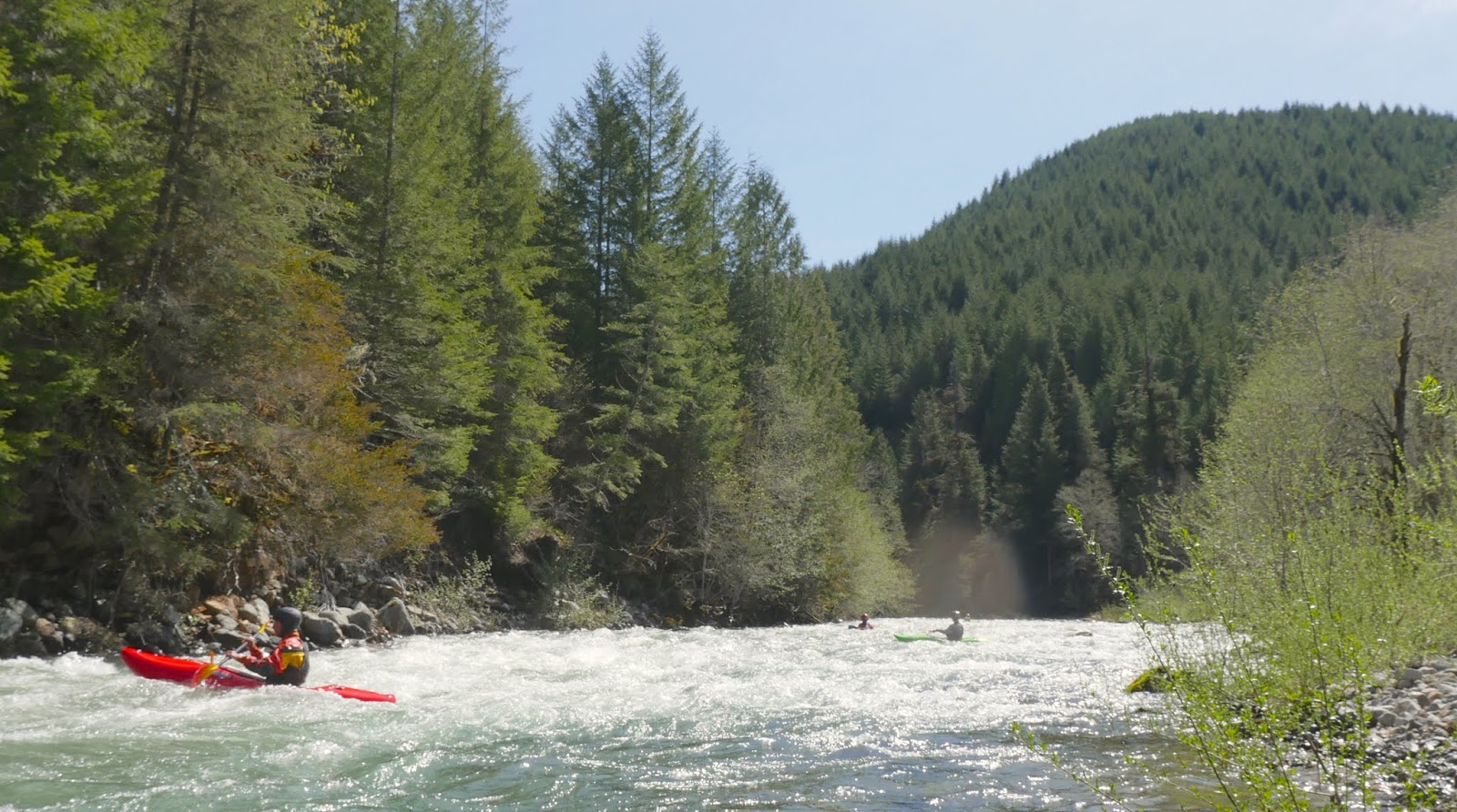
Thursday, October 30, 2014

Wiki #12: South Fork Grays


Stream: Below the put in bridge are a few minutes of class II to warm up on before a rock outcropping creates the first rapid.   Most of the water from this drop falls 9' into the wall on the left side creating a hazard.  We all boofed right, landing close to the wall.

The boof is beautiful, but a mistake could result in a wicked beating.
(or a cracked boat as we found out on the second descent).
 "Step Mother"
About to scrub the wall.

The next rapid comes up shortly and goes better than it may look.  Only a couple rapids downstream is a boulder garden that has had a tricky log in it thus far.  These are the "Step Sisters".

The "First Step Sister"
Willy sweeps up top.

The "Second Step Sister"


Things start rolling along after the Step Sisters.  The presence of wood and other hazards along with the blindness of some of the rapids necessitated prudent scouting the first time down, though everything was run.


I nearly face planted a rock in this rapid, apparently my fairy godmother was watching out for me.
 "Fairy Godmother"
Ben reminisces on his good line through Fairy Godmother while Aaron sets safety.

This triple drop was unexpected and one of the stand out rapids of the run.
"Ballroom"
Emile dancing his way through the Ballroom.

This ten foot drop is a blast and the second to last rapid.
"Stroke to Midnight."
Willy strokes to midnight


The last rapid is just around the corner.  There is a thin line to the right, if you slip through you can paddle happily ever after to the take out on the class II runout. However, if you miss the line you will be testing out the proportions of the slot on the left.  It is yet to be determined if a kayak is sized to fit.

Glass Slipper


Emile's edit of our first time down.


After Glass slipper, there is a 2 mile, class II runout. Keep your guard up until you pass a small, but Malevolent rapid where wood has been present on our trips.  As you near the end, Blaney creek comes in from the right at the same time as the South Fork consolidates one last time into an easy gorge a couple hundred yards above the confluence with the Grays. Either paddle across the Grays to take out or continue downstream on the Grays for some quality river running.


-----------------------------------------------------------------------------------------

There is no perfect gauges for this run.  There will be a little stabbing in the dark for attempts at this run.

From the few times Iv'e been up there, here are some nearby gauges and my guess at what flows to look for.  Listed in order of gauge aptitude.

250 was a healthy flow on Nov 27, 2018
A little over 300 looked runnable but full.
A group went in  1/19/2020 at 350 cfs on this gage and it was runnable, but low enough they had to portage some rapids. 
Another group went in 11/6/2021 at about 300 and flows were on the higher side of good.

Naselle gauge.
The first two times I ran the SF Grays, this was the only gauge I was aware of in the area.  The first time we had 950 cfs, most of us felt this was a good flow.  We returned the next year at about 1500 cfs on the Naselle gauge and flows were similar, but a touch lower.
The 1/19/2020 team had 1200 cfs on this gage.

Grays gauge
A bit over 3,000 cfs on the  Nov 4, 2018 looked like a full, juicy flow.
5,000 cfs and dropping was also healthy runnable, but a little lower.
The 1/19/2020 team had around 2,000 cfs on this gage.


There are now gates on the Grays shuttle road, so in order to do the Grays you may need to add on the SF unless the gate is open and you are comfortable tresspassing.  So leave a car either at the 101 bridge, or a little ways up Fossil Creek road where it gets close to the river.  Or even at the covered bridge a few more flat miles downstream 46.3548, -123.5812.

To get to the put in travel along Hwy 4 back East to the town of Skamokawa. Just on the East side of the bridge in town over the flat river, take East Valley Rd.  Follow East Valley Rd 1.3 miles before hanging a left onto Middle Valley Rd.  Stay on this road, in 2.6 miles it will make a sharp right turn and become Oatfield road.  There might be some signs about the road ending (it doesn't).

When the road turns to gravel, restart your odometer.  Stay on the main gravel logging road, at all junctions the main road goes more uphill than the spurs so stay going uphill on the main road and you will be good until you hit the ridge.  3.4 miles after leaving the pavement stay left as you top out at the ridgeline.  1/4 mile later turn right onto a smaller road and wind your way downhill for 2 miles to the put in bridge.  46.3604, -123.4261


   -jacob

---------------------------------------------------------------------------------------------------
Story
---------------------------------------------------------------------------------------------------


The scouting trip for this run was a lot more eventful than kayaking the stream, and just as fun!  My dad has been to a few Opera's over the last few years and convinced me to join him for one. We drove up to Seattle for the weekend and while I appreciated the talent of the performers in the Cinderella performance, decided Opera is probably not for me.  On the way back we decided to take a detour and check out access to a creek I had been looking at on the maps just before we crossed back into Oregon. 

Finding the put in bridge was easy enough, but we tried for the shorter shuttle route on the way out which weaves through a maze of logging roads.  There were still drifts of snow on the roads and while the Honda Element is a great car, its AWD system is terrible!!  It was designed such that when a wheel starts slipping, all the power goes to that wheel and stops sending power to the other wheels.  This was ridiculous in the snow as whenever a wheel lost traction we stopped moving while the wheel without traction spun endlessly and the ones with traction sat idle.  We spent more than an hour digging ourselves out of a couple different location, but it was a sunny day so quit enjoyable.  The crux maneuver was a washed out section of road near the end where a high speed wall ride was required to avoid falling into the washout.

We were happy to get the vehicle out that day and I at least look back fondly on that trip (you would have to ask my dad his opinion).

This year I had a number of opportunities to get on this creek, but it wasn't until the last significant rains of the year where it all came together.

The paddlers on this trip were Aaron Leiberman, Ben Mckenzie, Emile Elliot, Willy Dinsdale and myself.  However, the rafters who were willing to change plans to help out with shuttle were an integral part of this smooth trip.  Thanks Dan, Scott, Alec and Robert!

                  -----------------------------------------------------------------------------------------

The trip went smooth and is certainly one I will return to.  It offers a couple of incentives that make it appealing.

   1- The run it flows into is a good run (Grays), but people often pass up that run because it is short and a little out of the way/on the outskirts of people's radar.  Because the guidebook run is short, the two runs can be merged easily. 

   2- It tends to flow when other creeks are dropping out.  So if I was a day late to Hagen or Copper, I could then head to this stream.

   3- The put in is at a bridge and the take out is roadside, a plus for most boaters.

                   -----------------------------------------------------------------------------------------


Thursday, October 23, 2014

2014 Next Adventure Western Whitewater Championship Series (WWCS) results are in.

Into the outside's own Nate Merrill took 3rd overall (tied for 2nd with points) in the West Coast Championship Series this year. The only weekend warrior on the podium for Men K1!

Come watch the award ceremony at Next Adventure's PDXKayaker Film Festival on Nov 19th.

Nate starts the EF Lewis leg of the WWCS last year.


And his race on the Wind River in 2013.


From a post on pdxkayaker...


A big thanks to our participants, volunteers and sponsors for making this another successful WWCS and a huge thanks to Tim Brink for organizing it all! 274 kayak competitors and raft teams put on for this year's series, which included 8 events on 9 rivers.

Total points for the top 5 +\- of each event are listed below. These individuals will also be recognized at the upcoming PDX Kayaker Film Festival on Nov 19th.

Full Results at:
www.wwchampionship. org

Check out the Next Adventure Calendar for the film festival details.
www.nextadventure. net

Men R2
Oregon Rafting Team - Jaime Crone and Tim Brink - 17
Daniel Sutherland and Matt Linland - 9
Ben Sigler and Brian Carrington - 8
Jeffery Steehler and Greg Babikoff - 8
Jacob Cruser and Scott Michael - 6

Men R4
Oregon Rafting Team - Tim Brink, Jaime Crone, Daniel Sutherland, Jeffery Steehler - 21
Greg Babikoff, Bryan Carrington, Ben Sigler, Matt Linland - 12
Ark Sharks 1 - 5
Equipo Cascada - 5

Women R4
Red Lady Rafting - 5
Mountain Mamas - 4
Madame Cascade - 3

Men K1
Gerd Serrasoles - 23 
Issac Levanson - 12 
Nate Merrill - 12 
Aniol Serrasoles - 8 
Evan Garcia - 6 

Men Long
Dan Menten - 10 
Ben Marr - 5 
Joe Stumpfel - 5 
Paul Kuthe - 5 

Women K1
Sandra Hyslap - 12 
Nicole Mansfield - 11 
Roberta Grant - 11 
Sara James - 10
Katrina VanWijk - 9

Cheers,

Janice Bell (formerly Keeley)

Thursday, October 9, 2014

Sunshine Creek (Backyard)

This one flowed through my backyard growing up.  Its a tributary to Johnson Creek that flows through Gresham.  Highlights of this stream included Beavers damming the culverts that resulted in drops, boating the stream at flood in old bathtubs, K-Mart rafts, pool toys and whatever else we could find to float on (we lost a lot of "gear" on several occasions), a 2 foot mudstone ledge with a fast lead-in, foamy boating during low water periods, seal launching off bridges, zip-lining into the creek, running the dam we built, and kayaks were even used on some occasions.  Best at flood level, but always something to do if it happened to be your backyard run.  Usual suspects: Nick Hymel, Alex Hymel, Luke and Elijah Anderson, Kyle the neighbor, Gresham Union High School football team, extended Vogt and Cruser family, etc.

This bathtub saw plenty of whitewater action before we lost it in a logjam on a flooded Johnson Creek.
 There is a reasonable chance I taught Skylar how to wet exit before pushing him off this bridge.


Thursday, October 2, 2014

Blister Creek Falls

Photo: Priscilla Macy


Stream: This small stream flows into the Hot Springs Fork of the Collawash a short ways below Pegleg Falls. There is a beautiful looking 30 footer on it that has had some unfortunate wood in it.

2016 UPDATE:  The logs blocking a descent of the falls disappeared around the time of the Clackamas River Festival in Spring of 2016, so Bobby Brown, Priscilla and I all took runs down the falls in various craft that weekend.
  

Bobby more than earned the first crack at the falls.
 Photo: Priscilla Macy


 Priscilla


Smooth enough for tubes.
                                                                   Photo: Priscilla Macy


It's that clean.
Photo: Priscilla Macy

Downstream of the falls and bridge is a ten foot slide and some wood before the confluence with the Hot Springs Fork of the Collawash.  I lost the footage of when I scraped down that part back in high school.

Doing Nohorn Creek through Pegleg Falls, followed by a park and huck of Blister Creek Falls would be a full and enjoyable day of paddling.  Blister Creek Falls is a half mile drive back towards town from Pegleg Falls.

From another day; 3,000ish cfs at Three Lynx.
Kory Kellum
Photo: Priscilla Macy


Flows:  The falls can be run at a wide range of flows, most of the photos above were taken with the Clackamas Gauge reading around 1,300 cfs.   3,000 cfs is a nice flow up there, 5,000 is even better.


                                                                          15,000 cfs
                                                               Video: Catherine Loke


Access:  From Estacada take Hwy 224 up the Clackamas River about 29 miles (about 14.5 miles past Carter Bridge, and 4 miles past the Ripplebrook Ranger station).  At this point take a right towards Bagby Hot Springs (paralleling the Collawash River for much of this portion of the drive). 3.5 miles later take another right towards Bagby Hot Springs. 

5.3 miles after this turn you will cross Blister Creek and can see the falls upstream from the bridge.  There are a couple pull outs on river right along with a short trail leading to the falls.


44.9589, -122.1589

The trail leads right to the lip, making for easy access for entry and to scout/pick markers.

Beaver Creek


BETA

Stream:   Beaver Creek is a tiny little stream that drains the streets of Gresham, OR.   Near the end of it's course, before its confluence with the Sandy River, it enters a half mile long class III-IV gorge bounded by two neighborhoods.  Putting in at Troutdale Rd means you have some brush to contend with but directions are easier.  If you put in further up at Stark Street you will have two culverts to contend with, some may find those obstacles fun.

If you use the cul de sac put in (the furthest downstream), walk down the path to the river.  Put in and proceed cautiously.  When the left wall rises up, start looking for the right wall to do the same.  Just before it does is a spot you can walk up to the rim and walk through a field to scout the gorge.


Cul de Sac put in


Once past this point it's committing read and run, but the difficulty is only III-IV depending on the water level.  It's a unique section of stream that I always enjoy. In 2016 there was a log jam at the end of the gorge that could be portaged over the wood on the left.  Alex N reported in the comments below that the log jam was still there in January of 2017.


Typical scene in Beaver Creek gorge.


After the half mile long gorge the stream opens up and while there were no wood issues in 2015, there have been in past years.  There used to be a foot bridge marking the take out but that got blown out, so be on the look out for a place to hop out on the right, there is a trail that goes up to where you parked the take out vehicle.
  
Flows:  Beaver Creek flows only after significant rains.  Medium levels are 8'-9' on this gauge. 7' was the lowest we ran it and while that floats a boat, its definitely low.  This creek spikes and drops fast so if you don't like the flow, grab a burger at the Dairy Queen down the street and wait an hour for it to change.

Access:  

Click on the map to enhance resolution.

From the intersection of Troutdale Rd and Stark St in Gresham (there is a Dairy Queen here), head East on Stark St (West would take you up-hill).  Turn left at the next light onto Evans St. and stay the course for about 1 mile until you see this location, which is the take out.

Take out:  45.530068, -122.378283


There is access to an agricultural field from this neighborhood, and I like to walk along the edge of it and scout the gorge before gearing up, others may prefer to do this from the river though.

 To get to the put in, return to Stark St and head back towards the Dairy Queen.  Beaver Creek crosses under both Stark St and Troutdale Rd near here, but the put in I generally use has you turning right at the Dairy Queen onto Troutdale road, then right again in just over 1/4 mile onto Beaver Creek Ln.  After turning right, the access is through the first cul de sac on the right. 45.523693,-122.384203

There is a narrow path where the arrow is in the following photo that leads to what is sort of a park.


----------------------------------------------------------------------------------------------------------------------------------------------
Original Write-up
----------------------------------------------------------------------------------------------------------------------------------------------


This creek is a novelty, flowing through the town of Troutdale.  That being said, it is much more enjoyable that it has any right to be. The stream is impounded on the Mt. Hood Community College Campus, flows along through some class II, culverts and wood for a couple miles.  It then crossed under Troutdale road and enters a short class III-IV gorge.  To run this we would hike it in the summer and address any wood issues, then the day we were to run it we would scout the whole gorge from river right on the edge of an agricultural field.  Once you are in the gorge it is strikingly committing for flowing through a suburb.

The best rapids were the first and last in the gorge.  The final one being the trashiest with a barrel and other assorted garbage collected on the left, creating an obstacle.

 Priscilla near the beginning of the gorge.

 Once through the gorge there were a couple small rapids and usually an easy log portage before reaching a foot bridge.  The first few times we hiked out on a trail on the left, the last few times we took the trail to the right.  I would recommend the right side, the left was a mess of mud coming up the hill to Cherry Park when it had been raining enough for the creek to come in.  My dad and Val Shaul did the run down to the Sandy once and decided that walking out at the foot bridge is better.


-----------------------------------------------------------------------------------------------------------------------


 Put in either at Troutdale road or Stark street.  To cut to the chase, use these coordinates to avoid flat water and trees hanging into the stream.  45.523693,-122.384203

The trail to the put in is between these two houses. 
 To get to this cul de sac, turn right onto Beaver Creek Lane off of Troutdale road within a hundred yards of the point where Troutdale road crosses over Beaver Creek. After turning right, its the first cul de sac on the right.  The gorge starts within a hundred yards of this put in and the last point to get out and scout is on the right just before the first bedrock rapid. It is possible to get to the gorge rim and the agricultural field from that point.


Take out:  45.530068, -122.378283

This is the trail we came out on.  It is accessed from the first foot bridge to cross Beaver Creek below the gorge.  We headed downstream, then up on the trail to get to this point on Evans Ave.

For good whitewater, we would aim for 8'-9' on this gauge. 7' was the lowest we ran it and while that floats a boat, its definitely low.

The gorge drops 120 feet in .58 miles.

   -jacob

Wednesday, September 24, 2014

Middle Santiam Wilderness Run


BETA
III-IV(V)
18 miles (+6 on reservoir)


Stream: This section flows through the Middle Santiam Wilderness Area and provides an overnight kayaking opportunity for intermediate to advanced boaters.  While the overnight option is the best way to see this section of river, it can also be run in a (long) day, if someone is in a rush or the conditions are too Oregon (i.e. raining, unpredictable flow situation, and cold).  Overall the run is class II-IV, with two class V rapids that can be avoided.  


The first of the class V's (The OK Corral) is just below the put in bridge and can be scouted before putting on from the ridge the following photo is taken from.


If you don't like what you see, there is a road on river left with a spur that you can follow down towards the creek, followed by a bushwhack.  I haven't done that, but heard it's not difficult.  Or, people have put in on and run the last 1/4 mile of Lake Creek before, which is on river-right and has road access as well.


Pete Giordano on the day of the first descent of the OK Coral in 2008.

Jake Zwicke exits the O.K. Corral on a more recent 2017 trip.
Photo: Scott Baker


After the OK Corral (a series of ledges leading into a 10-15' exit falls), scout the next tricky boulder garden on the right.  After this boulder garden it's lots of read and run class III-IV, look for a creek entering on the right about a mile down (Lake Creek) with a small but tricky double drop you can hike up to if there is any water flowing down the creek.


More read and run eases off until Geomorph, where an active landslide on river right creates a series of rapids along a river-left cliff.

  The first in the Geomorph series is the largest, and should be scouted.


This series of rapids continues downstream and parts may require scouts depending on flows and wood.

More read and run leads to Shedd Camp Shelter and Shelter Falls.  As the levels come up, it's wise to be on alert above Shelter Falls.  There is a section of boulder bars that ends in a gradual right turn abruptly at this drop, with a brushy eddy on the left (where the un-manned red boat is in the following photo) immediately downstream from where a creek enters on the left.  If you are paying attention you will note the large boulders downstream and have time to make this eddy.

Scott Baker roosting Shelter Falls for his birthday.

  If you are doing this as an overnighter and the weather is bad, this is an optional place to camp in the form of a wood shelter in the forest on river left.  It's pretty early on in the trip though, so if the weather is nice it makes a better lunch spot than camp.

Photo: Zach Urness

  
The hardest drops are behind you at this point, with sustained stretches of read and run making up the rest of the trip.  Below Shelter Falls one of these sustained sections of easier rapids begins, then ends again about the time Pyramid Creek enters on the right a short way after crossing under a bridge, which is nearly the same size as the middle Santiam at this point.  The run takes on more of a river feel and becomes less creeky after this confluence.


Downstream of Pyramid Creek, a plethora of camping options exist, there are some decent ones early on, but the best ones are in the vicinity of Donaca Creek (which comes in on river right), about 1.5 miles below the Pyramid Creek confluence.

Jesse all smiles in the heart of the Middle Santiam Wilderness.


We camped immediately downstream of Donaca Creek and used it as a water source.  This site had the luxury of getting sun in the evening and morning on our Spring run.


 Camping options do exist downstream, but the big, open gravel and moss benches dwindle quickly below Donaca Creek.


Downstream of the boulder bars the stream consolidates again and enters the heart of the Middle Santiam Wilderness, this section defines scenic.  The forest in here is green, even by western Oregon standards.   The river moves along at the perfect pace through here in the form of mostly class II to III rapids (along with the occasional attention grabber), allowing you to take in what is around you without having to focus much on the rapids or making time.  Do keep an eye out for wood though, it is likely to be present, though don't be surprised if you don't ever need to get out of your boat.

Eventually, a corner is turned and the transition from wilderness into private timber land is obvious.   You may find your attention diverted from the greenery to the large cliffs visible high on the hills.


The whitewater picks back up with some read and fun, a little more exciting than the read and run that has come before.  Nearly every rapid in this section has a good jib feature or two, the smooth rocks make for great boofs, splats, and eddy turns.  Keep your eyes out for the occasional surf and the slalom opportunities as well.


This section eases off but the water keeps moving, over 4' there are no still pools so it's easy to make good time.  Don't forget to grab a snack!  There were newts everywhere both times I did the run, and the fishing is great if levels are low.


After some more cliff viewing, a final barrage of good whitewater begins.  This is my favorite section on the river, everything is boat scoutable and clean.  There is great mixture of friendly hydraulics, maneuvering, boofs, ramps and splashes.

Jesse gets a little of everything in this fun one. 


This last section of whitewater continues for some time, and left a smile on all our faces.  Finally, a bridge is reached near where the lake begins.  If you figured out access to near here it's a short lake paddle to where the vehicles are, but if you left your rig at Whitcomb Park you have 6 miles of flatwater in front of you.  Though chances are reasonable if the boat ramp is open, you might be able to bribe your way into a ride as motorized boat traffic on the reservoir for fishing is common.


While there is some good whitewater on this trip, there is also plenty of lazy floating between.  A great mix for an overnight opportunity.  The run can be done in a day, but with the long shuttle, long run and potential access hurdles I prefer to get the most time out of the run as I can on the rare opportunities that arise to paddle it.  As the only true wilderness run in Oregon's Cascades, with few trails reaching the river, you can count on the only people you see on the river being the ones you paddle in there with.


Flows:  The Middle Santiam has a foot gauge, but no cfs reading as of 2020.  The first of the following graphs show the flow we had on an overnight trip at what I would consider goldilocks flows, not too high, not too low.  The second graph was from my first time down when we did it as a day trip.  The day trip was at the low end of enjoyable, but I'd go back at that flow if it was an overnight opportunity and bring a fishing pole.  In 2017 two other groups did the run at 3.8' and 3.9' (May 20, 2017) and were satisfied by the level.  The highest level I have heard of so far was 5.2 dropping to 5.0 (May 30, 2023) from Willy Dinsdale, he said that felt like a perfect medium-high.  

Goldilocks Flows


Minimal Flows


You can also tinker around with the Inflow to Green Peter Reservoir to guess cfs.  Soggy Sneakers recommends subtracting the Quartzville flow from the Green Peter inflow to get an estimate for the Middle Santiam.  Using that calculation, 900 cfs was minimal and 1,200-1,500 was goldilocks.


Access:   The first thing to do is look the local snotel sites to get a feel for whether the put in road will be accessible.   The two closest are Jump Off Joe and Daly Lake.  The access road is between those two reporting stations, and give a reasonable estimation as to how much snow will be on the road.   The Sheep Creek road is prone to retaining snow drifts.  The logging company does plow up there some years, and has been happy to let us know whether they have done that yet at (541) 367-2111.  You can also try the local ranger district to find out the road conditions. 

And if there is snow on the road, you could always try getting resourceful.
                       Photo: Willy Dinsdale


Take Out:  The easiest take out to find is Whitcomb Creek Park boat ramp (44.477798, -122.507539).  Using this take out requires a 6 mile flat water paddle out, though bribing a ride from a motorboat is often an option if the ramp is open.  There is also a road on the other side of Green Peter Dam that goes all the way to the inlet of the reservoir, but is privately owned by a logging company.  High Deck Rd out of Cascadia is owned by that same company.  You can try and figure out those access routes if you want to reduce the reservoir paddle.  


Put In (44.466549, -122.147259):  Return to Hwy 20 and drive east about 24 miles to NF 2047/Sheep Creek Rd where you turn left.  Follow this road 8.7 miles to a bridge over the Middle Santiam (stay right at 0.3, left at 0.4, center/main at 2.3, right but not hard right at 3.6, then stay left just after, right at 5.9, 7.9 and 8.4).  The last few miles of the shuttle parallels the headwaters of the Middle Santiam

**If you don't like the look of the first gorge below the bridge (the O.K. Coral), there is a road on river left with an old spur leading close enough to the river that a short bushwhack can serve as an alternate put in.
                                 Photo: Willy Dinsdale @ 5.2'


From the Put In:  Once you reach the bridge, walk 1/10th of a mile downstream on the road to scout the OK Corral from the ridge overlooking it.


----------------------------------------------------------------------------------------------------------------------------------------------
Original Write-up
Marathon on the Middle
----------------------------------------------------------------------------------------------------------------------------------------------


The Middle Santiam is known as Oregon's only Cascade wilderness run.  My attempts on the run have been thwarted for various reasons over the last few years so this time I was bound and determined to get in there.  No one I knew seemed stoked on the trip so I loaded up my car with overnight gear, SPOT device and a scooter for shuttle.  Lucky for me I got a call the evening before my trip from Lucas Glick who agreed to join me on the 20 some odd mile run if we could do it in a day as he wanted to get on the Clear Fork Cowlitz the day after.  I unloaded my overnight gear and scooter and agreed to meet early the next morning.

To avoid the hike in and add in some adventure we planned to run the section the Oregonkayaking crew had uncovered a few years ago.  This would add about 5 miles of exploratory kayaking to the run, but allowed us to put in at a bridge instead of doing a hike.  We made good time on the shuttle and found the put in without undue difficulty.

The first hundred yards of the creek are the most stacked and difficult to scout so we hiked up a ridge to get a view of this section.  Lines committed to memory, we got ready to get underway.

**If you don't like the look of this first gorge, continue just under 1 mile past the bridge over the Middle Santiam to the bridge over Lake Creek (flows out of a culvert).  The 1/4 mile from this bridge to the confluence with the Middle Santiam has some issues, but everything is portageable and there is even a fun surprise or two waiting in there. **

 I was geared up first and slid into the water.  The first ledge was class two, I revoked my initial decision to go right when I noticed some obnoxious branches and went for the janky middle chute instead where I promptly pinned.  I tried budging the boat for a minute before Lucas got there, we both tried for another minute but the boat didn't give an inch.  I pulled my skirt and stepped onto a dry rock to my left.  My boat stayed stuck for another minute before coming free.

Glad to get the carnage out of the way early we continued on downstream into the gorge.  The first couple ledges went smooth, then I portaged a weird drop that Lucas ran before we both dropped off the fun exit falls.

The "OK Corral",  It may be short, but it sure was exiting, yeeehaa!
Also a nod to the Oregonkayaking (OK) crew for pioneering this upper section and many other runs in the area.  Boating in Oregon wouldn't be the same without them!

Lucas about to exit the O.K. Corral via a nice 10-15' foot falls.


Below here was a tricky boulder garden that we both fumbled our way through.


  The next couple miles were nice but we didn't have enough water to fully enjoy the rapids.  The area was super cool though!  There was a tantalizing double drop coming in from a creek on the right that would have been good with more flow.  The next major rapid I recall was created by a landslide coming in from the right.

Geomorphology in action.


There were more rapids in this section before we came to Shelter Falls.  This double drop is tough and I chose to portage.  Lucas cleaned up though!


Shelter Falls.

 Lucas seeks the shelter of the pool below.


The next stand out moment came when we were in cruise mode and  I caught a micro eddy just above a malevolent logjam and had to climb back upstream.  Second mistake of the day for me, I was not on top of my game.  We scouted and the jam turned out to be runnable in the middle.  Below here was a section that increased slowly in entertainment value before settling back to boulder bars.
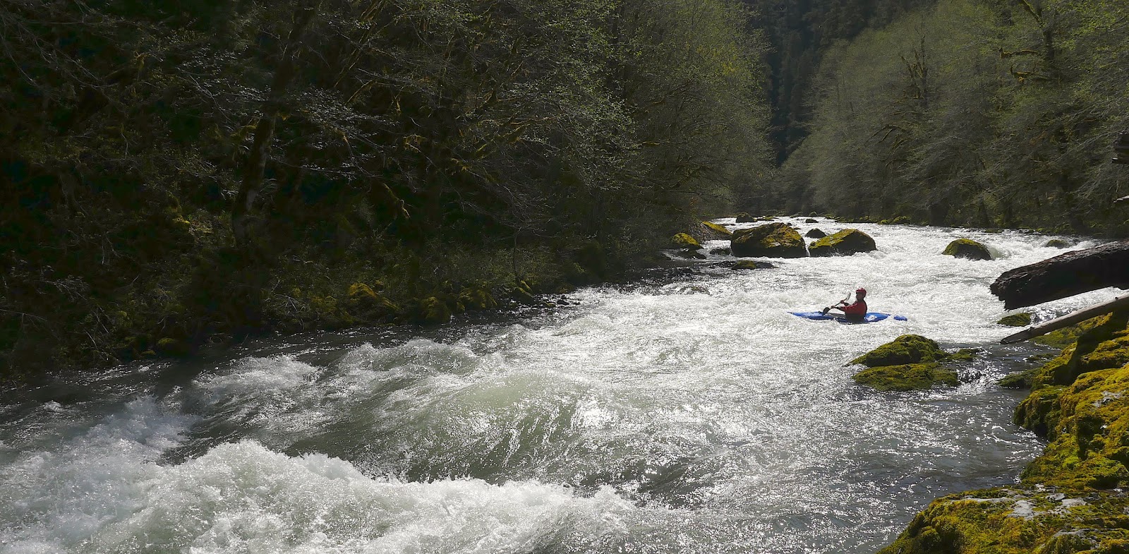
I wish I remembered more but we were moving expeditiously.  If I did the run again I would take two days to appreciate the area.  I do recall an enjoyable class III-IV section with fun rapids that lasts for quiet awhile, ending near the reservoir.  We stopped twice to fish and eat some food.


We paddled about a mile on the lake before being picked up by a motorboat.  

After this we still had time so headed over to the Pure Hate gorge on Quartzville.  That however, is a story for another day.

Video from the Middle Santiam Wilderness run.


MSantiamWilderness from Jacob Cruser on Vimeo.


Lucas and I paddled the run on June 1, 2013


The South Santiam@Cascadia dropped from 1,000 - 800 cfs that day after two days without rain.

Quartzville dropped from 700 - 550 that day.