Showing posts with label eagle creek. Show all posts

Friday, July 7, 2017

Rock Creek (Baker City) / WF Eagle Creek (Wallowa's)

In the morning of May 27, 2017 Joseph Hatcher, another guy and I checked out the Rock Creek that flows off the East side of the Little Alps near Baker City, OR.

The NF John Day @ Monument was running about 3,000 cfs from snowmelt.

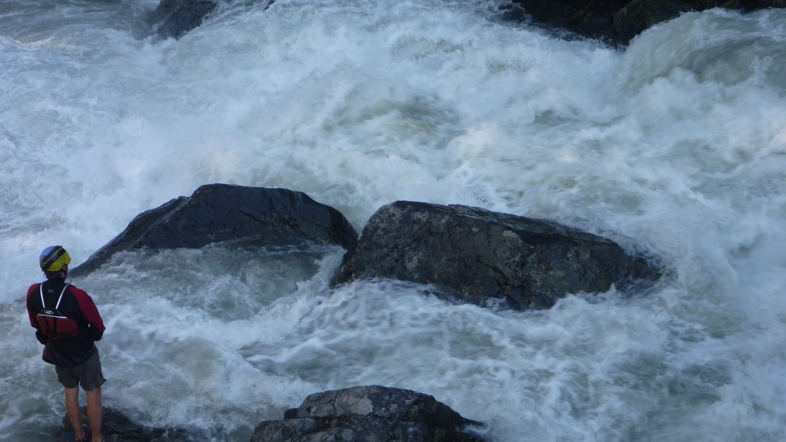
It was very steep (700 fpm+ for a portion: 44.8906, -118.0976) and we found a bouldery, eddy-free mountain stream cascading at a rapid pace down the mountain.  We discussed Joseph and the other guy running the creek, with me standing along the bank to catch them above wood hazards since eddies were not available.  In the end we felt it was more sketchy than we wanted to deal with and no one put on.  Neither Killamacue Creek or the section of Rock Creek above the Killamacue confluence looked any friendlier (in fact they looked worse).

Typical Rock Creek


There is a fools hope that a run might exist below the S Rock Creek Lane bridge, maybe a local would enjoy checking out that section.  It looked less steep than the parts we scouted, but scouting/portaging might put a boater on private property. The run we scouted would probably also be fun if someone knew it was completely free of wood, and could be run put in to take out without having to stop, though its unlikely that scenario will occur.

We then headed over to the south side of the Wallowa's and the Eagle Creek drainage, where Joseph Hatcher and I paddled the WF Eagle Creek.  We took out just upstream of the NF-67 bridge and put in a couple miles above that at a low water crossing, upstream looked flatter and woodier than the portion we ran.  The part we ran resembled a wider, less steep version of Rock Creek.  We found the run to be stressful class III+ with plenty of wood and few eddies.  We scouted every foot of stream eddy to eddy style and the eddies were more often difficult to catch than easy.  We had few portages, the fun came from puzzling the river together and not from the whitewater.

I'd not do it again, but was happy to find out what was on the run.

 We had 1300 cfs on the Eagle Creek Nr New Bridge gauge (which can be found here).

And about 2700 cfs on the Imnaha gauge, May 27, 2017, the Saturday before Memorial Day.

Put in:  45.0444, -117.4617
Take Out:  45.0235, -117.459

 -jacob

Thursday, July 6, 2017

East Fork Eagle Creek (Wallowa's)


 Photo: Michael Freeman

Michael Freeman and I checked this out in the Spring of 2013.

We hiked 6 miles to this point 45.1404, -117.3032, camped, then hiked up and scouted some more.

Camping in a drizzle.
 Photo: Michael Freeman


We didn't find anything we wanted to run that high up so returned to a meadow and floated down from there.  If I went back I'd put in here: 45.0869, -117.3067 where a 2.5 mile hike puts you in right at the top of the worthwhile whitewater.

To get there, drive to the East Eagle Trailhead.  Hike the trail on river left a little under 2.5 miles.  The spot to put in is notable:  For one, it is where the trail crosses over Curtis Creek.  Second, there will be another small tributary sliding down the mountainside into East Eagle from the other side of the creek.  Finally, there will be a large class V-VI rapid on East Eagle.  Scramble down to the creek and put in just below this rapid, which pinches down and drops 20+ feet.

Right around the corner the creek narrows, you won't have far to go before you will want to scout a  triple cascade.  There was an unfortunate log in the final tier when we were there in 2013 so we portaged the set on the left via the trail.

 Returning to the creek via a short glissade.
Photo: Michael Freeman


Downstream was a fun section of whitewater with a handful of unique bedrock rapids in the class IV-V range.

 Photo: Michael Freeman

Below the bedrock the creek looses character and runs through boulder channels that appear to change year to year.  The creek still has gradient so it kept us focused and we had a good time splashing down it.  We had one short log portage in this section in 2014.

At the very end was a bridge that had been destroyed by high water, we floated over it but its definitely worth a scout at the beginning of the day on your way up.

If you wanted a long day of boating you could combine this section with the main stem of Eagle Creek.


We had 940 cfs on the Eagle Creek Nr New Bridge gauge (which can be found here).


The Imnaha gauge was also fluctuating between 1200 and 1400 cfs from snowmelt when we ran the EF of Eagle Creek.


Click to enlarge map


    -jacob


Wednesday, November 26, 2014

Eagle Creek; Columbia River Gorge


BETA

Stream:  From the Pool below Twister Falls there is a short section of class III-IV warm up before a scout at the EF of Eagle Creek confluence.  Both the main channel and the EF channel can be run.  Just downstream is Grand Union Falls, a 50-ish foot ramp into freefall ending in a big pool.

Photo: Paul Thomson


2 miles of read and run boulder gardens lead to Skoonichuck Falls (you are getting close when you cross under a foot bridge).  Scout from either side, but left is more common.  This 50-ish foot double is usually run with a delayed boof in the middle for the first their, then wherever the current sends you for the second one.  The top drop can also be run left.  At least one person has ended up behind the veil but this is uncommon.


The pool exiting Skoonichuck is class III-ish but it is imperative that boaters get to the left bank after it ASAP.  The current gets shallow here and funnels into a narrow chute on the right that has a log wedged in it.  Boaters need to get left and go over a shallow slide.

Between here and the High Bridge gorge are three rapids, the first can be scouted from the right.  The second is run off the point just on the left side of the current (45 degree angle to absorb the shelf it lands on), and the third is run along the left bank.

A short and beautiful float through the narrow High Bridge gorge brings you to a tiered rapid best finished on the far right to avoid a hole.  The top tier is odd so take a look from river left.


A mile of read and run brings you to a 10 foot ledge, easily scouted on the right.  Just below here is the entrance to Punchbowl Falls.  There is a shallow class II entry slide, the eddies are small and soft so go one at a time.  

Scout Punchbowl from the left, I like to run the lead-in ledge on the right with a left stroke.  Then for the main drop most people like to drive up onto the boil and hold a right stroke going off.  People used to take a right side meltdown sometimes, but that's not very common anymore.


It's a tricky lip so analyze it thoroughly.  The hit can be hard, but good lines usually result in reasonable impacts.

It's worth spending some time in this punchbowl.  Float around the corner and take out above the next horizon.  If you want to portage Metlako without doing a throw and go, take the spur trail found here back up to the main one and head downstream.  Immediately after passing the second narrow cliff section there will be a way back down to the creek via a scree slope.  There is usually an animal style path helping the cause on the downstream end of this scree slope.  Below here it is class II-III to the take out at the low head dam.

If you are not portaging, scout Lower Punchbowl and run off the center-right flake.

There are two rapids between here and Punchbowl, the first one is run center and is III-IV depending on flows.  The second is a small riverwide ledge.  Run this ledge as far left as you can (even if you have to scrape).  There is a hundred feet of flatwater between here and Metlako.  Scout from the platform on the left.  It is possible to attain back upstream from here at lower flows, but it take some effort.

Here are a variety of Metlako lines, high water means a softer landing but a more hazardous pool (0:55).  The throw and go is intimidating but fine.  Try to land in the boil.  

The pool here is another special place, enjoy it if you have the time.  Easy floating leads to another horizon, it's an easy portage on the left.  Not sure if this ugly drop has been run, probably I'd guess.

Just downstream the creek leaves the gorge and meets up with the portage route.  There is one class III rapid and the rest is class II down to the take out at the low had dam. 

Flows:   Use the Bull Run Nr Multnomah Falls gauge.  400-700 is SOP, but 1,000 cfs is doable.

Access:   Take exit 41 off Hwy 84 East (no access heading West).  Turn right and follow the road to it's end in about 1/2 mile.  Find a parking spot and pay the $5 fee.  Hike up the trail until you reach your put in.   


Hiking distance to put-ins
 
      Full Run (Base of Twister Falls):          5 1/4 miles
         Standard  (Skoonichuck Falls):          3 1/2 miles
Hike and Huck (Puncbowl Falls):          2 miles 
 

----------------------------------------------------------------------------------------------------------------------------------------------
Original Write-up
----------------------------------------------------------------------------------------------------------------------------------------------


After running different section of Eagle Creek for years, Matt finally got the ball rolling and convinced us to hike past the conventional Skoonichuck put in, tracing the footsteps of the Preistly brothers, Ryan Scott and their friends to tackle the upper waterfalls.  The link below is to a Canoe & Kayak article about that trip.


After doing this trip, I now consider the true Eagle Creek run to begin at the base of Twister Falls.  Putting in lower is cutting out some good stuff, putting in higher lowers the fun:dealing ratio below the threshold of classic.  That said, all sections are enjoyable days in a kayak, tube, or swimming.  If you want to get vertical, this stream will leave you satisfied.

Thursday, May 24, 2012

County Teaser

Here is a quick teaser showing some of the wealth located in NE Oregon.  The melt is about to start, get out and explore!


    Some pictures Matt took of the intimidating gorge the crew took care of a few weeks back can be found here.

              -Jacob

Saturday, September 24, 2011

Part Two: Circumnavigation


Hoping that water would have dropped to a reasonable level after our trip to Idaho, Matt and I loaded up and headed out to see what the creeks of the Wallowa's would look like with water in them. Our first destination was magical looking V+ that would go with less water, but wasn't something we wanted to tangle with on this trip. Navigating the gravel roads was challenging at times, but Matt kept us on track aside from one short detour that lead to this old house.


After a forced 22 mile gravel detour around a 3 mile section of closed road (including the first of two bobcat sightings), we made it up to a promising fork that had plenty of water. We saw a massive granite face across the stream that was enough to get us to hike up the trail a ways hoping the stream would loose its sediment character farther up when this granite intersected the stream. We made it about half mile before deciding it would be more promising to head elsewhere. Higher up could be worth it, but we didn't have the time to explore at the time.

The massive granite face.

A gorgeous place.

What we were driving across may have been a road at some point, but at this point it was just a part of the creek.

Matt had a lead on a promising section of stream on the main fork, so we scoured the maps and this looked like a good put in.

I thought this sign was silly as we had been on loose gravel for the last 4 hours.

The flows were deceptive as it was running clear, but it was obvious once on it that it was high water. There really were not good eddies. Just slow spots near the shore with shrubs to grab onto. We almost portaged the jam in the next picture as we had to stop 100 yards upstream as there were no more eddies and it looked like it blocked the whole river. I portaged high, Matt low. I was able to get another vantage point and informed Matt it was a very clear route. It may look like there is a large eddy on his left, but that is deceptive, it was moving downstream quickly.

We came to some odd ponds on river left that signaled that we were about the enter the gorge. The next half mile was stressful and ultra fun at the same time. It was endless class four boulder gardens (or would have been at lower water) with boof after boof and lots of splashiness. The stressful part was it was challenging to stop and the river was moving fast. I made a move to catch a shrub on the left above this drop as did Matt.

Re-enforcing the addage that scouting blind corners on exploratory trips is a good practice.

We ended up portaging as the initial hole at the top was big and uniform, followed by a ramp into another large hole at the bottom. It would be more runnable at low water. Below here was some pushy class IV that didn't last long. More class II-IV lead to a campground, our take out, and some nice people willing to help us shuttle. This section would get run more often if located in western Oregon, and is still worth doing if you make a trip to the Wallowa's.

The take out at the campground.

 A local told us he hadn't seen the river this high at this time of year his entire life.
The next day we decided not to run the next drop on the list as it had a lot of water going over it. So off to complete the circumnavigation of the Wallowa's and finish our scouting. The stream we spent the most time on (The Lostine) had more water than we were interested in for the middle section that ended up being the most classic of the Wallowa runs, but we did cherry pick one good rapid higher up towards the confluence with the EF.

Head cam footage of the Cherry Picker Rapid.


The Chase from Jacob Cruser on Vimeo.

A picture perfect take out.


We had about 1600-1700 cfs on the Eagle Creek near New Bridge gauge for our run on Eagle Creek.

And for the Cherry Picker we had over 1,000 cfs on the Lostine Gauge.

   -Jacob

Wednesday, April 7, 2010

old clips

Found some clips I haven't used on the blog before. Some a couple years old, some taken last week. Nothing too special, just not much to do in Monmouth on a Tuesday night.
This is my 101st post, so I thought it would be good to look a bit into the past.


Guide to the video.
-Box smashing with the car was in my 2006 PDXkayaker film fest entry. My neighbor got stuck with a whole bunch of boxes, so we had to make good use of this unique opportunity.
-Second was our trip to Flugtag in Portland. We got there a bit late, so all the good seats were taken. We made due by heading to the top of a building about a quarter mile away, hence the shotty camera work. Fun all the same though, entertaining for sure :)
-Next, back to the boxes. We had always wanted to snowboard off the roof, we had just imagined there would be snow... Nick had a scary fall, luckily clipping the front of the boxes, luckily not getting injured. It was interesting to look back at when I used to snowboard, but kayaking is just so much funner to me and it stopped being worth the cost to head up to the mountain.
-Next clip is my dad on the Sandy river during a scouting trip of one of the tiny tributaries near oxbow park. The creek was runnable, but not worth it as I had imagined. It did however have a cool 40 footer that unfortunately landed in a very small pool. Cool to look at however. We ended the trip with a long wait in the dark as the keys were left in the put in car. Quit the debacle for a class one trip :)
-Dan, Shane and I on a top secret scouting mission :) Though anyone who has been to this spot will undoubtedly recognize it.
-Rick Cooley and Dan lowering the raft into Sick and Wrong on Sweet Creek.
-I have been wanting to backflip off the ground for 5 years, this was the first day I ever did itwithout using the blue mat! (It took me 4 separate days to get it down, but 5 years to get over the mental block). Then Zach did some gymnast stuff, including a backflip of his own.
-Kyle Robinson, Jeff Ivie and Emerald Ressler on our Eagle Creek K-mart raft mission the summer before my senior year of high school.
-Then Eric Fostermore on Eagle Creek from this year.
-Eric Arlington running "Muddyboof falls" on the headwaters of the Yaquina river.
-Myself running Punchbowl for my first time senior year of high school.
-John Jansky with a corkscrew at the Clack fest '09
-Kyle and Jeff hitting the nine footer upstream of Punchbowl.
--Additional footage by Alex Hymel and Danah.
-Jacob

Sunday, May 31, 2009

Eagle Creek

We had an epic day up on Eagle creek saturday.  This mission was about the first raft descent of Eagle Creek.  The day was led by Hans Hooman who did all the legwork and made the calls to get this together.  He was kind enough to share his descent with the group and we all had a super fun day.  Everything except Metlako and the narrow cascade below it got run.  Here are some teaser pics, I will have more up this week including the full report, video, and pictures.
     -Jacob
all photos by Paul Thomson www.ptnature.com
                                            myself probing Skoonichuck                 First known raft decent of Skoonichuck falls in a raft.                      First legitimate raft attempt at Punchbowl falls.
all  photos by Paul Thomson www.ptnature.com

Monday, August 25, 2008

Tubing Eagle creek

Alex and Nick and I headed up to Eagle Creek again this summer to tube the normal kayak run. I had kayaked it earlier in the year so I knew what we would be seeing. We put in with a throw and go at Skoonichuck, portaged on the trail the class two boulder garden section below the high bridge gorge and put back in right above punchbowl. It was a blast and is a fun low water alternative to kayaking. Between the three of us we ran every runnable drop except the 7 footer that lands on a rock shelf just above the bridge and the top drop of Skoonichuck. Nick even fired up punchbowl. Here is the video.
-Jacob