

Photo: Lucas Rietmann
Aside from a trip through the lower gorge I had done many years ago, none of us had run the Table Rock Fork of the Molalla. We decided it would make a good trip for the day so headed up to check it out with the Molalla gauge around 4,000 cfs, dropping to around 3,000 cfs by the end of the day.
Oregonkayaking mentions some larger rapids above the regular put in, so we drove up to the confluence with Lost Creek where a gate marked our roadside put in.
The first mile down to the next bridge was busy class III with one log duck that some chose to portage. This bridge would also be a decent put in.

Bi-passing the log duck.

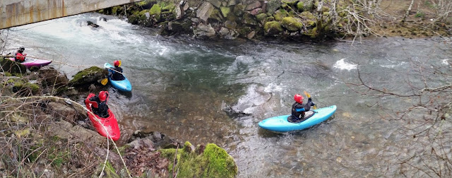
Below here was some more busy water leading to a long rapid near a quarry.
Some boogie.

Photo: Michael Freeman
Bi-passing the log duck.

Photo: Michael Freeman
Getting back in the water after a short break at the alternate put in bridge a mile below Lost Creek.

Photo: Michael Freeman
Below here was some more busy water leading to a long rapid near a quarry.
The entry to this rapid was a short flume/slide into a hydraulic before an eddy on the right where we were able to scout the next part of the rapid, which was long and bouldery.


The lower part paddled smooth, despite a dubious looking boulder pile in the middle.
 Photo: Lucas Rietmann
Anna finishes off the bouldery part of the quarry rapid.

Priscilla in the top half of the quarry rapid, with the flume visible in the background.

Photo: Michael Freeman
Anna boofing away.

Photo: Michael Freeman
The lower part paddled smooth, despite a dubious looking boulder pile in the middle.
Priscilla about halfway through the quarry rapid.

Anna finishes off the bouldery part of the quarry rapid.

Photo: Michael Freeman
More boogie water led to the standard put in, below which the splashy rapids continued. A large landslide on the left a short ways into the standard run deposited many logs on the right bank, these were scattered along the shore for the next hundred yards and have the potential to become mobile with the next high water event.
This landslide, along with the largest boulders seen yet mark the largest rapid of the standard run called The Pinch. The Pinch, which is about 100 yards below the landslide, has collected a couple of logs that came down during the mass wasting event.
This landslide, along with the largest boulders seen yet mark the largest rapid of the standard run called The Pinch. The Pinch, which is about 100 yards below the landslide, has collected a couple of logs that came down during the mass wasting event.
The logs in The Pinch did not complicate the line at all, but made the consequences for a mistake a little higher. The scout and/or portage is easiest from the left. We ran center to left in the first part of the rapid, then right to center in the second. The write-up on Oregonkayaking refers to a mandatory side surf in the bottom part of this rapid at higher flows. The level we had was not high enough for the last hole to be sticky and we all came through easily.

Anna cruising through the top portion of The Pinch.

Photo: Lucas Rietmann
Below the Pinch the stream rolls along for almost 4 miles of continuous splashy water. It was all easy to read and run, with two wood hazards. Both of these wood hazards were roadside, neither a mandatory portage.
More continuous and fun whitewater continued below here for a mile or two down to the take out. There was never a dull moment on this run, yet once below the Pinch, neither was there any point that required strong concentration. I was surprised by the quality of this run, and would not hesitate to do it again. We all agreed that even though the whitewater was easier than the Miracle Mile (a similar distance for us), it was decidedly more enjoyable.
Lucas did some kayaking too.

Logistical information and additional insight can be found at Oregon Kayaking, American Whitewater, or Oregon Paddling.


Anna showing her stoke about the run with her patented lamma-claw.

-jacob

