Showing posts with label scio. Show all posts

Monday, June 5, 2017

Bilyeu Creek (Lower)


*A paddlers face has been disguised in this report by request.


Pronounced "Blue Creek", this small creek enters Thomas Creek at the Hannah Covered Bridge.  Talking to a local farmer, there are apparently still some people from the Bilyeu family living in the area.  There is also a Blue Creek that flows into Bilyeu Creek (the French spelling of that word).

It's been on my radar for awhile, and some other boaters have looked at it, Pete and Jason from Oregonkayaking had run it.   Like me, everyone familiar with the creek was a little apprehensive about being forced onto private property while scouting or portaging during a descent.


Creek level, with a grass seed field in the background.


It's March 2017 and the first week of daylight savings.  Priscilla and I are planning to take advantage of the light, good flows and sunny weather to do some laps on the Jordan Dam after work.  While at work I remember that driving by on our way to another creek earlier in the month Bilyeu looked like it had enough water to float.  With the Thomas Creek gauge at just over 2,000 cfs and dropping I think it might be a good flow for checking out some of Bilyeu Creek.  With the advances in satellite imagery available to the public, I am pretty confident the run won't be very difficult and wood issues look minimal.   We pick a bridge 1.5 miles above the confluence with Thomas Creek to start our trip from, and decide if it's too low or high we will still be able to divert to the last couple miles of Lower Thomas Creek.

The flows appear perfect and we drive up to the Bilyeu Creek Rd bridge and put in quickly, we are not doing anything illegal but still don't want to draw attention from locals.  Most of the time interactions are positive, but often enough the interaction between kayaker and muggle on not-commonly paddled streams is time consuming and unpleasant enough that we don't want to risk it today and get geared up at the take out, ready to jump out of the cars and into the creek in as little time as possible at the put in.

We are pulling our spraydecks on 40 minutes before sunset.  I think that is plenty of time to go 1.5 miles if we don't have a slew of wood portages, Priscilla is pretty sure we are going to be hiking out through a field in the dark.  I noted the day before it looked like there is currently about half an hour  buffer past sunset where enough light remains that it would be possible to paddle, so with some encouragement she leaves her concerns at the put in and we push off.

--------------------

A month later I return with another guy to run the section Priscilla and I checked out, along with an additional 1.5 miles upstream.  Now it's getting dark around 8:30 so we are not as concerned with daylight, but plan on moving fast regardless.

Getting ready at the take out (Hannah Bridge).
630pm

Again we gear up at the take out, ready to make an inconspicuous put in.  We make note of the level at the put in, and ponder the installment of a foot gauge here some day.


Just below this put in are two log issues, we squeak by both.  We drift downstream, enjoying the small bedrock rapids that poke up here and there between the cruisy stuff.  Brush is present along both banks, and short bedrock walls pop up very now and then, giving the stream an intimate feel.


Typical Bilyeu Creek


Every now and then the brush closes in and impedes the downstream view.  Fortunately it never caused a problem and eddies were always available (however small some of them were) where we needed them.


There were two ledges in the first half of the run that stood out, both were worth a quick look as they had hazards if the line was missed.  The first one (Goulet) might be tough to look at if the flow was high.  We got out on the right and waded along the right bank to check it out.  There was an out-building from a nearby residence so we were sure to stay below the high water mark.  Right down the middle worked for us, just make sure not to get pushed into the overhangs on the right or left.

Right on line in Goulet.
Goulet is a French word for "bottleneck". When capitalized it is a guy who lives by a river constriction.
Both definitions work here.
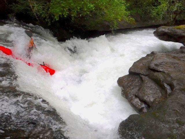
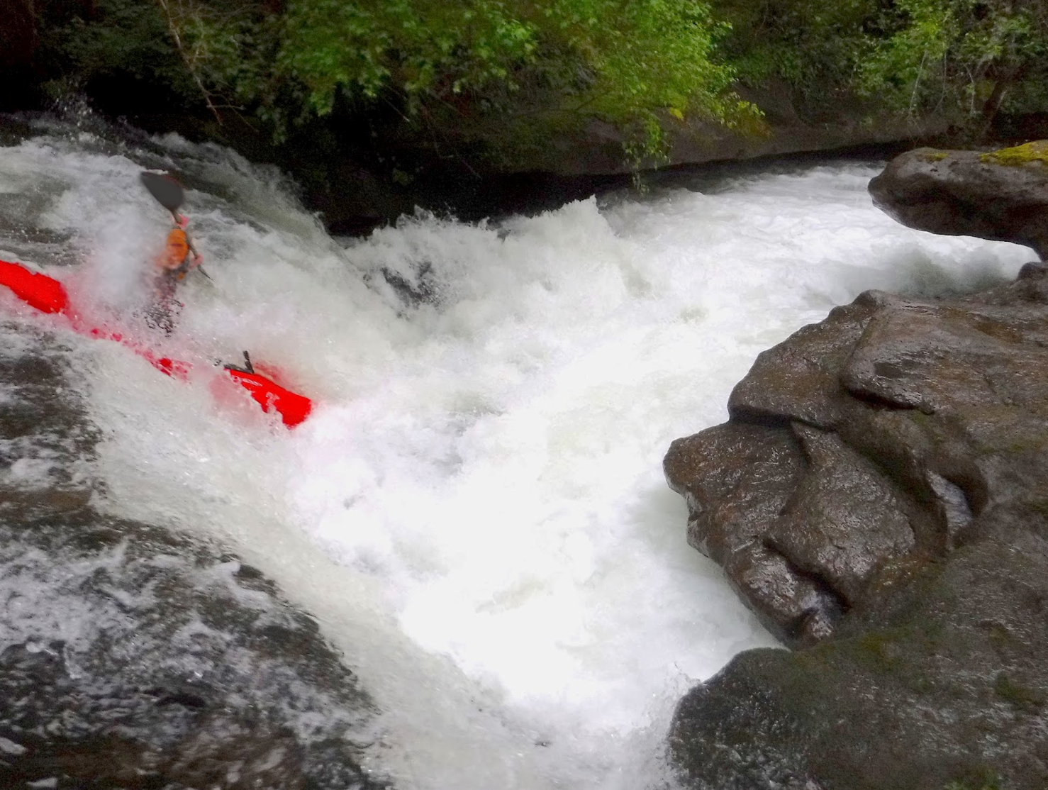
A private bridge over the creek signals the other significant ledge.  We were able to stop easily above it, but the situation was not ideal for getting out of our boats.  I was able to grab an eddy under some limbs on the right and scouted.  Walking along the bank was easy and I was able to pick out the line.  If the flows were higher I might plan on just running the drop without a scout, the line is to

"Run the easy lead in center, then go off the horizon line just left of center with a right stroke.  Error to the left".

While easily avoided with the above beta, the right side of the river does push into a rock that would be painful to collide with.  If you are too far left you risk a piton.  It's easy to keep your nose up off the 5' ledge, but if you were to really whiff it appeared possible to get stuck in the left side of the hole which would not be enjoyable as it might be a bit of a pothole.  A class IV move, but missing the line would not feel class IV.

Moving downstream it was smooth sailing, lots of read n' run and while the whitewater was easy it moved along quickly and semi-blind corners kept our attention (again, there were eddies where we needed them).


The creek is pretty consistent in nature.  Looking downstream it is either busy class II-III between walls of vegetation or small bedrock horizon lines, and the occasional log to deal with (we had no wood portages on either trip).


We were having a good time and when we reached the bridge Priscilla and I had used as a put in a couple months before we relaxed and enjoyed the remaining 1.5 miles down to Thomas Creek.


---------------------
Back to the trip with Priscilla
---------------------


The parts I had scouted in the summer seemed like pretty easy bedrock on a brushy creek with a couple notable rapids sprinkled in the section above where we are putting on.

The first rapid below where Priscilla and I put in is a nice set of small bedrock ledges, then not far downstream another small bedrock ledge.  There are eddies where we want them, but the banks look unpleasantly brushy so we are hoping we don't have to portage anything.  The stream is boat-scoutable so far, with some fun class III/IV ledgey rapids and a couple plucky holes.  There is more bedrock than I had expected and we have a good time cruising through the splashy rapids.

A ledge just below where Priscilla and I put in on our first trip.

We slide over a log, then deliberate about another one just above a bridge from our boats before Priscilla decides it goes and slides over the middle, it ended up being more straight forward than it looked from above.
Burmester Creek comes in from the left shortly below another bridge and the stream opens up a bit.

Below the confluence on a later trip.


One notable hazard was a line across the creek right at head level downstream of here.  It's hard to see from above and clotheslined Matt on our second trip.

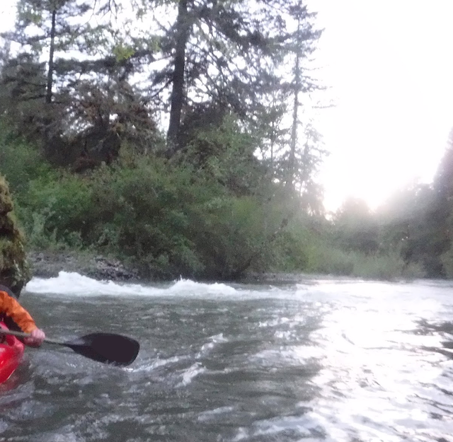
Half a mile and a few more small rapids later we float into Thomas Creek (being sure to drive right into the upstream eddy) and paddle up the eddy to the Hannah Covered Bridge where our car is waiting.  We had expected there to be some whitewater, but were surprised by the quantity and decide that as long as the run remains wood free we both hope to return.  The sun is still up at this point so we practice ferrying for half hour or so and have gear loaded just before darkness takes hold.

Floating in Thomas Creek, with Bilyeu entering just behind.

Rundown:

This is a fun, if oddball run, that I plan to return to given its proximity to my house in Albany. Take note though that with the brushy banks, wood presence and the couple more serious rapids it requires more of boaters than other class III-IV runs in the area like the Clackamas, Butte Creek or Molalla Rivers.

Also, while trespassing is not required to do this run, I implore any potential paddlers to be very aware that they are close to people's back yards and this is not the place to draw attention to oneself.  Gear up at the take out, put in quickly, and don't piss anyone off or infringe on their land.  

Difficulty:  III-IV  with wood potential and brushy banks.


Levels:  From the take out at the Hannah Bridge, walk to the confluence and look upstream.  This is a good barometer for flows.


Medium Flows
 7pm on March 16, 2017


Low, enjoyable flows.
7pm on May 17, 2017


A loose correlation to the gauge on Thomas Creek.

1,000 = Low, enjoyable.
2,000 = Medium
3,000 = High


Take Out:  Hannah Covered Bridge  44.7122, -122.7186
Put In:  Where E Bilyeu Creek Dr crosses Bilyeu Creek: 44.7041, -122.6669


The depicted on the map is 3.2 miles.

----------------------------

The further upstream you go on the creek, the more challenging the stream becomes until you get to a couple mile, 300 fpm stretch and above that a waterfall.  All of the access points are bridges, but the challenges on the water are substantial near the headwaters.

Monday, October 24, 2016

Thomas Creek: Upper


Photo: Lucas Rietmann


BETA

Stream: A fantastic intermediate trip in the mid-Willamette Valley that is only accessible during hunting season unless you are navigationally savvy and willing to put in a long day.  Keep an eye out for wood the whole day, but in Fall 2016 there were no portages.

There is some easy floating through boulder bars to warm up in before the Runaway, the first rapid.  In Runaway the current is forced against the right wall creating a rapid that ends in a short plunge into a powerful hydraulic.  Run this final plunge on the left side of the right channel with a strong right stroke, staying away from the right wall.  You can scout/portage this rapid on the left, but it's also easy to find yourself past the eddies before you realize you are in the rapid.

Runaway
                                                              Photo: Lucas Rietmann

More easy floating is below here before this section of Thomas really reaches its prime as bedrock begins to line the stream and the green walls are in stark contrast to what is turbid water if the flows are not low.


Sustained and enjoyable pool and drop class III begins to become the norm.  


As flows rise past 1,000 cfs the difficulty creeps up, never reaching class V (even at 8,300 cfs) but as flows approach 2,000 cfs the eddy situation gets loose and people have reported floating downstream alongside flotsam in a class IV environment.
                                    Photo: Lucas Rietmann


The last three rapids are the most exciting, and come in quick succession.  The first (Firebox) comes after a right hand turn, and is rowdy at flows upwards of 1,000 cfs.  I like to start right, working back to center and hold steady through a violent but forgiving bottom hydraulic that empties into a large pool.  At some flows you can sneak more center/left, and scouting is always possible from either side.

Firebox


Shoo Fly is next and pushes into the left wall if you run left, but has a line to the right of a folding hydraulic that allows for easy passage.  It can be scouted from an island just upstream of the rapid.

Shoo Fly


After another pool the creek enters the final set of ledges at Caboose Juice which make for a terrific finale and can be run right down the tongue, just keep that nose up.  

Caboose Juice

If you are looking for more action, put in a little higher to tack on the Pumkpin Patch, which has some IV (V) and a beautiful 30-40' runnable waterfall.
  
Flows:  This stretch can be run as low as 400 cfs, but ideally look for 800-1,500 cfs for a class III-IV trip.   USGS Gauge Thomas Creek @ Scio.

Access:  Directions from Anthony Boesen.  

If it is Cascade Deer or Elk hunting season, the gate has historically been open (call this number to be sure 888-741-5403).  If not, it will be closed and your only option is to find access through the Santiam State Forest via the Rock Creek drainage out of Mill City or hike a long way.

Thursday, November 5, 2015

Crabtree Headwaters: Of rumors confirmed


 I was looking over some maps a couple of years ago as I often do, and came across a steep section in the headwaters of Crabtree Creek.  This upper portion of the creek looked pretty small, but like it maybe had enough water to be a boatable stream.  Anna Herring and I went up there to scout out access last year and while access looked reasonable the stretch we paddled in our playboats (between the section I was interested in and the guidebook stretch) was low, of so so quality with an intriguing bedrock rapid right at the take out under the bridge that is used as a put in for the regular stretch.  Not long after I got in touch with Pete Giordano about the area as he tends to have run, scouted, or knows of people who have the streams of the Willamette Valley.  He said that he heard that there used to be a run in that drainage that was once a favorite among the Eric Brown/Dan Coyle crew out of Corvallis many years ago.  After further recon I began to believe that this section I was looking at could possibly be that run.

This year the rains finally arrived during hunting season and the gates that usually block access to the drainage were open.  I was surprised when 10 people showed up to gamble that these whisperings of a forgotten gem might be true. 

Boaters: Ben Mckenzie, Brian Ward, Emile Elliott, Susan Hollingsworth, Adam Elliott, Jesse Shapiro, Pete Giordano, Ross George, Priscilla Macy and myself (Jacob Cruser). 

Well I take that back, 6 people were there for that reason.  Two more were there to run the guidebook stretch downstream and two more thought they were there to run the guidebook stretch. 

After figuring out logistics the full crew drove to the put in, 8 of us geared up, said goodbye to Priscilla and Susan (who were doing the guidebook stretch) and did the short walk down the decommissioned road to the put in.  Pete took the correct route on the walk in while the rest of us spent a few extra minutes portaging down a tributary.


Once consolidated, we set up parameters for doing a a trip of this nature at healthy flows and set off downstream.

I think at this point Brian had caught on, but Ross still thinks we have put on to the class III guidebook stretch.

Fast and fun splashy rapids quickly built into class IV and we found ourselves running some good whitewater.  My suspicion that my creeking ability had degraded after months without rain was confirmed as I missed a pretty straight forward eddy and subsequently ran a rapid I had been told to scout without doing so.  We talked later on about how this was a fun intro to the season, though many of us wished we had been more dialed in!


More fun whitewater led to a horizon line with some wood visible.  Here the right wall was sliding into the river and a straight away with some challenging whitewater lead to a right hand turn.  A long scout from part of the team and it was decided that most of the us would make the portage on the right. 


The straight away.

The scout had revealed that at the end of the straight away the river turned right and entered a class V set of boulder gardens.  The rapids were big and there were no eddies in sight.  Ben and Adam decided they were confident they would find a way to stop before they found wood.  I watched them turn the corner into the rapid we later named Browntown for Eric Brown, who was the first to run so many of the creeks around here, including this one. I then helped catch the rest of the team along the bank one by one for the portage.

Brian in the straight away just before things get serious, planning to crash into the shore where this photo was taken so we can grab him for the portage.


 Ben arrives in Browntown.


Us portagers attained the treeline where the going was easier and returned to the river near the end of the 1/4 mile long set of rapids.  After reading and running some serious whitewater, Ben and Adam had indeed found a way to stop when they needed to in order to scout the final rapid in the set.  We had not seen them run the middle portion, but they described it in this way.

    Ben:  It is the hardest thing I have run in Oregon
    Adam:  It's similar to the stuff on the Upper Little White, but harder.


 Adam enters the last part of Browntown.


Staring down the final boulder jumble before things ease off.


Waiting while the team regroups a rapid or two downstream.


Ben and Adam linked every piece of whitewater aside from 20 yards that was mistakenly portaged, so gnar dudes could feasibly do the whole run without any portages if the take out just below Birgus is used.


More class fun waited below downstream.

 Par for the course.


Emile and Pete head downstream.


At the end of the challenging whitewater is the finale, a fun ramp into a right turn and over another small ledge.  Just above this drop, it appeared that an attempt had been made to divert the creek.  You can see where the diversion returns in the picture below.  Maybe in a number of years that will be the main channel?

Birgus - Named for the only crab known to climb trees.
Adam drops in on the unique ramp.  


Jesse is all smiles below Birgus.


 Things tapered down pretty quick after this, now the creek was a series of splashy III+ rapids.  There was one log portage that we easily walked on the left, the road is also close here so this location could be used as a take out. 


The mandatory log portage, it looks like it was cut down to make a bridge.

We bee-bopped downstream some more and came to a place where the stream had diverted into the woods where a unique portage ended up being our last.


After that it was splashy paddling to the take out. 


Jesse's smile had grown even more by the time we made it to the end.


Ross' emotions were less discernable.


Looking upstream from the take out bridge.


Flows from Pat Welches site, we were there on November 1st, 2015.  


2.3 miles long
280fpm
1/2 mile drops 200 feet.


-jacob