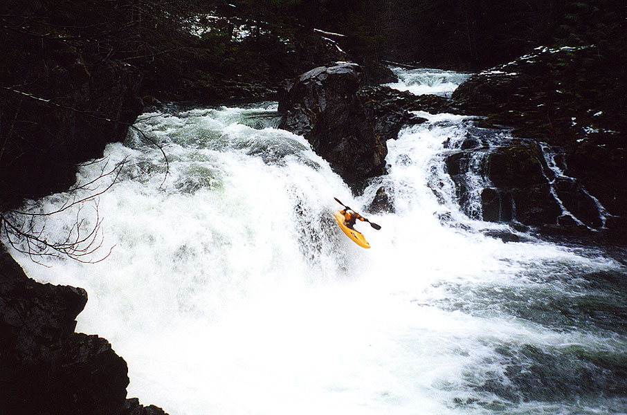
Stream: Ben had found this creek some how or another a few years ago while driving around, then saw it had this mention in the back of Soggy Sneakers. We had made a couple goes at it over the next couple years, but whether it was snow or logs across the road we had not made it to the put in.
We were finally able to get on the creek near the end of 2019, and found the Soggy Sneaker description to be perfectly adequate.
Photo: Priscilla Macy
It had been a dismal Falls as far as water levels go, so we went for it even knowing it would be very low. The one class V rapid (or it would be with decent flow) was steep and bouldery, lasting a couple hundred yards. Each segment of the rapid could be broken down into individual drops at the flow we had. Most segments we ran, a couple we portaged.
Photo: Priscilla Macy
Below the confluence with Bulldog Creek, the creek matured a bit and the rapids were a little more quality. Most of the run was bouldery read and run, with the occasional tease of bedrock.
Photo: Priscilla Macy
We had a handful of quick portages, all at water level. In fact everything could be handled at river level. In this instance, I was able to hold up a log while the other two went under.
That's about all you need to know if you want to check out the creek, you might consider paddling down Steamboat Creek a ways to add some more rapids and floating if you head that way.
Photo: Priscilla Macy
Flows: Iv'e had two visuals on Big Bend Creek. The first time the Steamboat Creek gauge was at 3500 cfs, this looked like a medium flow. We were not able to do the run due to logs blocking the road that day. When we actually ran the creek on Dec 14, 2019 flows dropped below 1,000 cfs on the Steamboat gauge. These flows equated to scouting the creek with our kayaks, we were able to paddle the whole way, but it was too low for interesting hydraulics to form.
Access: Take Highway 138 East from Roseburg, in a little under 40 miles turn left onto Steamboat Creek road. Follow Steamboat Creek road 11 miles until it crossed over Big Bend Creek. You can take out here, or at the next bridge downstream on Steamboat Creek, which is what we did.
After crossing Big Bend take the first immediate right turn, in 2.7 miles is a very old road dropping off to the right that could easily be missed. We drove half a mile down this road, cutting logs as we went. Eventually we decided it was faster and easier just to drag our kayaks down the hill. It only took 5-10 minutes to get close enough to the creek to schwack down into it.
Stream: A short section of bedrock not far off Hwy 22 that flows into the North Santiam near the town of Marion Forks. It's a novelty run at best, but was worth doing for us under the right occasion. We thought if we were driving from Salem to Bend at the right time of year it could be a nice way to break up the drive. Or if someone was looking for a class IV version of Sweet Creek.
There is a short walk in through the woods, and everything can be scouted either by the standard method of catching eddies and walking down the bank, or before putting on by walking down a rudimentary use trail that parallels the creek on river right.
There was one log that was in the way when we did the run in 2019 that required us to bang down a shallow channel on the left. The rest of the run was clean.
The last horizon is the tallest, and is run down the middle. Below this ledge/ramp the creek returns to boulders and the take out is on the right just below the island in the following photo.
Flows: We were checking this creek out on July 5, 2019. It had some water left due to snow-melt, but it wasn't really "in". Enough for a fun adventure for us, not enough to recommend to others.
These photos were taken from the bridge just downstream of the take out.
The rock circled in the photo was wet, with water washing over it. If it was covered, I think that would be a runnable flow.
Access: No need for a shuttle vehicle. Drive to the town of Marion Forks, about 16 miles SE on Hwy 22 from Detroit (between Salem and Bend). Head up Marion Creek Rd 3 miles, there will be a bridge off to the right. 100 feet past this an easy-to-miss road goes to the right into a campground, which is the take out. Scope out/mark the exit from the creek at this point. To get to the put in drive upstream 1/4 mile, on a short straight away after a right turn and before a left turn park in a tiny pull out to the left. Walk up the road another 100 feet and enter the woods and b-line for the creek.
The walking is easy, there is a final bench to drop down to the creek. If you are in the right spot there will be a log jam above and the first horizon below.
If you want, you can set the boats down before the bench and walk upstream a short distance to take in Gooch Falls. It's not runnable, but is pretty. There is a rudimentary trail that goes down to the campsight from Gooch Falls along the creek, so you can scout everything before putting on if you like.
It was the first weekend in July and we had done two week long trips to California in June. I didn't really want to spend much time in a car this weekend, but still wanted to see something new. It had been a good snow year so I thought there might be some water flowing off the Cascades still, so I set about finding a creek that would be capturing that snow melt I had not paddled yet.
I had seen plenty of photos of Marion Creek in the summer-time and it seemed like it held it's water better than rain fed streams of similar size. I had read the Oregonkayaking trip report and while I didn't want to repeat that experience Jason had mentioned in there a section of ledges and slides below Gooch Falls. The maps did show some waterfalls, and there was a bridge downstream that would make for a take out to a half mile section.
Priscilla and I headed up on a Friday with our rock boats, and found the logistics pretty straight forward. We hiked in to Gooch Falls via a short bushwhack. Gouch Falls was worth staring at for a bit before we headed downstream. 50 yards of boulders led to a log jam portage, and just downstream was a horizon line. I recognized this first drop from the OK trip report. We ended up taking a center line instead of the left line.
We found the section below to be just as advertised, 1/4 mile of small ledges and slides. We scouted a number of them, one had a log in the main line that we skirted to the left of. Other than that it was a clean creek bed.
Just below the largest ramp/ledge the creek returned to boulders and I saw a log jam downstream of the next island. I headed over to the right bank to portage and noticed it was at a campsite. I set my boat down and looked around the corner to see the take out bridge, so instead of portaging just left the boats at the campsite and I jogged back up to the car while Priscilla explored a trail heading upstream from the campground.
We decided that we should do another lap, so drove up to a point Priscilla had determined from her trip up the trail from the campsite would drop us in just below the log jam we had portaged at the top on our first lap. This time we didn't have to get out of our boats and were smiling as we hopped out again at the take out.
We both thought we might be back some day to break up a drive between Bend and Salem, feeling it was like a tamer Sweet Creek experience. With more water, maybe we would even leave the rock boats at home.
We still had some time left over so paddled the Breitenbush at the lowest flow I have done yet. We didn't have to get out of our boats and I'd probably even do it again at that flow under the right circumstance. The left side of Sharon's closed out and pinned Priscilla, and we took the second from the left slot at the Notch, everything else went in the normal lines. We took out just upstream of Humbug Creek, as we typically do if flows are low.
I try to mix up my trips to the Quartzville drainage these day. Because the upper section that is the usual draw is short, there are a number of combos that can be had. The ambitious can head upstream, or even further upstream. My favorite option is to do the section from Greg Creek down to the reservoir, but sometimes doing a park and plop or adding on a tributary is the ticket for the day.
This day we did an Upper Qville lap, then with a large group split up. Some car portaged their rafts around the middle section to avoid Double Dip and Pick up Sticks, others did another lap on the upper run. Priscilla and I went and checked out Packers Gulch.
The hike in was about 1 mile on a gravel logging road, no shuttle needed. The first pitch is steep, then it flattens out until reaching a bridge at the put in. The description in the back of Soggy Sneakers just says "class IV" and that's about how I'd sum it up too. The run was worth doing once, had a few neat sections, engaging boogie water, problem solving, and two easy log portages.
Stream: This is an obscure Oregon stream up in the headwaters of the Middle Fork Willamette near Diamond Peak that provides an adventure style challenge to the type of local boaters who enjoy that kind of boating. The first mile is steep, dropping about 400 fpm. There is a larger rapid in the middle of the run that marks a transition to less gradient (still 150-200 fpm) marked by a boulder garden leading into a vertical wall on the right and the most significant drop of the run. There are no committing canyons or features out of the ordinary on this creek, and I recall being able to deal with everything at river level.
The lower portion of the creek is more open, and on our trip had a fair bit, but not overwhelming amount of wood. The run is bridge to bridge.
Flows: Not sure, but we were able to guess a good exploratory flow from intuition so it must run when the stuff nearby is running.
Access: Take Hwy 58 SE out of Eugene past the town of Oakridge, then take NF-21 up the West side of Hills Creek Reservoir. Eventually you cross a bridge over Hills Creek Reservoir, 10 miles later turn right over a bridge across the MF Willamette and stay right after the bridge onto NF-2133. 1.3 miles after the bridge a road to the right leads to the take out bridge ( 43.4943, -122.4231). Put In: Backtrack from the bridge and continue upstream on NF-2133. In 4.4 miles Coal Creek goes under the road through a culvert at the put in (43.4401, -122.424).
Ben Mckenzie and I had been chatting about this one for awhile. The gradient was good, and it was a sister drainage to Staley Creek. At some point Ben got a chance to get out there and scout some of it at low water. He said it looked neat, and had some bedrock and ledges. Ben also said he only thought he saw a couple pieces of wood, but that he was also daydreaming for a lot of it so may have missed some.
That was enough for me, so we went and checked it out at some point. The access was good, we parked at a bridge and drove up to another bridge over a culvert. This culvert was a fun way to start the trip!
We knew the first mile was the steepest at 400 fpm, and expected to be portaging a fair bit in here (Ben had not scouted this part). We were surprised when it was pretty much all runnable, even if there was some strange in there. I walked a couple of the sections that Ben ran.
At the end of this steep section the stream matured and spread out a bit. There was one long boulder garden that dropped down into the tallest boulder ledge yet with a vertical right wall below (we portaged left) that marked the transition from steep and tight boulder rapids to more open ones with the occasional steeper rapid. This transition period had a few large boulder ledges, Ben still reminisces about one of those boofs to this day. It was also down here that the wood started to play a larger role. Ben started to recognize some of the stuff from his scout, but was surprised by the wood, validating his earlier hypothesis that he may have been daydreaming during the scout trip.
The gradient eased off some more and we made it to the take out bridge well before dark. Ben scooter shuttled, and he only had to push it up a couple steep hills. In hindsight the stream was a lot more runnable than I had expected, and a nice little adventure.
Pete Giordano, Priscilla Macy and I kayaked some of Mosby Creek 3/28/18. It is on private logging land, but permits can be obtained for the South Valley area which gives one access to this creek.
We paddled a 5.5 mile section starting at Lilly Creek (43.5791, -122.8649) and ending at a bridge near Allen Creek (43.6408, -122.9125). The beginning and end had quality class III bedrock slides and rapids, with one near the end being class IV. In the middle was a gravelly section with a couple logs to negotiate.
On the drive out we stopped to paddle a fun, roadside class IV chute against the left bank.
Yellowstone Creek is a small tributary to Quartzville Creek, if you have run Upper Quartzville Creek you have crossed over this one. Ben Mckenzie's brother had told him about a small waterfall on the creek, so a couple times after Quartzville we/I had walked up there to take a look. It looked like a fun drop, but nothing special so each time we made excuses not to bring our boats up there. Finally, after finishing a trip on upper Quartzville we were driving by mid-day and Priscilla and I couldn't come up with any reason not to carry our boats the short distance up the creek to run the falls. I'm glad we did, it was a fun plop, good enough that I carried back up for a second go.
I walked a short distance upstream of the falls while we were there and thought the creek looked runnable, and the next week I received this information from Geoffrey Marcus via the Facebook:I did some stream surveying up their a few summers back and it had decent gradient... Ive only been about 1/2 mile upstream of the drop, and it was mostly steep boulders. A little bit of bedrock here and there but nothing quite like that drop.
So this creek has joined a long list of other creeks that I may or may not run someday. There is in fact a logging road that crosses the creek up there and some real gradient. If you are up for a short adventure, consider checking this one out after a morning on Quartzville some time.
The first half mile drops 280 feet, the rest of the run is in the 250 fpm range.
This was the flow the day we ran Yellowstone Falls, I think the flow we had would be a good first time flow for exploring the rest of the creek as well.
Stream: The put in is a little over 1 mile upstream of Jawbone Flats. The standout rapids on this run are all bedrock. Most of them are runnable, while some of them are not, while nearly all are unique. There are some short waterfalls, slides, ramps, chutes and pockets. Scout each rapid carefully, fortunately it is usually obvious straight away whether you are looking at a fun rapid or a portage. Part of the fun of this run is figuring it out like a puzzle. There are a few portages (all easiest on the left) mixed in with fun and unique bedrock rapids that are sure to leave you smiling. Scout everything your first time down, and don't go around any corners without knowing where your next eddy is. The competency crux of the run is the final portage. There is a ten foot falls that splits around an island with most of the current going left and a semi-scenic tributary coming in on river right. The aforementioned Flume Creek Falls
If you have made it this far, I am sure you will recognize this as an unsafe drop as the landing zone appears to be exploding. Head up to the trail on river left and instead of returning to the creek as early as possible, continue walking down to a foot bridge (don't drop back to the creek earlier that that bridge). Put back in wherever you feel comfortable finding your way down below this bridge. Shortly below here you will reach the confluence with Battle Axe and your trip down Opal Proper will be over. If you did not get an early start, hiked slow, had carnage or fiddled around you will be noticing that the light is starting to fade. If that is the case, start looking for the road on river right to hike out on. You can continue all the way to Cascadios De Los Ninos before being committed to running the entirety of the Upper Opal section of the Little North Santiam. If you were efficient with your time, you can look forward to more boating. The most obvious choice is to continue down through Upper Opal to the Mine at the Classic Opal put in, where a short uphill hike along the road will return you to the gate where you began your hike that morning. Though if you were moving really quickly you may have time to go further if you set shuttle beforehand. Flows: 1,000 cfs is bare bones on the Little North Santiam @ Mehama gauge, 1500 cfs is the level shown in the video below and was a friendly, enjoyable level. No idea what the upper limit would be, I wouldn't hesitate to head up there with 3,000 cfs and dropping though. Access: Take I5 to Salem and head East on Hwy 22. In about 22 miles turn left at a flashing yellow light onto N Fork Rd. In about 15 miles the road turns to gravel, and at 21 miles you will reach a gate where you leave the vehicles, a location that has a $5 fee to park.
**If you know you are an efficient boater and think you will have time to do both Upper and Classic Opal after Opal Proper you can leave a vehicle at Three Pools to rid yourself of any hiking at the end of the day**
From the gate, get your gear carrying devices out and head past the locked gate up the gravel road about 3 miles to Jawbone Flat along a nice gravel road. This is a perfect use of the kayak wheels. After reaching Jawbone, head to the back of town and over Battle Axe Creek. Veer right just after the Pelton Shed, passing through an open area with a gravel pit. Just passed this open area will be a sign for "Opal Pool", if you like drop your boats here for a moment and hike down to scout the nasty rapid that lands in Opal Pool. It is worth checking out the situation above this drop so you don't accidentally get blown into it.
Return to your boats and continue along the path, shortly the path will make a sharp bend to the left and a small trail will head off to the right; take this trail to the right. Follow the trail for a little over 1 mile, at about this point you will see nothing but bouldery class II above you and it is time to put in. Looking upstream, then downstream from the put in. On the downstream end of Cedar Flats.
Original Write-up
----------------------------------------------------------------------------------------------------------------------------------------------
I realized a funny thing a couple years ago. This being that I had many times planned, joined and executed kayak trips to "Opal Creek" in the North Santiam drainage without having ever run Opal Creek itself. This was not due to debacles, in fact, those trips were all fun and usually smooth. This is because I had never intended to put on to the actual Opal Creek in the first place. From the confluence of Battle Axe Creek and Opal Creek near Jawbone, the stream the boating community usually refer to as Opal Creek is actually called the Little North Santiam. I had read the Oregonkayaking trip report and decided I would one day try to head up and boat the actual Opal Creek.
I went up to check out Opal Creek proper (above Jawbone Flat) fall 2014 armed with beta collected from the report on Oregonkayaking. I was hoping that making my trip early in the year before the snow hit would give me a more positive outlook on the stream. Video from the trip.
There have been a few changes since the OK trip occurred, here are the changes I noted
There is a new trail up creek right (OK travelled on creek left) that was not difficult.I would not be excited about trying it in the snow though. To find this trail, locate the signs in Jawbone Flats to Opal Pool. Once you scout the Narrows, return to the old road/Kopetski trail and follow until a sign for the Kopetski trail takes off to the right. Follow this to wherever you decide to put in.
The log bridge mentioned in the OK TR is gone now
The logs at the lip of Log Leap Falls are gone.It is still a dubious drop that I did not run, but with safety and the right group it may go.
Because I had read the OK TR I knew what to expect on the run, this allowed me to not have to hike out from Cascadios Los Ninos at the end of the day.Even with a late start I had plenty of time to paddle down to the Mine.If I were to repeat this run and had a shuttle, I would try to get an early start with the idea to take out at Salmon Falls for a nice long day of boating.
I had 1500 cfs, same as oregonkayaking, but without the snow I ended up having a little more water. This was a good level and I would think 1500 would be the ideal level to do Opal through Salmon Falls.
The Narrows into Opal Pool addressed in the OK TR is just as menacing as they claim, it appears that it would be very easy to boat scout past the last eddy here.If you portage Log Leap on the river left trail, keep walking until past this section.If you run Log Leap, take out as soon as you can egress up the left bank through the brush.Or better yet, make a plan as you hike upstream at the beginning of the day.
The rapid described as just below the log bridge is just as fun as noted!Great rapid.Quote from Jason “This is one of the most entertaining drops I have run in a long time; if we hadn't been so concerned with time I would have hiked up to run it again and again!“
There were a handful of portages, I did all of these on the left.If you are creative, none of them are strenuous (without snow).
I used a wheel system to get my boat to Jawbone, this helped a lot.
It took me 5 hours car to car.
The scenery is classic upper LNF drainage and there are enough unique, fun rapids to make this trip worth doing. I won't be hiking all the way up there every time I am in the area, but I wouldn't say no to a return trip in the future, near or far.
I agree with OK that Battle Axe has more runnable whitewater, but the best/most unique rapids are on Opal. If I were to have a rule of thumb about the area above Jawbone, I would say one Opal trip to two Battle Axe trips sounds about right.
If you are the kind of person who enjoys this type of run, that should be more than enough info.Go when there is no snow and enjoy!
Stream: The South Santiam is a quality, underutilized resource for Willamette Valley boaters. It's a worthwhile destination for anyone in the area, but really shines as a good run for groups with a mixture of skill levels. The run is mostly III-IV, with 3 harder rapids that can be portaged, and the stand-out-scenic Hobbit Gorge.
The put in is at the half bridge, across the river from the Yukwah
Campground. There is a large pull-out off Hwy 20 here that fits as many
vehicles as you need. If you are short on time, or it's a cold day it is also possible to
put in 3 miles downstream where Highway 20 crosses the South Santiam.
If you use the half bridge campground, you will get some easy warm-up, and three stand out features in the form of an unnamed class III rapid, a small riverwide surf ledge, and Longbow Falls. If you use the Highway 20 bridge you miss those features, but quickly get into the best part of the run.
Rob Cruser, starting out below the Highway 20 bridge.
Below the highway bridge is a series of fun class III-IV drops in a setting that feels quite isolated, even with the proximity of the highway.
In the midst of the class III-IV series of rapids.
A ledge just below.
The biggest obstacle on the run is The Monster. The Monster gets run, but more people walk it than run it. There is a ledge 100 yards above that signals that you have arrived.
The ledge just before The Monster.
Following a moving pool is, The Monster.
The Monster can be portaged on either side, but be careful not to pile up here.
There is a slowly moving pool above, and the eddies are not large. Be
cautious at high water. The easiest move here
is to eddy on the left, make a short portage at river level, then ferry
in front of the wall at the bottom. If you are not comfortable with this ferry, or the water is too high for this maneuver, it is possible to portage high on either side with additional effort.
The top of the Monster. Photo: Clinton Begley
Emile and Ben
Just below the Monster is Crawdad, which is trickiest at low flows. It can be hard to avoid the left wall, so right momentum is useful.
Rob Cruser scouts the entrance to Crawdad. The whitewater in the distance is the outflow from The Monster.
In the mile between this pinch and Tomco Falls are a couple of easier bedrock rapids. When you pass under a bridge and the river bends left get ready to hop out on the right to scout Tomco Falls, a unique drop that is ugliest at low levels.
Moose Creek comes in from the right at Tomco Falls, complicating the scout a little. And most people end up wading through Moose Creek to take a look or portage. If you don't like the look of this tricky and hazardous looking rapid, you can seal launch from the right between the two ledges. Or go further downstream if needed to avoid the whole thing.
Jean Loosmore seal launching between the two drops in Tomco.
Below Tomco there is a calm stretch before this scene and then the entrance to the Hobbit Gorge.
Photo: Priscilla Macy
The first drop in the Hobbit Gorge is the only tricky one. It is a small ledge with some turbulence that can roll people. At most flows driving hard right with speed gets you through, but take a look from the lip using the eddy on river right, you should be able to get a feel for the best line from your boat.
In the Hobbit Gorge.
The Hobbit Gorge is a special place every Oregon boater who is capable should make sure they find themselves in at some point.
Photo: Priscilla Macy
There are a couple more small rapids before the take out at Cascadia park, marked by a bridge. The trail up to the parking lot starts above this bridge. There were no portages in 2016.
Flows: I usually do this stretch below 1000 cfs on the South Santiam @ Cascade gauge when
everything else in the area seems just a little too low. Below 700 the run is less than class
four except for the first drop in Hobbit gorge and the two class V
drops, but it can be run at 500 cfs if you just really want to get in your boat. 1,000 cfs give or take a couple hundred is worthwhile. 1,500 cfs is medium. It can be run
higher, but if it is much over 1,000 cfs I usually find myself running one of the nearby creeks. One such fun nearby option is to run Canyon Creek all the way down to Cascadia State Park, that way you get to float through the Hobbit Gorge since Canyon Creek enters the South Santiam within the Hobbit Gorge. Access: Take I-5 to Highway 20 and head East. After passing through the town of Sweet Home it's a little over 14 miles to a left turn over a bridge and into Cascadia State Park at the take out. 44.398683, -122.481146 After dropping a vehicle, return to Highway 20 and head upstream 7.6 miles to the pull out at the half bridge. 44.398725, -122.343068 If you want to reduce your time on the water, put in at the Highway 20 bridge over the South Santiam just shy of 5 miles upstream of Cascadia. 44.398729, -122.393304
A video from a past trip. South Santiam segment starts at 1:50