Showing posts with label yamhill. Show all posts

Friday, June 10, 2016

Gladiator Creek: Rock Quarry Access


BETA
4.5 miles   :      Class IV/IV+(V)


Stream: This is the section of Gladiator Creek I run most often.  The hike puts you in about 1 mile below Vesuvius Falls, thus removing that drop from the equation along with ending up with a shorter hike while still getting the vast majority of the class fun whitewater.  There isn't much to say other than it is fun, there are loads of rapids, and everything is scoutable/portage-able.  Once on the creek, the rapids start off pretty quick with some bedrock and don't let up until the bridge marking the beginning of the lower section.  Depending on flows, the rapids are IV-IV+.  The only class V rapid at the flows I have run the creek is The Punisher, on the lower section, which can be portaged.  I always appreciate the amount of variety in the rapids.


Flows:  This section is best with the gage reading 2.5-3.0' at the end of the day, but Iv'e still had a good time down to 2' when I took out, and it could be paddled higher but I wouldn't be able to tell you anything about that.

Access:  To get there, hike up to the bridge at the start of the Lower section, staying on the mainline.  There are no turns, but at any major junctions stay right.  Cross the bridge and continue upstream, and uphill for a steep mile.  At the far end of the rock quarry, the road takes a sharp right.  Just as the road turns right, an overgrown road veers to the left of the main graveled road.  Get onto this overgrow road and follow it as far as it will take you, the end is on an obvious nose of land.  Find your way down to the creek from there, following the path of least resistance.  Easier access to the creek and more whitewater await if you veer upstream while descending the nose.

Click on the maps to increase resolution.  If you run the creek, print it out or save to your phone to reference while you are hiking. 

Overview

Zoomed to Rock Quarry


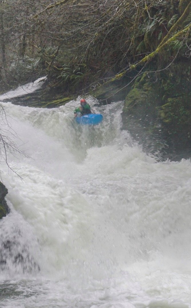
Note:  While the parts of Gladiator upstream from this section leave me with a sense of accomplishment and satisfaction, the rock quarry section always puts a smile on my face.  If this photo is indicative of that, Priscilla agrees.


Thursday, December 11, 2014

Gladiator Creek: Middle


  Photo: Emile Elliott


Gladiator Creek: Middle
3 miles (+4 on lower section)


After crossing over the Lower Bridge, there is a steep 1 mile stretch of uphill hiking.  After a left turn towards the waterhole, it's flat to the Middle bridge.  Below the put in bridge for the middle section, the creek starts off bouldery.  If flows are not up, this will feel a bit janky.


Once the bedrock appears, diligent scouting (right bank) is recommended as it is not long to the waterfall, and rapids lead up to it. 


Vesuvius Falls
  Photo: Priscilla Macy


Portaging Vesuvius can be done with a rappel on the right at lower water, or a throw and go appeared possible as well (get as far out into the middle of the pool as possible if you jump).


Adam Edwards repelling around Vesuvius at low water (1.8').


Below Vesuvius the rapids continue.  While they begin to ease in difficulty for awhile, the abundance remains consistent with a mix of small boulder gardens, ledges and surf waves.


The rapids kick back up at Ludi, a long parade of fun class IV rapids.   The Ludi have plenty of variety and is my favorite stretch on the whole creek.  Everything is scout-able from the shore, and aggressive boat scouting can get you through too if that's your style.  You can even put in here if you want to skip Vesuvius.

 The start of the Ludi is marked by a rapid that requires a move to the left and through the small bedrock pinch Joseph is floating through. 


Jacob Flock part way through a multi-part rapid of the Ludi stretch. 
 Photo: Dax Kirkwood


As the Ludi fade away, be on the look out for the creek to be diverted left by a low outcrop of bedrock at the end of a sliding straight away of easy bedrock, and into Venator, a 5 foot drop into a carnivorous hole.  This is one spot in particular where aggressive boat-scouting could backfire.

Taking a look at Venator from the low bedrock outcrop that diverts the creek left.

Spearing to the right.
Photo: Priscilla Macy                                                                                          Paddler: Chris Korbulic


Just downstream from Venator is a straight away leading to the bridge marking the beginning of the lower section of Gladiator Creek.


Emile's Video from our first time down the Middle section in 2014.


Flows:  Refer to the Gladiator gauge page or the main page for flow specifics, Vesuvius is best at or over 2.5' but the rest of the run can still be fun down to 2' and can be run lower (1.5' is too low for most everybody though).  If it's low, it's probably best to skip Vesuvius, and just paddle the Rock Quarry Section.

Access:  As of 2020, walking in is allowed during the rainy season.  When driving up the access road you will quickly cross a bridge over Gladiator Creek, this is where you take out.  To get to the start of the Hall, continue up this Fire road to a gate.  At the end of the day it's an easy 1/4 mile walk up to the gate from the take out bridge so no need to set a vehicle shuttle.  

From the gate the hike is 6 miles, 4.5 miles are relatively flat, 1.5 miles is an uphill slog.  If you are running the middle section, you will be paddling 7 miles.  The wheely-walkers are ideal for this hike, also bring food and water.

- From the gate at the bottom of the road, it's about 3 miles along the mainline to the put in bridge for the lower section, staying right towards the creek if in doubt.  There are mile markers painted on the trees to orient during the walk and you will be on the mainline until the bridge.

- To get to the middle put in, cross this first bridge, and it's a steep mile up to a quarry with no turns.  A few minutes past the quarry veer left at a "Y" (it's not the first turn) onto a road marked "waterhole", this road leads down to the put in bridge in under 1.5 miles. 

If it's your first time, it wouldn't hurt to print this and carry it with you, but a phone with GPS capability and a cached map is better.


Overview


Note:  If you don't want to run Vesuvius Falls, you can take the first left after the rock quarry for the Rock Quarry Section onto an overgrown road that will lead to a nose of land you can follow to the creek at the top of Ludi.  This makes for a fantastic day of IV/IV+(V) boating and is the option I most often take when paddling the creek.


 -----------------------------------------------------------------------------------------------------------------

Ebbinghaus Horizon

------------------------------------------------------------------------------------------------------------------


By the time Emile, Ben and I ran the Middle section of Gladiator for the first time, I had been to this creek 5-10 times for scouting and boating and had a number of failed attempts at kayaking the middle stretch.  I had seen Vesuvius at very low water, and had hiked around it to see if a portage with a kayak was reasonable (it wasn't).  This hike dropped me and my hiking partner back to the creek well below the falls so I didn't get another look at it.  Standing at the top of the falls before heading off into the woods, it had looked about 30' tall.

When Ben, Emile and I finally got in there with a good amount of water in the creek, we were again standing at the top of the falls thinking it looked about 30' tall.  Ben, the most proficient waterfall runner in our group agreed to go first.  He had a good line, but adamantly signaled we needed to tuck.  After we were all in the pool below we understood why, looking back up at the falls from here our estimation of the height now ranged from 40-60' depending on who you asked.

For a few years the thought of running this drop had kept me from going back.  I just don't have the technique required to safely run waterfalls I need to tuck for so don't like to roll the dice with my back (which has already fractured once) on drops in the 30+ foot category.  However two trips in 2019 have reinvigorated my enthusiasm for paddling this creek.  On one trip we just put in below Vesuvius, and the other we repelled around it (though I'd like to throw-and-go next time).  So now that I know dropping Vesuvius is not mandatory for paddling the creek, I need not fret anymore about going back to what is almost certainly my favorite creek in Oregon.


    -jacob


Thursday, September 18, 2014

SF Yamhill

I took a couple friends down the run starting near the Spirit Mountain Casino, adjacent to HWY 18.  They both swam in the first 100 yards so hiked out through a field.  I ran the next five miles to get the vehicle since we had done a bike/hitchhike thing.  Mostly class 1, a couple of 2's maybe with some willows growing in the creek bed.  I have read about good play at high flows including some surfboarding.  I use this gauge, when its nearing 2000 I know the smaller creeks in the area are at a good level.


Monday, February 8, 2010

Willamina Creek

Rick Cooley and I were unfortunate enough to put onto Willamina Creek earlier this winter.  It has changed a lot since the Oregonkayaking crew first discovered it.  It is now full of wood and will not be clean for a long time.
    We portaged the first drop, followed by the rest of the creek... If you don't want to read the story, that is all you need to know about this creek.
-----------------------------------------------------------------------------
  It wasn't quit to that extent, but after the first couple hundred yards, we did portage the next four hundred yards of creek due to a couple thousand alders in the creek.  I don't think Rick took many pictures, and I have no video so I'll just compare to the pictures on www.oregonkayaking.net
..................
-first picture-  It's big and the landing is shallow, we did not consider running it.
...................
-second picture- There was already a riverwide log by the bottom of the picture.  I was able to wade out and pull it out though so we actually made it to the first horizon without having to get out of the creek(less than 50 yards).  Nate also took one look at this section and decided to hike right back out.
..................
-third picture- This first drop looks like a boat beater, and I still don't know how they got under the log.  We walked.
...................
-fourth picture-  This is where the logs started to seem like a normal exploratory run.  We were dodging some sketchy logs at this point, and I bet if you took the same picture now, there would be at least twelve logs in the creek.  I don't recall if we had to portage in this section(two hundred yards), but we were starting to worry. This part would have been fun with no wood though.
.....................
-between fourth and fifth picture- We basically portaged the entire section between the two pictures.  This probably took an hour and a half to two hours.  It was all on nasty muddy slopes.  We were portaging during the portages as we had to climb over sketchy logs on muddy/vegetative slopes, for a long time, eventually we came to a place where we decided we had another hundred yards then we would hike out.  At this point we made it to the next picture.
....................
-fifth picture- This is when we determined the creek truly destroyed.  You could theoretically run the drop, but you would have had to drop over and landed just between two criss-crossed logs.  We decided to portage, which involved going over about fifteen thick logs on the shelf, starting just to the left of Pete in the picture.  Once again if you were to take the same picture now, you wouldn't be able to see Pete because of how much wood was in the way. This was also the only drop over 3 or so feet.
................................
-my mistake-  We walked part of it then decided to seal launch, then immediately ferry to the opposite side of the creek.  To do this you had to hit the deck as you dropped between two logs or get your head taken off...  I was concentrating so hard on keeping my head low enough and not to slide to the right which would also have involved a dive into some wood, that I forgot about what to do with my paddle.  It got wedged between ground and wood and it stayed there. I let go and luckily stayed upright, since I can't handroll this boat, that would have been a big problem as there was a riverwide log just downstream and a small slot on the right.  I was about to try to handpaddle through the slot (not likely), when I heard Rick yell my name, I turned just as his paddle hit me square in the hands with a perfect toss.  With the paddle I was able to make it where I needed to be and avoid the slot.  I can't express how appreciative I am that Rick was so heads up in this situation and clutch enough to dispense a perfect throw.  Rick then retrieved my paddle and made the move with no mishaps.
.........................
-next- The wood actually started to get better, then we were actually starting to go long enough without portages it started to seem like kayaking.  By the time we got to the boulder garden section we were starting to believe we might get out before dark.  This part seemed kind of fun, but did involve a couple sketchy log ducks in the middle of the drops. It only lasted a couple hundred yards.
.........................
-sixth picture- This was the funnest, cleanest drop on the run.  The final drop in the picture was for us the only real boof of the day.  Below here the creek resumed its class 1-2 nature and before we knew it we saw the take out bridge.  
...........................
-We didn't do the lower section.

    -Jacob

Monday, December 7, 2009

Slick Rock Creek


Photo by Nate Merrill
Nate, Matt and I ran Slick Rock Creek off highway 18 on the way to Lincoln city back when we had water a few weeks ago.  I had found the creek by chance last year and had wanted to go back to check out what was in there.  Strangely enough, you can drive right to the put-in for this creek on an old forgotten looking gravel road.  The take out we used was right under highway 18.  At the put in there are boulders on bedrock, and immediately enters a section with gorge walls.  We put in and were swept downstream quickly through many class four boulder gardens.  We boat scouted all the boulder gardens, so we didn't get many pictures except where Matt hopped out once.
(photo by Matt King)

Somewhere in here was an island with some bedrock.  We took the left and it was a fast slide ending in some mank, but the right side looked better with a slide and ledge.
       At one point I was in the lead and came across a steeper drop with bedrock on the sides of the walls.  I hopped out to look while Matt and Nate caught up and bashed through some devils club to see a nice double drop.   I signalled Matt through, and Nate went next off verbal beta, then I came down.    It was a nice break from the boulder gardens.

Myself in "Twist off"
(photo by Matt King)

Nate coming through the bottom hole in Twist Off.
(photo by Matt King)
Reason for the name from Matt- "cause it's sometimes nice to get a beer that you can crack easily, but them easy crackin' beers don't taste as good as others."  It also was sort of a twisty drop.
 Below here there were two spots we portaged for wood, and eventually the creek tapered off down to class II-III for the last quarter mile.  In this section Matt found a rope swing and tried it out, in the video it is obvious to tell it was created for low water use :)
            Before too long we passed a building with "park ranger" or something like that on the side.  I decided to hike out here because I was jogging the shuttle, according to a local the guy in this building is only there in the Spring.  Nate and Matt continued downstream and reported more class III and a surf wave on the way to the highway take-out.  
          The people in the area were very friendly and were interested to see kayakers.  I jogged back to the car, evaded our car alarm (Oakland the dog), and headed back to the highway within 5 min. of Nate and Matt arriving.  The video is not very indicative of the drops, as we have no footage of any rapids except the class III+ stuff at the put-in.   At high flows this run would be rockin'.  Really its a mini version of lower Roaring River.  It's about half the length, the shuttle is 5 min. instead of over an hour, no hike, and the wood situation is better.  Maybe a good way to warm up for Roaring River.
             level of the SF Yamhill should be around 2000, a boater could probably paddle all the way down to 1000, but I wouldn't recommend that. Not sure how high you could go safely.  We had about 1500 and there were a few F.U. rocks.  From Pat Welches site. we ran it 11/18  
A couple weeks ago Ben Sigler and Dan McCain fired up the put-in drop on Butte Creek Oregon.  There used to be wood in there but its good now.  The rafters cleaned up on "The Butte Crack", so I guess it goes.  Here is a video from these two trips.
And I forgot to credit it on the video, but the photos in the video are by Matt King
-Jacob


** Since we ran the creek, a gate has been installed along the access road.  This means a short hike is now required to reach the put in.

Sunday, November 16, 2008

Gladiator Creek: Lower


BETA
 4 miles


Stream: There are 3 great rapids on this stretch, it is best run as an extension to the Middle or Upper, but I have put in here before when Iv'e hiked to the bridge and decided flows were either too high, or too low for me to want to continue on.  Arena is just below the bridge, and is my favorite on the lower stretch.  The obvious line down the middle is as fun as it looks, a fast ramp into a kicker.


A couple small ledges seperate Arena from The Punisher.  Keep an eye downstream for a horizon and a waterfall coming in from the left, eddy on the right as soon as you see this, it would be easy to run out of eddies.  The scout and portage are both along the right, the drop has been run right at high water, but left at medium and lower flows.


Another short stretch of class II leads to The Colleseum, a very long set of low angle slides.  Along the right wall is the most exciting, if flows are high I recommend going left.  It is a good idea to scout this from the left if you don't know the situation, which is easy to do and obvious when it should be done.


After taking in the Colleseum from the pool below, you are done with the good stuff.   The whitewater starts off consoledated, but gradually spreads out and starts weaving through islands.  If the water is low, you take the wrong channel, or wood shifts this section can be a pain.  However, if flows are up, you guess the wood-free channels, and maybe bring some hot chocolate to sip this section goes by alright.  There are some small surfable features to change the pace too.  


Eventually the islands end, and the take out bridge comes up just around the corner.  If you only brought one car, just drop the boats and walk the short distance back up to the gate to retrieve your vehicle.
  

Flows:  The rapids are still fun even when the Upper and Middle are low.  That runout is still a bummer though when flows are low.  The Punisher lives up to it's name at high water.  Flows detailed here.

 
Access:  From the take out drive upstream 1/4 mile and turn left, park at the gate.  Hike about 3 miles on the mainline until reaching the Lower Bridge going over the creek to the right, this is the put in for the lower.


----------------------------------------------------------------------------------------------------------------------------------------------
My first time down
----------------------------------------------------------------------------------------------------------------------------------------------


My first time down was with Tim Brink and Bruce Reed from ORT, who were going to raft the creek. The last adventure we had done was the North Fork Lewis, none of the drops on this trip would be as large as those, but the unknown factor was higher.  The gate is only open during hunting season so we brought along a bunch of camo stuff and stuffed the kayak in the back of Tim's Truck (2014: now it's walk in only).
      We got skunked by low water on the upper and middle sections, but decided to try out the less mysterious lower run.  This trip started in excellent fashion, with a peal out into the 15 ft Arena Falls.  After this is a short ledge, that demanded its own respect when it gave the raft an exciting shove in the wrong direction [the upside down direction :) ].  Shortly after this was Punisher, which had not been run on the previous descent.  I felt at this water level it looked good and was able to hit a line going left-left (and have repeated that line a few times since).   The first drop lands in shallow water so nose up is the only way to go.  The raft could have run it, but chose to ghost boat it on this trip.  A minute of class II and we arrived at the large horizon line of Colosseum.  It is about a 200 yard long series of slides, with multiple lines.  After this came the two miles of class two we knew we had in store.  It took awhile with the raft, and while there was some log dodging no portages were needed.
       I was really jazzed on this trip, and have been back a number of times.  It's one of my favorite creeks in Oregon.  I am thankful that Tim and Bruce were willing to come along, and that I got to see another awesome place I probably never would have without my kayak. 


-Jacob

11/15/2008
     SFY@W-1070-970

SFY@W   - 1,000

Willamina 500-400