Saturday, September 24, 2011

Kayaking in Yellowstone

When I made my way out east, I knew there'd be lots of good outdoor activity to be had; skiing, hiking, fishing, ect. On the other hand, I was moving away from kayak central and had no idea if there'd be anything good to run. So I started with the guidebook, which pointed me straight to the lower end of of the Imnaha River. When flows started to rise in the spring, I knew the time had come! I scrounged up my kayaking gear from it's winter hiding spot and headed down the Dug Bar road into the canyon with a modest crew: Caitlin and Oakland the dog.
The Imnaha River drops from the east side of the Wallowas and parallels the Snake in Hells Canyon until the Sake takes a turn and the Imnaha cuts in. Needless to say, the canyon is impressive!

Dropping into Hells
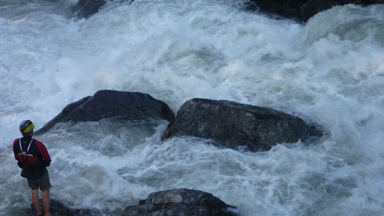
When we got down to the last bridge over the Imnaha at Cow Creek, the river was raging, but still had eddies and some pools. I later looked at the gauge and saw that it was over 3300 cfs, which is a bit over floodstage. But it looked good to go, and I put on and left Catilin and Oak to hike the trail and do the camera work. The water was big and pushy, but there weren't any big holes you had to hit and no real class V's, just lots of really fun wave trains and even a few boofs. It was easy to hop out and scout on the trail most places too.
Big Water Goodness


The last mile or so has the hardest drops and is the only really continuous part, but it empties out into the Snake and is consumed by the flatwater. There's some really cool history at the confluence, with some terraces from a doomed hotel, and a huge bar that's perfect for a picnic.
Then there's the hike. While you could continue down the Snake to Heller Bar, the shuttle is heinous and makes the hike the best option, with a kayak at least. This run would be great in a raft, but you'd certainly want to float down. With minimal gear, the hike's really not that bad: 4.5 miles on pretty flat terrain, definitely worth the effort. The trail is also in great shape, albeit shrouded in poison ivy and a had quite a few ticks (we pulled 100 off Oak, then just stopped counting...).
The Imnaha proved to be a fantastic run and definitely one that's made annual list, but it only piqued my curiosity of what the headwaters looked like. But that's a story for another day..
Signing Off,
Matt "The Labrador" King


Part Two: Circumnavigation


Hoping that water would have dropped to a reasonable level after our trip to Idaho, Matt and I loaded up and headed out to see what the creeks of the Wallowa's would look like with water in them. Our first destination was magical looking V+ that would go with less water, but wasn't something we wanted to tangle with on this trip. Navigating the gravel roads was challenging at times, but Matt kept us on track aside from one short detour that lead to this old house.


After a forced 22 mile gravel detour around a 3 mile section of closed road (including the first of two bobcat sightings), we made it up to a promising fork that had plenty of water. We saw a massive granite face across the stream that was enough to get us to hike up the trail a ways hoping the stream would loose its sediment character farther up when this granite intersected the stream. We made it about half mile before deciding it would be more promising to head elsewhere. Higher up could be worth it, but we didn't have the time to explore at the time.

The massive granite face.

A gorgeous place.

What we were driving across may have been a road at some point, but at this point it was just a part of the creek.

Matt had a lead on a promising section of stream on the main fork, so we scoured the maps and this looked like a good put in.

I thought this sign was silly as we had been on loose gravel for the last 4 hours.

The flows were deceptive as it was running clear, but it was obvious once on it that it was high water. There really were not good eddies. Just slow spots near the shore with shrubs to grab onto. We almost portaged the jam in the next picture as we had to stop 100 yards upstream as there were no more eddies and it looked like it blocked the whole river. I portaged high, Matt low. I was able to get another vantage point and informed Matt it was a very clear route. It may look like there is a large eddy on his left, but that is deceptive, it was moving downstream quickly.

We came to some odd ponds on river left that signaled that we were about the enter the gorge. The next half mile was stressful and ultra fun at the same time. It was endless class four boulder gardens (or would have been at lower water) with boof after boof and lots of splashiness. The stressful part was it was challenging to stop and the river was moving fast. I made a move to catch a shrub on the left above this drop as did Matt.

Re-enforcing the addage that scouting blind corners on exploratory trips is a good practice.

We ended up portaging as the initial hole at the top was big and uniform, followed by a ramp into another large hole at the bottom. It would be more runnable at low water. Below here was some pushy class IV that didn't last long. More class II-IV lead to a campground, our take out, and some nice people willing to help us shuttle. This section would get run more often if located in western Oregon, and is still worth doing if you make a trip to the Wallowa's.

The take out at the campground.

 A local told us he hadn't seen the river this high at this time of year his entire life.
The next day we decided not to run the next drop on the list as it had a lot of water going over it. So off to complete the circumnavigation of the Wallowa's and finish our scouting. The stream we spent the most time on (The Lostine) had more water than we were interested in for the middle section that ended up being the most classic of the Wallowa runs, but we did cherry pick one good rapid higher up towards the confluence with the EF.

Head cam footage of the Cherry Picker Rapid.


The Chase from Jacob Cruser on Vimeo.

A picture perfect take out.


We had about 1600-1700 cfs on the Eagle Creek near New Bridge gauge for our run on Eagle Creek.

And for the Cherry Picker we had over 1,000 cfs on the Lostine Gauge.

   -Jacob

Tuesday, September 20, 2011

Weekend fun

Youngin' Andrew Bradley came along with us this weekend for some fun in the rain.  He put together a little video of our Lewis River run.


   -Jacob

Wednesday, September 7, 2011

Wallowa Wiki's

Matt just moved out east to Northeast Oregon. His desire to explore had him seeking out runs in this not often sought out area of Oregon. Map work and good fortune had it that he had landed on a gold mine of creeks. The geology and steep terrain proved to create some very high quality creeks. I was in the area twice this year and was fortunate enough to get on three very good runs over there. Two of which happened to be best class five runs Iv'e done in Oregon!
In the midst of a long Class V
Stay tuned for parts 1-4.
-Jacob

Wednesday, August 10, 2011

Tube Scouting

I haven't posted anything for awhile, so here is some tubing.


   -Jacob

------------------------------------------
County Teaser #2


   -Jacob

Monday, August 8, 2011

Ohanepecosh Update

The ohane is open for busniness. As of Sunday, there are three new pieces of wood to note (between secret camp and la wis wis) that have accumulated since last year.

-About a quarter mile below secret camp there is a log jam that is easily portaged on the left. (This is the drop directly after the six foot boof on the right).  There was a moving pool leading up to this drop at our flow (2100 cfs approx. on the cowlitz).

-The second piece of wood is directly below the ledge with the old growth log stuck in it (about 3/4 of a mile into the run, I think it is called rail slide). The new piece of wood is in the run out below the ledge and is avoidable on the far right, but makes the drop more consequential. Most of the current kicks into a root wad. It also complicates the portage on the left. We found an easy portage route on the right side (The eddy was immediately above the large boulders blocking the right side of the river.  It was easy to catch, but no promises that it exists at low flows).

- The triple drop is still woody but runnable.

- The next was in the rapid that is a boulder garden leading into a low angle slide on the right.  We were able to find a route that zig-zagged down the left side, before catching an eddy and relocating into the right channel to finish off with the slide.

- The rest was squeaky clean (except of course elbow room, which was nasty)

This drop was newly clear of wood!  

     Nate M.

Monday, July 25, 2011

Snoqualmie Pass for the Weekend

Nate checking in. I'm throwing this post up in a hurry because the runs detailed below won't be in for much longer. Get em' while they're hot. With a week long business trip to Turlock, CA looming in my future, I began to lay plans for the following weekend. After spending several days in the 100 degree heat of central California, I figured that that best way to relax would be a leisurely camping and paddling trip. Having spent the last few weeks paddling the stuff around Portland, I decided that it was time to branch out a little bit and quickly convinced Anna Herring to join me on a foray deep into Washington. We initially had our eye on the Ohanepacosh, but after watching the gauge for a few days, we quickly realized that the ohane (my favorite run) was still going to be too high by the time the weekend rolled around. After examining a few other options, we settled on S.F. Snoqualmie River, east of Seattle. The South Fork, often referred to as Fall in the Wall had been described to me as a miles worth of class 4 ledges ranging from 5 - 10 feet. . I'd also heard about the 20 foot falls (fall in the wall) at the put-in with a rep. for pounding paddlers into a cave/undercut combo. By the time we were saddled up and ready to embark on our mission north, we had picked up Chris Harman and my girl friend Claire (who was down for a weekend in the woods even though she doesn't kayak. Thanks for the shuttles by the way!) We all met up at 9am on Saturday morning, loaded up my Outback and were on the road by 9:15. With a few stops along the way, we arrived at the Put-In around 2 Oclock. Upon arrival it is immediately evident how unique this creek really is. Not only is this section abnormally high in the drainage (the section is less than a mile from the pass where water starts to drop east instead of west) but it is also located between the lanes of I-90. Despite this fact, the run feels completely secluded and you really feel like you're paddling through a tunnel of old growth the entire trip. After scouting Fall in the Wall and descideing to save it for another time, we rounded the bend on the way to the lower put-in (below the 20 footer) and ran into two other kayakers (Boris and Kent?). They immediately offered to show us down the run and we didn't hesitate to accept there generous offer. 10 minutes later we were geared up and floating above the first series of drops known as 'the fearsome foursome'. I believe we ran right, right, right to left, and right again respectively through this series of 5-10 foot ledges. Nothing difficult, just good clean fun. The rest of the run was littered with tight chutes and steep falls. Everything was separated by beautiful emerald pools which made this run a great class IV experience. We had about 300 cfs on the SF gauge.
Anna Runs one of the Fearsome Foursome
After finishing up the 1 mile long section with a left line down the rapid known as root wad (the root wad is no longer present) we hiked our boats back up along the road to the put-in for round 2.
Chris digs in for the boof at the bottom of Root Wad
As were preparing to put-on for our second lap of the day, I decided to take another look at Fall in the Wall. After warming up on the first lap, I felt confident I could hit the fine line on the 20 footer and avoid being stuffed into the cave on river right. The photos I've thrown up don't quite paint an accurate picture of how consequential fall in the wall really is. What's not shown is the vertical wall the sits directly in front of the base of the falls (about 7 feet from the edge of the veil) perpendicular to the current. Basically all the water pushes into this wall and then splits (about 70% pushing right into the cave and 30% kicking out to the left and downstream.) In addition to the wall, there wasn't much of boil at the bottom, so boofing the drop was a scary proposition with the inevitable hit at the bottom. After talking with a few more of the locals (who had seen the drop run before), I opted to give er'. The plan was to eddy out at the lip of the drop to kill my speed (for fear of launching too far and flying into the wall). From there I was going to slowly roll of the flake at the lip taking half of a right stoke just enough to push my bow a little to the left and keep my boat around a 45 degree angle when entering the water. Having safety set and my line defined in my head, I jumped in my boat, hit the eddy, and dropped over the lip. Things went according to plan and I kept 'er up right at the bottom while avoiding the nasty wall. I subbed out pretty deep on the landing, which made of a really soft touch down. Thanks go out to Chris and Anna (also the other paddlers we met) for setting great safety and helping me get my boat up the canyon wall and around the portage after the falls.
Nate at the lip of Fall in the Wall And down we go..
Feeling stoked already, we bombed down the second lap stopping only to shoot photos here and there. It was really an excellent day on the river. By the time we were setting up camp (a few miles down the road) all memories of the long drive had faded away and we were stoked for day 2 of our trip.
The crew all smiles at the takeout.
We had initially planned to venture over to the skykomish on Sunday morning. However, the locals we had met at the South Fork advised us to keep heading east and tackle the Cooper River near Cle Elum, WA. I quote " We run the Skykomish all year when nothing else is running; the Cooper is what we look forward to running all year" With this description, how could we say no. After a waking up and breaking down camp, we were on the road headed east towards Cle Elum round 10 AM. After a few wrong turns, we finally ran into some other kayakers who go us on the right track. We arrived at the Put-In to find a pretty large conglomeration of boaters gearing up and starting the hike into the Cooper river gorge. After chatting with a few folks about the various rapids and hazards on the run, we were again invited to tag along with an experienced group of paddlers. Oh how I love the boating community. JD and Scott, especially, thanks for all the beta. note: Make sure to follow the trail all the way to the river. Don't be tempted to put in where you first see the creek. A 50 foot un-runnable falls lurks just around the corner. Put-in below the falls! Sadly, we didn't get a chance to snap any photos on the Cooper River, but rest assured, the run is spectacular. A secluded canyon with quality class IV ledge drops that come one after another. Great boofs everywhere! Highlights included Sharks tooth (the lone boulder garden on the Cooper) which had a boat horizontally pinned about half way down and S-turn (a chaotic rapid in which everyone had to throw a brace). We'd been warned abut Norm's Resort, but with the beta and guidance we had from the group, it was really an easy drop, just charge right (similar to bowey hotel on the the LW). According to the guide book, we were at running at fairly high flow (around 1200cfs), but talking with the local guys revealed that the level we had was about medium or even on the lower end for normal runs down the stretch. I strongly recommend everyone to give this one a shot. A true classic! Worth the drive. Do multiple laps! After a little cliff jumping at the take-out and some lunch in the sun, we reluctantly loaded up the car and began our voyage back to Oregon. The drive went by fairly quickly and we were back home and de-rigged before night fall. Great mission guys, thanks for coming along. Until next time. Nate, signing off.