Showing posts with label amboy. Show all posts

Thursday, December 3, 2015

Siouxon

This is one of those runs a lot of people talk about doing, yet few actually do.  The logistics are more challenging than your average boating trip with snow conditions, hiking, daylight and flows all weighing in to the equation.

I kept putting it off but after hearing from Jeff Compton, Scott Michael, Nick Hymel and others that this was a special run I decided that I would give it a go when the next opportunity presented itself.

A couple of the videos that got me excited about Siouxon Creek.

From Nick Hymel


Siouxon Creek Washington Kayaking from IKNick on Vimeo.

And another from Scott Michael.


A couple weekends ago I got that chance, others also wanted to see it for the first time (Priscilla Macy, Ben Mckenzie, Jake Brown) and two were happy to go back (Scott Michael and Matt King).  We met in Jantzen Beach at 6:30 and decided to do the shuttle this time around.  Utilizing a spur road we reduced the hike to 1.5 miles of easy downhill or flat hiking.

The shuttle is not for everyone, it requires modest navigation skills and adds a big chunk of time at the end of the day.  Those I have talked to who have hiked from the bottom say its pretty darn easy as far as 6 mile hikes go, plus when you finish the run you are done and can head home instead of having to retrieve your car.  That said, I might still do the shuttle next time.

Oregon kayaking has accurate shuttle directions and a good description of the run.

Hiking in


  Below is the hike that we did, including an easy 5 minute bushwhack to meet up with the trail.


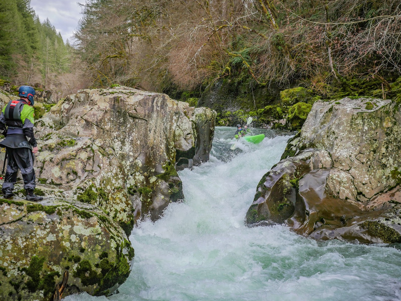
The run starts off right away with fun bedrock features, these are all pretty straight forward but keep an eye out for wood.

The first twenty footer (Upper Siouxon Falls) is really fun and clean.  Matt sent us all off blind which was a fun way to do it, a couple of us even went back up for seconds.

More high quality intermediate bedrock rapids with an occasional wood hazard continues until a big and obvious horizon line presents itself, scout/portage Middle Siouxon Falls on the left.  We thought we were in trouble for daylight at this point as we had been moving very slowly so we all portaged what looked like a good drop without giving it a good look.

Downstream more excellent intermediate bedrock whitewater continued, broken up by stretches of class II-III.

Eventually after an extended class II stretch an obvious horizon presented itself at the double drop.  We scouted right, Ben went middle off verbal beta because he was chilly and didn't want to get out of his boat, but also didn't want to miss out on the big boof in the middle.  The rest of us scouted right and three of us ran left while a couple others walked on the right.  The left side was fun and more friendly than it had looked from the right bank.


We paddled a ways more to the horizon line at Lower Siouxon Falls, again the scout/portage is on the left.  We looked at it for a short bit and I decided it was too doable to leave it unrun so gave it a go.  I was where I wanted to be from top to bottom, but was tossed nearly 180 degrees by the big feature at the transition resulting in a descent that ended up being more spectatorially amusing than technically proficient.


More class II broken up by some III+ continued a little less than 1.5 miles to the West Creek campground where we took out.  This take out is not obvious and we only knew it was there because Jake Brown had hiked there before and recognized the spot.  West Creek is the second creek to enter from the left below Lower Siouxon Falls, if you pass that creek you are in for a long day.  The preferred take out is about 100 yards above that confluence on the left at a clay bank.  I would suggest following Oregonkayaking's advice and scope out your take out before putting on.

We did the short hike back to our vehicles and set about running the long shuttle with half hour or so of light left, finally meeting at Nick's Diner in Amboy for dinner around 8pm.

The downside of the car shuttle; once you finish the run you still have over 2 hours of driving before you finally exit the Siouxon drainage.


We were there November 15 and thought flows were good.  Could have gone higher or lower.


   -jacob

Tuesday, March 29, 2011

Yacolt Creek

This is a creek you may have noticed if you paddle the EF Lewis very often.  Just passed Moulton Falls, and right as you are turning onto Sunset Falls road you can catch a glimpse to the left of a waterfall.  The creek upstream and downstream of here is pretty tame class II, but Yacolt Creek Falls offers a challenge when in the area.  The drop can be run as a 20' waterfall down the right, or a double ten footer down the left.  The right side is tricky and goes under the right wall a bit so take a good look before running.  After the two sides merge the creek drops over one more 8 foot spout and it's a short class II ride down to a bridge next to Moulton Falls.  The  EF Lewis gauge needs to be flowing over 1,000 cfs for this to be worth a look.
-------------------------------------------------------------------------------------------------------
Story
-------------------------------------------------------------------------------------------------------

After a run down the EF Lewis, we headed over to Big Tree Falls on Yacolt creek. We looked at it for awhile and while it looks easy at first glance, on closer inspection, you begin to notice problems with it. We decided the two biggest problems were glancing off the boof flake on the left and getting launched head first into the wall on the right. Matt mitigated this issue by running from right to left and melting the drop. The second issue was the undercut immediately after the drop. I thought there was a pretty good chance a boater would get shoved into this so I set safety there after running the left side boof which is easy and low stress.
Matt went, and as predicted, got tractor beamed into the undercut. He caught some downstream current as he flipped over and pulled himself out as he was beginning to sink.
Then he hopped into the raft with Dan for round two.

(All photos by David Riess)
A couple clips of Yacolts Falls at the end of this video.
 
EF of the Lewis river from Jacob Cruser on Vimeo.


On another note. We met Steve Cameron on this run, who is just getting into boating again. We found out the interesting tid-bit that Steve was on the first decent of the Truss section of the white salmon! They put in below double drop and went down through Husum either 25 or 35 (i forget which) years ago. He was also the third person ever to run Husum falls.


  -Jacob

Friday, January 28, 2011

Canyon creek; From afterwork run to mission training and back again

I started writing this post a couple months ago but never finished.  It seems relevant now so I will finish it up.
---------------------------------------------------------------
Canyon Creek Washington used to be the go to run. When the water came, people went there. After work run? Canyon Creek. I remember I never really like this run because I would always want to go do something new, but I would get duped and sucked into going to Canyon. I always had fun, but would feel I was always missing out on other runs. Why take a risk when you have such a great go to run right there I would hear(a reasonable question). A couple years ago however, the logjam arrived. Most kayakers were devastated. However, secretly I was happy with the situation. Now I could get on all the runs I wanted without Canyon Creek foiling my every move. I have gone the last couple of years without thinking too much about Canyon Creek. I knew some people went in there and portaged the jam, but that didn't seem like a bunch of fun to me, so I steered clear. Late October, 2010, the rains we had been hoping for finally hit. Extravagant plans were made to head up into the mountains in search of unseen waters. We waited for the 3 inches of rain that was forecasted to come. Friday...Saturday...still not more than a tease. Finally, Saturday evening it began to happen. The solid rain came. It was decided to wait to morning to make the call given the total uncertainty about water levels. Morning came and it was apparent the rain had begun about 8 hours too late to make Sunday a great boating day. People started heading back to the summer runs, or not going at all. Nate and I, however, were determined to get on a creek.
-------------------------------------------
We ended up on Canyon creek and I had fun.  I thought the new version was great because it was nice training for harder exploratory missions, while at the same time had some guaranteed good drops and was a known entity.  We finished the day stoked on a good year to come
--------------------------------------------
Now the Jam is gone and everyone is ready to pounce back on the local gem.  I must be the only person disappointed by this turn of events.  


Goodbye my friend, you tried your best.
(Nate Merrill photo)

   -Jacob

Disclaimer: Obviously Canyon Creek is an awesome run and I will enjoy getting on it a couple times a year.  It is the consequences of it being such a good run that led to my bitterness towards it.  This was just a satirical version of the recent events on the creek.

Monday, February 15, 2010

EF Lewis River


Photo: Priscilla Macy


BETA
 3.5,  5.5,  8,  or 11 miles


Stream: The EF Lewis is a fantastic intermediate stream near Battleground, WA.  Don't come here for a constant barrage of whitewater though, for that head to Canyon Creek where you get more bang for your buck.  That said, I like the EF Lewis run better.  It's longer, and if you accept that you will have a lot of easy floating between rapids, you will be rewarded to a lot of good rapids and a great day on the water.   Higher flows makes the boogie go by faster, which can be tedious at low flows, and spices up all the rapids.  

Sunset Falls is easy to lap and has a few different lines, so makes a nice way to start the day. 

Photo: Priscilla Macy


 When you get your fill here just peal off downstream and warm up for some rapids in the class II boogie.  The first notable rapid comes on a right bend with a rip-rapped road visible on the left just above the turn.  This is Hippie John's and is best run to the left of a large mid-stream rock that can be seen from the top of the rapid.

A short class III rapid ends in some fast water above Skypilot, my favorite rapid of the Race Course section, the most common line is down the left.  A quick moment of bouldery class II leads to the gorge.  The gorge starts of with Screaming Left, followed quickly by Dragon's Back.  Both of these can be scouted from the left before entering the gorge.

The red boat is exiting Screaming Left, and the Blue boat is entering Dragon's back.  There are paddlers visible on shore where the scouting happens.  At lower flows there is a pool between these two rapids.
Photo: Priscilla Macy


Dragon's Back empties into a class III rapid that ends in a pinch point that often has logs broached between the walls.  Typically these logs are a non-issue for boaters, but occasionally they can be problematic.   The local community will have the latest on the wood configuration.

A nice flat section within the gorge is a great place to take it in before John's Swimming hole.  John's Swimming Hole is the location of the most swims on the river outside of people botching rolls in the pool below Sunset.  While the hole can be punched at lower flows, avoided left or right at any flow, it is sticky.  Some people use this as a place to practice working their way out of holes, since it is a fairly forgiving place to get thrown around and even swim.  Just mind that wall downstream that the flow pushes into.

Chris Leach goes it right.
Photo: Priscilla Macy


Just around the corner Copper Creek enters from the left, at the end of the race course.  When the flows are up the next half mile is fun and splashy class III.  Things do start to taper off for some time, but be sure to keep your eyes downstream for the horizon line at Horseshoe Falls and stay left to scout.  The far right chute would be  a bad place to find yourself drifting into by accident.  Attentive boaters will have no problem getting left to scout.  The middle line is the most common, a beautiful 10 foot autoboof.  I have heard people knock this route because it is "too easy", but I view such an easy line as a real treat.  

While autoboofs are fun, the hit can be notable if you don't land well.
The rafters about to land well.


There are also a couple fun lines on the left if you are looking for more of a challenge, and if that's not enough for you the far right line has been run a number of times.

Phil from Seattle getting creative on the left side of Horseshoe.

Photo: David Riess


Below here the river eases to class II as it passes by a house once owned by Tanya Harding, and before long King Creek enters from the left at the take out used by people looking for an "introduction to creeking" sort of day.  For boaters looking for more of a class IV-V day, this just marks the end of the warm up.


After another easy boogie section is the secret stash.  The two named rapids in here are Double Duece/Double Rainbow, and Pillow-Biter.  To run this section you should be confident figuring out class IV-V whitewater for yourself.  It can be done without trespassing, be courteous, and stay below the high water mark when scouting/portaging.  And don't run anything blind, this section is not conducive to reading-and-running.


Pillow-Biter

The secret stash ends at the Dole Valley Rd bridge.

Continuing on the river boogies along through some easy whitewater again, picking up some flow from Rock Creek on the left.   The doldrums can set in here if the water is low, making for a good place to grab a lunch.  Eventually Naked Falls is reached and the easy floating is forgotten.  Naked is a fun three part rapid that is worth a scout.  The first two tiers can be scouted with ease from the right bank, where there is a nice eddy at the top of the rapid.

              Jake Brown comes clean through the first hydraulic of Naked Falls.

Downstream is the third tier, a ramp that can be boat scouted with some faith, but can also develop a hole at some flows.

Around the corner is a tall bridge spanning a beautiful pool, before the river bends left and over Moulton Falls, which is best scouted left where access from the water is easiest.

Moulton should be scouted and deserves respect, it makes for a great finale.
Photo: Priscilla Macy


It is possible to continue down to Lucia Falls, where more doldrums lead to a gorge section with a powerful class IV rapid, then Lucia.  Lucia should not be run when Salmon are present, and swimming or water contact is actually prohibited.  It is possible to take out legally on the upstream end of the park.


Flows:  People often run the EF Lewis River as an introduction to waterfall running and creek boating.  For these folks 500-1500 is friendliest, and taking out at King Creek is recommended.  If you looking for a class IV/V run, 1,500-2,500 cfs (or higher even) starting at Sunset and taking out at Moulton or Lucia Falls is the ticket.


  • My favorite trip is just a little over 1,000 cfs and paddling from Sunset Falls to Moulton Falls for a IV(V) sort of day.


  • The most bang for your buck is Sunset Falls to the Dole Valley Road Bridge.


EAST FORK LEWIS RIVER NEAR HEISSON GAUGE


Access:  From Battleground, WA take Highway 503 north, 3.6 miles after crossing over the EF Lewis River turn right onto NE Rock Creek Rd.  9.7 miles later you pass by Lucia Falls Park, if you are taking out here then drop a car.  If you are taking out at Moulton Falls, it's another 3 miles on the right.

From Moulton Falls, continue upstream and in 1/4 mile turn right onto Sunset Falls Rd.  In 7.5 miles you will reach Sunset Falls (passing the Dole Valley bridge access at 2.0 mi and the King Creek access point/pullout at 4.1 mi).  If you continue a short distance past Sunset Falls Campground, the road turns to gravel and you don't have to pay a fee to park).


Notes:  There is a section upstream of Sunset Falls, starting about 5 miles above Sunset Campground at the Green Fork confluence [45.824241, -122.166415].  This section has one great rapid (Double Drop), one weird rapid (Tombstone) and some other class III-IV ledges and loads of easy floating.  It's worth doing on occasion, a minimum flow is 1,000 cfs but more is better.


 The best rapid upstream of Sunset.