Thursday, January 24, 2019

Coal Creek


BETA


Stream: This is an obscure Oregon stream up in the headwaters of the Middle Fork Willamette near Diamond Peak that provides an adventure style challenge to the type of local boaters who enjoy that kind of boating.

The first mile is steep, dropping about 400 fpm.  There is a larger rapid in the middle of the run that marks a transition to less gradient (still 150-200 fpm) marked by a boulder garden leading into a vertical wall on the right and the most significant drop of the run.  There are no committing canyons or features out of the ordinary on this creek, and I recall being able to deal with everything at river level.


The lower portion of the creek is more open, and on our trip had a fair bit, but not overwhelming amount of wood.  The run is bridge to bridge.


Flows:  Not sure, but we were able to guess a good exploratory flow from intuition so it must run when the stuff nearby is running.


Access:  Take Hwy 58 SE out of Eugene past the town of Oakridge, then take NF-21 up the West side of Hills Creek Reservoir.  Eventually you cross a bridge over Hills Creek Reservoir, 10 miles later turn right over a bridge across the MF Willamette and stay right after the bridge onto NF-2133.  1.3 miles after the bridge a road to the right leads to the take out bridge ( 43.4943, -122.4231).

Put In:  Backtrack from the bridge and continue upstream on NF-2133.  In 4.4 miles Coal Creek goes under the road through a culvert at the put in (43.4401, -122.424).


----------------------------------------------------------------------------------------------------------------------------------------------
Trip Report
----------------------------------------------------------------------------------------------------------------------------------------------


Ben Mckenzie and I had been chatting about this one for awhile.  The gradient was good, and it was a sister drainage to Staley Creek.  At some point Ben got a chance to get out there and scout some of it at low water.  He said it looked neat, and had some bedrock and ledges.  Ben also said he only thought he saw a couple pieces of wood, but that he was also daydreaming for a lot of it so may have missed some.

That was enough for me, so we went and checked it out at some point.  The access was good, we parked at a bridge and drove up to another bridge over a culvert.  This culvert was a fun way to start the trip!


We knew the first mile was the steepest at 400 fpm, and expected to be portaging a fair bit in here (Ben had not scouted this part).  We were surprised when it was pretty much all runnable, even if there was some strange in there.  I walked a couple of the sections that Ben ran.


At the end of this steep section the stream matured and spread out a bit.  There was one long boulder garden that dropped down into the tallest boulder ledge yet with a vertical right wall below (we portaged left) that marked the transition from steep and tight boulder rapids to more open ones with the occasional steeper rapid.  This transition period had a few large boulder ledges, Ben still reminisces about one of those boofs to this day.  It was also down here that the wood started to play a larger role.   Ben started to recognize some of the stuff from his scout, but was surprised by the wood, validating his earlier hypothesis that he may have been daydreaming during the scout trip.

The gradient eased off some more and we made it to the take out bridge well before dark.  Ben scooter shuttled, and he only had to push it up a couple steep hills.  In hindsight the stream was a lot more runnable than I had expected, and a nice little adventure.


   -jacob


Thursday, January 17, 2019

Calculating Stream Gradient (quickly)


When you are paddling outside of a guidebook, one of the key attributes of a stream to ascertain is the gradient.  While it won't tell you exactly what you are in for, it can give you a clue, especially if compared to the gradient of similar sized streams in the area.

Iv'e been asked what tools I use to do this more than once, so decided to create a short tutorial for the quickest way I know how.  The math is simple and while the whole process can be done with a paper map and a string, I find this method faster.

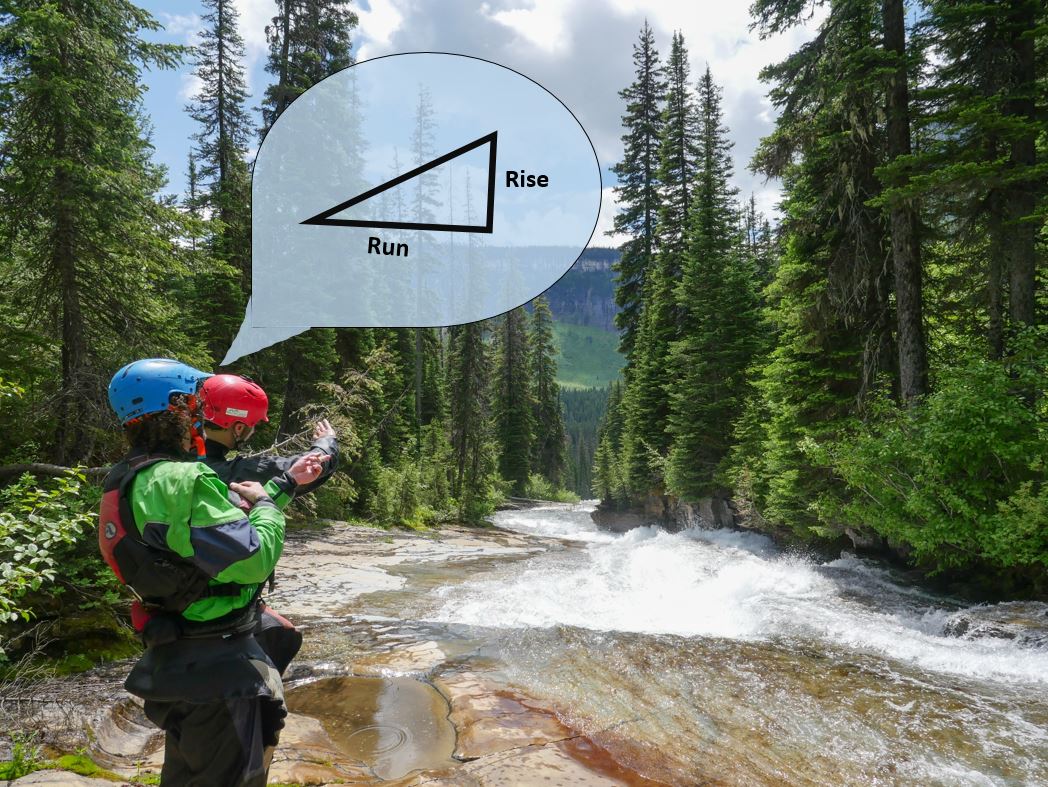
If you want background knowledge in rise/run and the math, click here.  Kayakers think in elevation lost, so on this page I will use the word "drop" in place of "rise".  They are the same, and simply represent the change in elevation.

The simple of it is you want the elevation dropped (in feet) divided by the distance traveled (in miles). 


The next step is to find elevation lost and the distance traveled on a stream. Here’s how to do it:


1) I start by going to Hillmap.com    I find it to be a simple and effective tool for this job.

2) I put the program in "terrain mode", using the drop down menu and clicking the terrain option button like shown below.  This creates a hillshade effect over-layed with contour lines once zoomed in.


3) I locate the section I am interested in and zoom into it.  For this tutorial, I'll be analyzing a section of Cavitt Creek between it's confluence with Plusfour Creek (43.147, -122.9556) and a bridge just under 4 miles downstream (43.1569, -123.0167).


BEFORE CONTINUING, MAKE SURE YOU UNDERSTAND HOW TO READ A CONTOUR MAP.


4) I find an index line near where I want to start calculating gradient.  Then trace the stream using the "path" tool to a contour line down near the end of the section I am interested in.  In Hillmap, just click on "Paths" then click on the map and it will start drawing.


  • You can see that once the path is traced, the distance of the path shows up in the top center of the screen. 3.67 miles in this case.   

  • I know the distance between 2 index lines at this scale is 200' (they are written on the index lines themselves) and 5 contour lines are counted before the next index line is reached so I can ascertain that each contour line is 40 feet (200/5=40).  Note that if you zoom out enough this changes to 400' between index lines, so be aware of which scale you are at.

  • In this case I passed two index lines and two more contour intervals, and the scale was such that the index lines were 200' apart.  This means the total elevation dropped was 480'.  
 
  • With a drop of 480' and the distance traveled being 3.67 miles, I plug those into the equation as 480'/3.67 miles which rounds to 131'/1 mi or to put it in the form kayakers are used to..........131 fpm

And that's how you calculate the gradient of a stream.


TIP:  If you flip the basemap to satellite mode and zoom in, you will be able to trace the stream more accurately, before flipping it back to terrain mode to count the contour lines.  


-------------------------------------------------------------------------------------------------
More
-------------------------------------------------------------------------------------------------


For kayakers, there is more to it than that.  131 fpm is the overall gradient, yet the most important figure for me to determine on an exploratory run is the maximum gradient.  That will answer the question of what is the steepest section of stream we will encounter?  Where is the biggest challenge most likely to occur and how big of a challenge might we be talking?

For that, I look for the two closest index lines on the map.  When you have done this enough times, that is easy to eyeball.  If you are just starting out you might need to guess and check a bit.

 For Cavitt Creek, the two closest index lines would be between...

Then I draw the path between those two index lines, and come up with a distance of 0.88 miles.


Since I know those index lines show 200' of elevation difference the calculation is 200/0.88 which equates to 227 fpm.  I find this number more important than the overall gradient.

You can get much more in-depth than this, many guidebooks even list gradients mile by mile, but you can make the call about how much information you need.  The gradient can be combined with other tools like satellite imagery, flow charts, hiking photos of the stream, fishing forums, scouting trips, rumors from a friend of a friend and anything else you can get a hold of to paint a picture of what you might find on a stream to help you make a decision if its something you want to explore with a kayak.


*Astute observes will notice that when tracing a path in Hillmap, that next to the distance traveled is the ft gained and ft lost. I don't find the elevation lossed/gained to be represented accurately by Hillmap when tracing a stream so choose to count the contours myself.


-------------------------------------------------------------------------------------------
Story
------------------------------------------------------------------------------------------- 


The advantages of knowing the gradient on a new stream to explore can be obvious. From 600 fpm, holy cow that's nuts!  To 13 fpm, hmm maybe I'll save that one for teaching grandma how to kayak.

A good case study on the usefulness of being able to obtain gradient information was when planning for a southern Oregon tributary to the Illinois River called Lawson Creek.  Typically I want to put in as high as possible on a new stream for the first time to see as much of it as I can.  Then afterwords can find a put in/take options that gives me the best bang for the buck (if it's even worth repeating the stream in the first place, often it's not).

For Lawson Creek, the stream looked pretty uniform from the satellite imagery, boulder strewn with some tantalizing bedrock at the very top.  When I went to calculate gradient, I noted the upper reaches were mostly reasonable, but had some pretty high gradient sections around 300 fpm.  Now gradients over 300 fpm can be good fun, but only in rare cases is it not at least class V once you get past the 250 fpm mark in Oregon.

 Boulder Creek is an exception to the rule.
300 fpm and never reaches class V.


Most often though that kind of steepness ends up being extra dangerous and partially to fully unrunnable in the PNW, especially when it is bouldery like was obvious Lawson Creek was from the satellite imagery.  Downstream of the 300 fpm section there were a couple more reasonable miles then the gradient soured to over 450 fpm for a short bit.   However, I noted that just downstream of that gradient spike, the stream eased off to 100-150 fpm for the last couple miles, which seemed just about right for us to roll the dice on an adventure given the size and style of stream that Lawson is.

The area is rugged, so just bushwacking in below the gradient wasn't a great option, so I looked at a different basemap (CalTopoFS) that includes trails, and found one!  I rechecked the gradient starting at the trail going both upstream and downstream, and saw that it was placed in a pretty ideal location just downstream of the last Richter high section of gradient.  


This trail ended up having a lower elevation access road than dropping in from the top so snow wouldn't be as large a concern and meant we could do the run as a day trip, and weren't as worried about dealing with long class V and unrunnable sections and could expect more of a IV-IV+ (V) trip which is more our style.  You still never know what you will get on those type of runs until you go, but in this case we set ourselves up to have the best chance we could of having a good adventure and it paid off with one of our favorite days of boating that year.  On the hike in, we had high visibility both upstream and downstream and could see that we were in fact putting in just below a section of very steep whitewater, and just above what turned out to be a couple miles of fantastic IV-IV+ boulder gardens.


    -jacob


A comparison in Gradients


 400 fpm and bouldery in Oregon


450 fpm bedrock in Montana


 600 fpm polished granite in California


Some known entities in this area and their gradients (rounded).


Rogue.................................................13 fpm
Illinois................................................24 fpm
Clackamas (Three Lynx)....................30 fpm
North Umpqua....................................30 fpm 
Wilson................................................35 fpm
Crooked..............................................40 fpm
Bull Run.............................................50 fpm 
Breitenbush........................................60 fpm
Grays..................................................65 fpm
White Salmon
     Farmlands......................................60 fpm
     Truss..............................................130 fpm (174 max)
     Middle...........................................50 fpm
     Lower............................................30 fpm
     Lower Lower.................................50 fpm
Upper Wind........................................90 fpm
Blue....................................................90 fpm
Little North Santiam (Opal Creek).....100 fpm
Quartzville Creek (Upper)..................100 fpm 
EF Lewis.............................................110 fpm
Canyon Creek, WA.............................120 fpm
Copper Creek......................................125 fpm 
Lower Trout........................................125 fpm
Ohanapecosh.......................................130 fpm
Cispus (Upper, Upper)........................150 fpm
Canyon Creek, OR............................. 90 fpm (200 max)
NF Clackamas....................................200 fpm 
Lake Creek Slides..............................200 fpm
Mccoy Creek......................................200 fpm
Brice (Upper).....................................215 fpm
Brice (Lower).....................................60 fpm
SF Coquille (The Gem)......................220 fpm
Clear Fork Cowlitz.............................230 fpm
Miracle Mile.......................................250 fpm  
Little White Salmon...........................250 fpm (295 max/Gettin' Busy)
Lostine................................................250 fpm
Hagen.................................................260 fpm
Upper Trout........................................260 fpm 
Christy Creek.....................................400 fpm in steepest mile


It's a whole different game in California's High Sierra's, where 300 fpm wouldn't even get you an honorable mention.


Thursday, January 10, 2019

Lacamas Creek


Photo: Priscilla Macy


BETA
1.3 miles


Stream: With a take out less than 30 minutes from downtown Portland, Lacamas Creek is (excluding the novel Willamette Falls and Oswego Creek) the closest challenging whitewater to Portland, OR.  Short and sweet, the run flows out of a dam and flows when it has been raining hard.  It's tucked into Lacamas Creek Park, which in turn is tucked right into the middle of Camas, WA.


From the parking area at the put in, either put in on the reservoir right at the bridge next to where you parked, or shoulder your boat.  Either way, paddle or walk, it's about 1/3 of a mile to the dam.  The run starts on the downstream side of this dam.


Photo: Priscilla Macy


The first drop is the smallest, but least commonly run.  It's about a 5 foot tall ledge, it has a hole and I have heard that if you have seen this place in the summertime without water, the potholes will have you taking this drop seriously.  Some people choose to put in just below this ledge.


Photo: Priscilla Macy


It's easy floating down to the next horizon line at Pothole Falls, scout left.  There are three line choices.  The one that seems most obvious is the middle line, but this line lands in bout 6" of water if you go straight off.  If you choose to run this line drive hard left.  At some levels it's a sweet Boulder Sluice style boof.  But again, if you boof the peak, you will smash the bottom of the river.


 Pothole Falls, all three lines are visible in this image.
Photo: Paul Thomson


The right (but not right wall) line is the easiest, just line it up and bounce 15" into the pool.

Far left is a sloping ramp that goes smoother than it looks, so long as you line it up correctly.

Andrew Bradley, lining it up correctly.
Photo: Priscilla Macy

More easy floating and a 5' ledge leads to a foot bridge.  Be sure to eddy out before this bridge on the left to scout Little Norway, the largest drop of the run.  

Photo from the footbridge: Priscilla Macy

This big slide is intimidating, but good to go.  Wood sometimes collect here, and in 2018 was problematic but still runnable.  It is best scouted and portaged on the left.  Safety can be set at the bottom.  Most people run just to the left of a large hole mid-slide.


Ben Mckenzie makes the final move to the left, avoiding the wood in the runout.
Photo: Priscilla Macy


From the base of Little Norway it is about half a mile of class II down to the take out.  It's worth pre-scouting your take out route, or, risk facing the wrath of the blackerry bushes.
  
Flows:  Lacamas is controlled by a dam and does not have an online gauge, so comes with the uncertainty of such a combination.  If the reservoir is full, and it has been raining the spillage is funneled into the creek so when the reservoir is full it's reliably in on high water days.  Since it's on the way to the Washougal drainage, it's easy to fallback on something in that drainage in the event you get skunked on Lacamas. 

Both times Iv'e run Lacamas, it's been on a day we also ran Hagen.  So 2,000 on the EF Lewis gauge, and 3,000 on the Washougal gauge are good minimums to shoot for.  If the first drop looks runnable, the rest of the creek will too.

Access:  Take Highway 14 into the town of Camas.  Below is a map of the shuttle route, click on it for higher resolution.


Take out:  45.5891, -122.3916

Put In parking:  45.6037, -122.4068

Dam: 45.6005, -122.404


The creek even has cell service!
Photo: Priscilla Macy


----------------------------------------------------------------------------------------------------------------------------------------------
Story
----------------------------------------------------------------------------------------------------------------------------------------------


My first time down was shortly after Dan and his buddy Trevor had the first go at rafting Hagen Creek.  That was fun, and with some time left over Ryan Scott suggested we try out Lacamas Creek nearby.  I hopped in the back of the raft with Trevor and Dan up front, while Matt King, Eric Foster-Moore and Josh Grabel kayaked.  There was hardly any light so we were moving fast.  Everything went smooth, I have a vivid memory of being in the raft below Little Norway, looking up as the three kayakers blue angled the drop, careening down the face all at once on slightly different lines.  We took out as dark set in, with cheers to another loose operation where the bolts held fast.

Jeff Compton guides an R4 team down Little Norway on another trip. 
 Photo: Paul Thomson

My second trip to Lacamas Creek was many years later, at the opposite end of the day.  We set shuttle in the dark after flows were reported as too high on option #1.  This time we were able to move slower and take it in more, Priscilla and Ben even observed a large Beaver sending it into the outflow of the first drop shortly after the sun came up!
 Photo: Priscilla Macy

With the addition time allotted to scouting, we tried out the left line at Pothole Falls which I had in my mind was ultra stout but I know consider the preferred line (at least at the flow we were there).  Adam probed and we were relieved but not surprised that it went so smooth.  Three more of us lined it up and rode the ramp into the pool below.

Little Norway ended up having a pretty prolific wood situation at the base on this trip, I definitely wasn't feeling it this time around but Adam wanted to give it a go.  He checked with the group to see how we felt about him running the drop.  The consensus was we trusted his judgement, but were not comfortable with the risk unless proper safety could be set at the wood.  Andrew and I scrambled out to the problem spot and found the footing manageable enough to feel good about assisting in the event we needed to administer a rescue.  There was no need, Adam executed the line so well it convinced Ben that he wanted to run it too, repeating a perfect line.

Adam Edwards running Little Norway, wood be damned.


Andrew, Priscilla and I chose to hike the trail to the take out, much to Priscilla's chagrin.  It didn't help when we passed some hikers and they told Priscilla they felt sorry she was going to have to carry her boat so far.  I promised her we'd paddle out next time, but the looks got no less dirty :)

With plenty of daylight left, we headed up to the NWF Washougal drainage where loads of paddlers were running Hagen.  Priscilla joined them, while the rest of us headed further up the drainage for something new.


Further up on the NWF Washougal.
Photo: Adam Edwards


           -jacob


Thursday, January 3, 2019

Fall River (La Pine)


BETA
1/2 mile


Stream: Like the Metolius, the 10 mile long (give or take a couple miles depending on whether you measure the meanders or are more a how-the-crow-flies sort of cartographer) Fall River pops up out of the ground at its full volume.  A couple miles upstream of it's confluence with the Deschutes River it spills over a small cascade.  The rest of the river is flat, aside from a little turbulence near the fish hatchery.   To run this novel 10' cascade, seal launch off the downstream side of W Deschutes River Rd into the river where the Fall River flows underneath, through some culverts. 


Bop down to the flat water and float 1/4 mile to the falls.  Make sure to look down through the clear as crystal water, we saw a lot of fish when we were there (fly-fishing only).  


Those who enjoy technical challenge might dig trying to dial in the perfect execution of the various nuanced line options.  Others may find floating down the middle and resurfacing in the pool below satisfactory.  It's easy to walk back up for laps on the left.  When you have had your fill follow the trail the short distance back up to the parking area.


The most unique attribute of paddling this novelty section of the Fall River, is the trail is at river level and within feet of the river in spots.  This makes for a good outing for non-boating friends and boaters to hang out casually on the river without it being a whole adventure, so long as you were already in the area.  The shore near the falls would make for a good picnic spot too.


Flows:  The run is spring fed and fluctuates very little.    We had about 100 cfs December 23, 2018 which seems to be as low as it ever gets.  Fall River near La Pine gauge.


A years worth of fluctuation


Access:  This paddle/hike is less than 30 minutes from Bend. Traveling south on Hwy 97, and about 10-15 minutes south of Bend, be on the lookout for a right turn onto Vandevert Rd.  A mile later turn left onto S Century Drive.  5 miles later turn left onto W Deschutes River Rd/W River Rd.  In just under a mile there will be a parking area on the left just before crossing over the Fall River.  Refer to the following map from there.

 Click on the map to enlarge it


----------------------------------------------------------------------------------------------------------------------------------------------
Story
----------------------------------------------------------------------------------------------------------------------------------------------


I first stumbled upon the Fall River quite by accident.  While on a field trip in college, we camped along the Deschutes River at the La Pine State Park Campground.  I had woken up early in the morning and went for a jog.  I went along aimlessly for some time.  At some point I started seeing small trail signs for "Fall River Falls", I didn't know how far it was but figured I'd head in that direction for a bit.  After about 3 miles I came to the drop.  It was pretty, and did seem runnable, but didn't really warrant investing time and effort to coordinate a return trip with the aim of boating it.

 I hadn't spent a lot of time wandering around Central Oregon by myself before and got a little disoriented on my return, I was not used to navigating along such flat land with lack of geographic features to orient with, so many identical looking trees, and lack of undergrowth. I even ended up knocking on a door to inquire within the house to see if they could confirm I was still on the right track.  Having been gone for what felt like a couple hours I worried I would be holding up the trip, but upon arriving back found out I had left much earlier in the morning than I had thought and breakfast was just getting made.  The trip went on and 3 days on the Deschutes filling my brain with the business of rocks washed away any noodlings of curiosity I had regarding the Fall River.


Fast forward 6 years and Priscilla and I were visiting Sun River over the Christmas Holiday with her family.  We had our kayaks with us since we planned to boat on the way home.  Saturday evening her father brought up the idea of hiking to Fall River Falls.  I remembered my jog from years before and that I had thought that while not worth devoting a whole trip to, the cascade did seem like it was probably runnable.  I looked it up on the map, and did some photo searching online.  I saw the logistics would be remarkably un-complicated for Priscilla and I to float down to the falls while the rest of Priscilla's family walked down.  Then we could all hike back together.


It ended up being pretty cool, her family got to see her boating without having to do anything out of the ordinary.  We had fun surmising which type of fish we were seeing as we walked/floated mere feet from each other.  It was really a perfect little afternoon outing from Sun River.


   -jacob