Wednesday, November 26, 2014

Eagle Creek; Columbia River Gorge


BETA

Stream:  From the Pool below Twister Falls there is a short section of class III-IV warm up before a scout at the EF of Eagle Creek confluence.  Both the main channel and the EF channel can be run.  Just downstream is Grand Union Falls, a 50-ish foot ramp into freefall ending in a big pool.

Photo: Paul Thomson


2 miles of read and run boulder gardens lead to Skoonichuck Falls (you are getting close when you cross under a foot bridge).  Scout from either side, but left is more common.  This 50-ish foot double is usually run with a delayed boof in the middle for the first their, then wherever the current sends you for the second one.  The top drop can also be run left.  At least one person has ended up behind the veil but this is uncommon.


The pool exiting Skoonichuck is class III-ish but it is imperative that boaters get to the left bank after it ASAP.  The current gets shallow here and funnels into a narrow chute on the right that has a log wedged in it.  Boaters need to get left and go over a shallow slide.

Between here and the High Bridge gorge are three rapids, the first can be scouted from the right.  The second is run off the point just on the left side of the current (45 degree angle to absorb the shelf it lands on), and the third is run along the left bank.

A short and beautiful float through the narrow High Bridge gorge brings you to a tiered rapid best finished on the far right to avoid a hole.  The top tier is odd so take a look from river left.


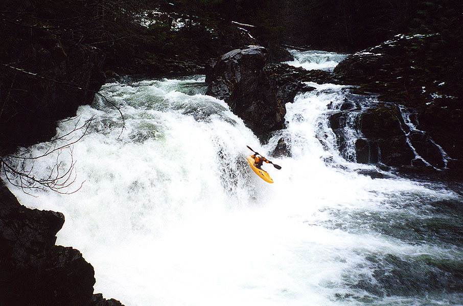
A mile of read and run brings you to a 10 foot ledge, easily scouted on the right.  Just below here is the entrance to Punchbowl Falls.  There is a shallow class II entry slide, the eddies are small and soft so go one at a time.  

Scout Punchbowl from the left, I like to run the lead-in ledge on the right with a left stroke.  Then for the main drop most people like to drive up onto the boil and hold a right stroke going off.  People used to take a right side meltdown sometimes, but that's not very common anymore.


It's a tricky lip so analyze it thoroughly.  The hit can be hard, but good lines usually result in reasonable impacts.

It's worth spending some time in this punchbowl.  Float around the corner and take out above the next horizon.  If you want to portage Metlako without doing a throw and go, take the spur trail found here back up to the main one and head downstream.  Immediately after passing the second narrow cliff section there will be a way back down to the creek via a scree slope.  There is usually an animal style path helping the cause on the downstream end of this scree slope.  Below here it is class II-III to the take out at the low head dam.

If you are not portaging, scout Lower Punchbowl and run off the center-right flake.

There are two rapids between here and Punchbowl, the first one is run center and is III-IV depending on flows.  The second is a small riverwide ledge.  Run this ledge as far left as you can (even if you have to scrape).  There is a hundred feet of flatwater between here and Metlako.  Scout from the platform on the left.  It is possible to attain back upstream from here at lower flows, but it take some effort.

Here are a variety of Metlako lines, high water means a softer landing but a more hazardous pool (0:55).  The throw and go is intimidating but fine.  Try to land in the boil.  

The pool here is another special place, enjoy it if you have the time.  Easy floating leads to another horizon, it's an easy portage on the left.  Not sure if this ugly drop has been run, probably I'd guess.

Just downstream the creek leaves the gorge and meets up with the portage route.  There is one class III rapid and the rest is class II down to the take out at the low had dam. 

Flows:   Use the Bull Run Nr Multnomah Falls gauge.  400-700 is SOP, but 1,000 cfs is doable.

Access:   Take exit 41 off Hwy 84 East (no access heading West).  Turn right and follow the road to it's end in about 1/2 mile.  Find a parking spot and pay the $5 fee.  Hike up the trail until you reach your put in.   


Hiking distance to put-ins
 
      Full Run (Base of Twister Falls):          5 1/4 miles
         Standard  (Skoonichuck Falls):          3 1/2 miles
Hike and Huck (Puncbowl Falls):          2 miles 
 

----------------------------------------------------------------------------------------------------------------------------------------------
Original Write-up
----------------------------------------------------------------------------------------------------------------------------------------------


After running different section of Eagle Creek for years, Matt finally got the ball rolling and convinced us to hike past the conventional Skoonichuck put in, tracing the footsteps of the Preistly brothers, Ryan Scott and their friends to tackle the upper waterfalls.  The link below is to a Canoe & Kayak article about that trip.


After doing this trip, I now consider the true Eagle Creek run to begin at the base of Twister Falls.  Putting in lower is cutting out some good stuff, putting in higher lowers the fun:dealing ratio below the threshold of classic.  That said, all sections are enjoyable days in a kayak, tube, or swimming.  If you want to get vertical, this stream will leave you satisfied.

Wednesday, November 19, 2014

13th annual PDXkayaker Film Festival

The 13th annual PDXkayaker Film Festival is tonight (November 19th).  There have been a lot of submissions this year, details on getting there are below along with a few teasers from our friends.


Emile Elliot
Great editing, Emile's many abilities are reflected in this video.  Including playboating, creeking, surfing, and squirt boating.


Priscilla Macy/Anna Herring
Two Girls, one boat.  Watch these gals learning a new way to get down the river.


Taylor Hazen
Good editing, you may have seen all the rapids in videos before, but you probably were not aware of just how many swims occurred in the northwest last year!  He has two videos, while both are good, the carnage reel is pure gold.


Dan Mccain, Jeff Compton, Johnny Watson, Josh Sheldon, and the rest of the rafting crew
The combination of Jeff Compton and Dan Mccain is likely the most accomplished R2 team in the world.  However, the video they are putting out this year shows what is really important to these guys.

Their video from 2 years ago.


See the full length features this evening on the big screen.

Thursday, November 13, 2014

Beatery: It can strike anywhere

Things had just started cooling off on an exploratory run near Mt St Helens last weekend.  I let my guard down and got tripped up by an innocuous obstacle.


Beater1 from Jacob Cruser on Vimeo.

  -jacob

Thursday, November 6, 2014

Opal Proper

Photo: Pete Giordano


BETA

Stream: The put in is a little over 1 mile upstream of Jawbone Flats.  The standout rapids on this run are all bedrock.  Most of them are runnable, while some of them are not, while nearly all are unique.  There are some short waterfalls, slides, ramps, chutes and pockets.  Scout each rapid carefully, fortunately it is usually obvious straight away whether you are looking at a fun rapid or a portage.

Part of the fun of this run is figuring it out like a puzzle.  There are a few portages (all easiest on the left) mixed in with fun and unique bedrock rapids that are sure to leave you smiling.  Scout everything your first time down, and don't go around any corners without knowing where your next eddy is.

The competency crux of the run is the final portage.  There is a ten foot falls that splits around an island with most of the current going left and a semi-scenic tributary coming in on river right.

                                                       The aforementioned Flume Creek Falls

If you have made it this far, I am sure you will recognize this as an unsafe drop as the landing zone appears to be exploding.  Head up to the trail on river left and instead of returning to the creek as early as possible, continue walking down to a foot bridge (don't drop back to the creek earlier that that bridge).  Put back in wherever you feel comfortable finding your way down below this bridge.

Shortly below here you will reach the confluence with Battle Axe and your trip down Opal Proper will be over.

If you did not get an early start, hiked slow, had carnage or fiddled around you will be noticing that the light is starting to fade.  If that is the case, start looking for the road on river right to hike out on.  You can continue all the way to Cascadios De Los Ninos before being committed to running the entirety of the Upper Opal section of the Little North Santiam.  

If you were efficient with your time, you can look forward to more boating.  The most obvious choice is to continue down through Upper Opal to the Mine at the Classic Opal put in, where a short uphill hike along the road will return you to the gate where you began your hike that morning.   Though if you were moving really quickly you may have time to go further if you set shuttle beforehand. 


Flows:  1,000 cfs is bare bones on the Little North Santiam @ Mehama gauge, 1500 cfs is the level shown in the video below and was a friendly, enjoyable level.  No idea what the upper limit would be, I wouldn't hesitate to head up there with 3,000 cfs and dropping though.

Access:  Take I5 to Salem and head East on Hwy 22.  In about 22 miles turn left at a flashing yellow light onto N Fork Rd.  In about 15 miles the road turns to gravel, and at 21 miles you will reach a gate where you leave the vehicles, a location that has a $5 fee to park.  


**If you know you are an efficient boater and think you will have time to do both Upper and Classic Opal after Opal Proper you can leave a vehicle at Three Pools to rid yourself of any hiking at the end of the day**

From the gate, get your gear carrying devices out and head past the locked gate up the gravel road about 3 miles to Jawbone Flat along a nice gravel road.  This is a perfect use of the kayak wheels. After reaching Jawbone, head to the back of town and over Battle Axe Creek.  Veer right just after the Pelton Shed, passing through an open area with a gravel pit.  Just passed this open area will be a sign for "Opal Pool", if you like drop your boats here for a moment and hike down to scout the nasty rapid that lands in Opal Pool.  It is worth checking out the situation above this drop so you don't accidentally get blown into it.


Return to your boats and continue along the path, shortly the path will make a sharp bend to the left and a small trail will head off to the right; take this trail to the right.  Follow the trail for a little over 1 mile, at about this point you will see nothing but bouldery class II above you and it is time to put in.  

               Looking upstream, then downstream from the put in.  On the downstream end of Cedar Flats.


 Map of the area
click to enlarge


----------------------------------------------------------------------------------------------------------------------------------------------
Original Write-up
----------------------------------------------------------------------------------------------------------------------------------------------


I realized a funny thing a couple years ago.  This being that I had many times planned, joined and executed kayak trips to "Opal Creek" in the North Santiam drainage without having ever run Opal Creek itself.  This was not due to debacles, in fact, those trips were all fun and usually smooth.  This is because I had never intended to put on to the actual Opal Creek in the first place.  From the confluence of Battle Axe Creek and Opal Creek near Jawbone, the stream the boating community usually refer to as Opal Creek is actually called the Little North Santiam.  I had read the Oregonkayaking trip report and decided I would one day try to head up and boat the actual Opal Creek.

---------------------------------------------------------------------------------

I went up to check out Opal Creek proper (above Jawbone Flat) fall 2014 armed with beta collected from the report on Oregonkayaking.  I was hoping that making my trip early in the year before the snow hit would give me a more positive outlook on the stream.

Video from the trip.

There have been a few changes since the OK trip occurred, here are the changes I noted


  • There is a new trail up creek right (OK travelled on creek left) that was not difficult.  I would not be excited about trying it in the snow though. To find this trail, locate the signs in Jawbone Flats to Opal Pool.  Once you scout the Narrows, return to the old road/Kopetski trail and follow until a sign for the Kopetski trail takes off to the right.  Follow this to wherever you decide to put in. 


  • The log bridge mentioned in the OK TR is gone now


  • The logs at the lip of Log Leap Falls are gone.  It is still a dubious drop that I did not run, but with safety and the right group it may go.


  • Because I had read the OK TR I knew what to expect on the run, this allowed me to not have to hike out from Cascadios Los Ninos at the end of the day.  Even with a late start I had plenty of time to paddle down to the Mine.  If I were to repeat this run and had a shuttle, I would try to get an early start with the idea to take out at Salmon Falls for a nice long day of boating.

--------------------------------------------------------------------------

Other notes


  • I had 1500 cfs, same as oregonkayaking, but without the snow I ended up having a little more water.   This was a good level and I would think 1500 would be the ideal level to do Opal through Salmon Falls.


  • The Narrows into Opal Pool addressed in the OK TR is just as menacing as they claim, it appears that it would be very easy to boat scout past the last eddy here.  If you portage Log Leap on the river left trail, keep walking until past this section.  If you run Log Leap, take out as soon as you can egress up the left bank through the brush.  Or better yet, make a plan as you hike upstream at the beginning of the day.


  • The rapid described as just below the log bridge is just as fun as noted!  Great rapid.  Quote from Jason “This is one of the most entertaining drops I have run in a long time; if we hadn't been so concerned with time I would have hiked up to run it again and again!“


  • There were a handful of portages, I did all of these on the left.  If you are creative, none of them are strenuous (without snow).


  • I used a wheel system to get my boat to Jawbone, this helped a lot.


  • It took me 5 hours car to car.


  • The scenery is classic upper LNF drainage and there are enough unique, fun rapids to make this trip worth doing.  I won't be hiking all the way up there every time I am in the area, but I wouldn't say no to a return trip in the future, near or far.


  • I agree with OK that Battle Axe has more runnable whitewater, but the best/most unique rapids are on Opal.  If I were to have a rule of thumb about the area above Jawbone, I would say one Opal trip to two Battle Axe trips sounds about right.


If you are the kind of person who enjoys this type of run, that should be more than enough info.  Go when there is no snow and enjoy!  


               -jacob