Saturday, September 24, 2011

Kayaking in Yellowstone

When I made my way out east, I knew there'd be lots of good outdoor activity to be had; skiing, hiking, fishing, ect. On the other hand, I was moving away from kayak central and had no idea if there'd be anything good to run. So I started with the guidebook, which pointed me straight to the lower end of of the Imnaha River. When flows started to rise in the spring, I knew the time had come! I scrounged up my kayaking gear from it's winter hiding spot and headed down the Dug Bar road into the canyon with a modest crew: Caitlin and Oakland the dog.
The Imnaha River drops from the east side of the Wallowas and parallels the Snake in Hells Canyon until the Sake takes a turn and the Imnaha cuts in. Needless to say, the canyon is impressive!
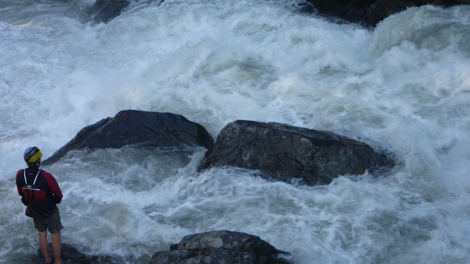
Dropping into Hells
When we got down to the last bridge over the Imnaha at Cow Creek, the river was raging, but still had eddies and some pools. I later looked at the gauge and saw that it was over 3300 cfs, which is a bit over floodstage. But it looked good to go, and I put on and left Catilin and Oak to hike the trail and do the camera work. The water was big and pushy, but there weren't any big holes you had to hit and no real class V's, just lots of really fun wave trains and even a few boofs. It was easy to hop out and scout on the trail most places too.
Big Water Goodness


The last mile or so has the hardest drops and is the only really continuous part, but it empties out into the Snake and is consumed by the flatwater. There's some really cool history at the confluence, with some terraces from a doomed hotel, and a huge bar that's perfect for a picnic.
Then there's the hike. While you could continue down the Snake to Heller Bar, the shuttle is heinous and makes the hike the best option, with a kayak at least. This run would be great in a raft, but you'd certainly want to float down. With minimal gear, the hike's really not that bad: 4.5 miles on pretty flat terrain, definitely worth the effort. The trail is also in great shape, albeit shrouded in poison ivy and a had quite a few ticks (we pulled 100 off Oak, then just stopped counting...).
The Imnaha proved to be a fantastic run and definitely one that's made annual list, but it only piqued my curiosity of what the headwaters looked like. But that's a story for another day..
Signing Off,
Matt "The Labrador" King


Part Two: Circumnavigation


Hoping that water would have dropped to a reasonable level after our trip to Idaho, Matt and I loaded up and headed out to see what the creeks of the Wallowa's would look like with water in them. Our first destination was magical looking V+ that would go with less water, but wasn't something we wanted to tangle with on this trip. Navigating the gravel roads was challenging at times, but Matt kept us on track aside from one short detour that lead to this old house.


After a forced 22 mile gravel detour around a 3 mile section of closed road (including the first of two bobcat sightings), we made it up to a promising fork that had plenty of water. We saw a massive granite face across the stream that was enough to get us to hike up the trail a ways hoping the stream would loose its sediment character farther up when this granite intersected the stream. We made it about half mile before deciding it would be more promising to head elsewhere. Higher up could be worth it, but we didn't have the time to explore at the time.

The massive granite face.

A gorgeous place.

What we were driving across may have been a road at some point, but at this point it was just a part of the creek.

Matt had a lead on a promising section of stream on the main fork, so we scoured the maps and this looked like a good put in.

I thought this sign was silly as we had been on loose gravel for the last 4 hours.

The flows were deceptive as it was running clear, but it was obvious once on it that it was high water. There really were not good eddies. Just slow spots near the shore with shrubs to grab onto. We almost portaged the jam in the next picture as we had to stop 100 yards upstream as there were no more eddies and it looked like it blocked the whole river. I portaged high, Matt low. I was able to get another vantage point and informed Matt it was a very clear route. It may look like there is a large eddy on his left, but that is deceptive, it was moving downstream quickly.

We came to some odd ponds on river left that signaled that we were about the enter the gorge. The next half mile was stressful and ultra fun at the same time. It was endless class four boulder gardens (or would have been at lower water) with boof after boof and lots of splashiness. The stressful part was it was challenging to stop and the river was moving fast. I made a move to catch a shrub on the left above this drop as did Matt.

Re-enforcing the addage that scouting blind corners on exploratory trips is a good practice.

We ended up portaging as the initial hole at the top was big and uniform, followed by a ramp into another large hole at the bottom. It would be more runnable at low water. Below here was some pushy class IV that didn't last long. More class II-IV lead to a campground, our take out, and some nice people willing to help us shuttle. This section would get run more often if located in western Oregon, and is still worth doing if you make a trip to the Wallowa's.

The take out at the campground.

 A local told us he hadn't seen the river this high at this time of year his entire life.
The next day we decided not to run the next drop on the list as it had a lot of water going over it. So off to complete the circumnavigation of the Wallowa's and finish our scouting. The stream we spent the most time on (The Lostine) had more water than we were interested in for the middle section that ended up being the most classic of the Wallowa runs, but we did cherry pick one good rapid higher up towards the confluence with the EF.

Head cam footage of the Cherry Picker Rapid.


The Chase from Jacob Cruser on Vimeo.

A picture perfect take out.


We had about 1600-1700 cfs on the Eagle Creek near New Bridge gauge for our run on Eagle Creek.

And for the Cherry Picker we had over 1,000 cfs on the Lostine Gauge.

   -Jacob

Tuesday, September 20, 2011

Weekend fun

Youngin' Andrew Bradley came along with us this weekend for some fun in the rain.  He put together a little video of our Lewis River run.


   -Jacob

Wednesday, September 7, 2011

Wallowa Wiki's

Matt just moved out east to Northeast Oregon. His desire to explore had him seeking out runs in this not often sought out area of Oregon. Map work and good fortune had it that he had landed on a gold mine of creeks. The geology and steep terrain proved to create some very high quality creeks. I was in the area twice this year and was fortunate enough to get on three very good runs over there. Two of which happened to be best class five runs Iv'e done in Oregon!
In the midst of a long Class V
Stay tuned for parts 1-4.
-Jacob