

BETA
III-IV+(P) /// 2.5 - 8 miles
Stream: This creek was an adventure Pete Giordano and I went on just before the pandemic arrived. Snow levels had been high the day before, yet while we were running shuttle that started to change, we were thankful my dad would be running shuttle to keep us from stressing about if the put in vehicle would be snowed in by the end of the day.
Access ended up being good, no gates, decent logging roads, followed by a short bushwhack. The creek started off small, and blind. We had a few scouts early on, and one portage for a sieve.
Some scouting early on.

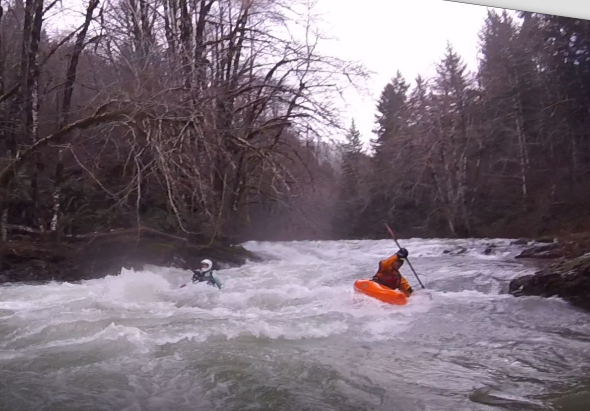
A quality rapid early on.

Photo: Pete Giordano
The creek was a bit immature near the top, and while there was some fun stuff, there was also some weird stuff. Yet a favorable wood situation made the adventure enjoyable, and kept the pace up.

The further we went, the more water we got. It was interesting starting on a micro-creek, and ending on a high water Wilson River.

Boogie

I figured that as we went further, and the gradient lessened, the rapids would get dull. However with the seemingly ideal water level we had, there were enjoyable rapids throughout.


We did have some wood to navigate, as well as an old bridge that was creating a rapid we scouted.

Around the time we reached the NF, my dad joined, along with his friend Linn. I switched out of the IK and into a hardshell.

The North Fork Wilson was pretty fun at this flow, certainly worth doing on it's own, even for non-adventurous boaters.


The WFNF > NF Wilson > Wilson run was a nice, full day adventure. The WFNF was relatively low hassle for a creek of it's size. I'd go as far as to say I'd suggest it for that certain type of boater who likes to get off the beaten path on high water days, given how close it is to Portland, so long as they don't mind getting in and out of their boat a lot.
As far as the NF Wilson goes, I'm surprised I don't hear more about it. It seems like a quality, high water class III-IV option.
Flows: We were there January 11, 2020. I'd call the flows we had ideal, a filled in medium. For a return trip, I'd look for between 5k-10k on the Wilson.
Wilson River peaked at 7500 cfs

Access: We took out at Jones Creek Day use area, just half a mile downstream of the Lee's Camp Store off Hwy 6.
There were no gates and the roads were decent on the way to the put in, but they do get up to about 2500' in elevation, so be sure you have a good idea about what the snow situation is before heading out there.
Just north of the bridge over the Wilson near Jones Creek Day use area, we turned right onto NF Wilson Road. 1.5 miles later we turned left onto Diamond Mill Rd. If you are looking on a map, following Diamond Mill Rd for 6.5 miles gets you to the spur road (off to the right) we drove down towards the WFNF as far as we could go. On the ground though, about 2.3 miles after turning onto Diamond Mill, we went to the south of a small peak rather than north, which can be seen in satellite imagery (but currently google maps doesn't recognize it). Per usual on this type of run, cache the shuttle route on your phone if you are going to try this.
From the spur it was a relatively short and easy 300' bushwhack through ferns to the creek.
Where we started our bushwhack: 45.63196869089631, -123.6224198404706
Take out: 45.587711428206205, -123.55490891371407
This shows the section we ran in blue, and shuttle route we took in yellow. The black circle indicates where the run changes from the WFNF to the NF Wilson, and about were my dad and Linn joined us.

No comments:
Post a Comment